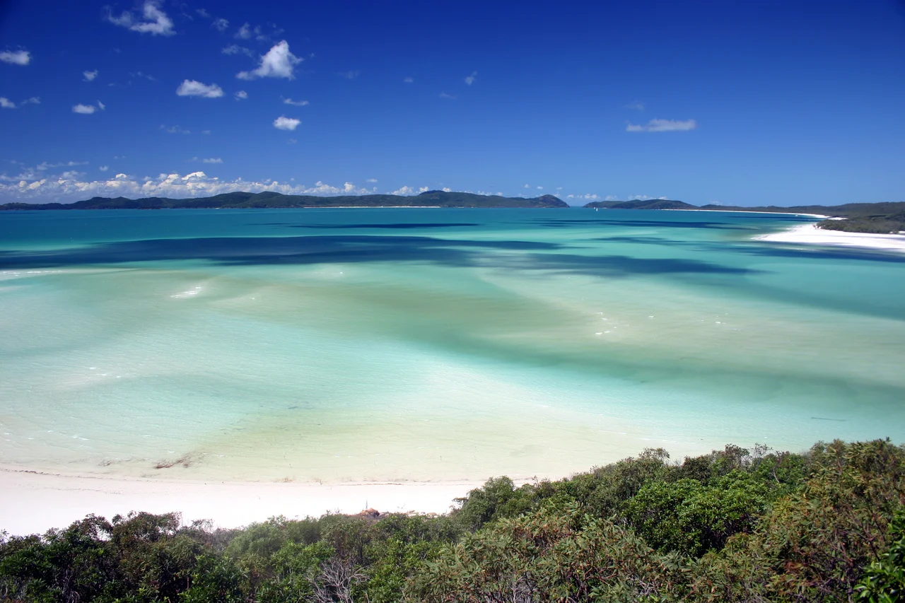

Whitehaven Beach
The sand squeaks. Step onto Whitehaven Beach and the white powder underfoot makes a soft, dry sound with every footfall, because this is not ordinary sand at all but silica so fine and so pure, around 98 percent, that it behaves like nothing else on a coastline. It reflects the sun rather than soaking it up, so even at midday in the tropics you can walk barefoot without burning. It is brilliant, blinding white against water the colour of cut turquoise, and it runs for seven unbroken kilometres along the edge of Whitsunday Island. CNN once named this the best eco-friendly beach in the world, and travellers routinely rank it among the finest on the planet. Standing on it, you stop arguing the point.
Hill Inlet
At the northern end, the beach performs its greatest trick. Here Hill Inlet meets the open bay, and twice a day the tide drags the white silica out across the shallows and folds it into the blue-green water, painting fresh swirls of cream and aquamarine that never resolve into the same pattern twice. From the sand it is beautiful; from above it is staggering. A 1.3-kilometre track climbs Tongue Point to a lookout that hangs over the whole estuary, and from that platform Hill Inlet looks less like a landscape than a slow-moving abstract painting, the sand and sea marbling and remarbling with the pull of the moon. It is the single most photographed view in the Whitsundays, and the photographs still fail to do it justice.
Ngaro Country
This beach has belonged to the Ngaro people for far longer than it has carried an English name. One of Australia's great seafaring Aboriginal cultures, the Ngaro navigated these islands for at least 9,000 years in winta, sewn three-piece canoes of ironbark, hunting turtle and dugong and reading these waters as home. Their middens and rock art survive in the caves at Nara Inlet on nearby Hook Island, and the Ngaro Sea Trail now links sites across the islands so visitors can travel, in part, the ways they travelled. The name Whitehaven came much later and from much further away: a British naval surveyor, Staff Commander E.P. Bedwell, attached it in 1879 after a town in the English county of Cumberland, following James Cook's 1770 christening of the wider group as the Cumberland Islands. The English names sit lightly on the surface. The Country underneath is Ngaro.
How You Meet It
There is no road to Whitehaven and never will be. You come by boat from Airlie Beach, by seaplane that lands on the water and taxis to the sand, or by helicopter clattering over Hill Inlet. Most visitors arrive for a single perfect day: a swim in water that hovers around the temperature of bathwater, a barefoot walk along the squeaking shore, a barbecue lunch under the she-oaks. A hardier few book the national-park campsites and stay the night, waking to the beach entirely empty and the dawn light pouring down seven kilometres of white. Each November since 2009 the beach hosts an open-water ocean swim as part of the Hamilton Island Triathlon, two kilometres of front crawl through some of the clearest water on the planet. However you come, the rule of the place is the same.
Fragile Perfection
Such purity is not indestructible. In 2017, Cyclone Debbie tore into Whitehaven, scouring away sand and forcing an intensive reconstruction of the southern end, a reminder that even a place this famous lives at the mercy of the weather that shapes the whole reef. The silica itself is a curious thing: so fine it can scratch the lens of a camera or work its way into a phone, yet gentle enough that locals have long used it to polish tarnished jewellery. There is nothing to buy on Whitehaven and nowhere to stay but a handful of national-park campsites. You arrive by boat, seaplane or helicopter, you walk the squeaking sand, you climb to the inlet lookout, and then you leave it exactly as you found it. That is the deal, and on a beach this perfect, it feels like the only honest one.
From the Air
Whitehaven Beach runs along the eastern shore of Whitsunday Island at roughly 20.28 degrees south, 149.03 degrees east, in the heart of the Whitsundays. From the air it is one of the most recognisable features on the Queensland coast: a seven-kilometre ribbon of blinding white sand, with the swirling cream-and-turquoise estuary of Hill Inlet curling around the northern end near Tongue Point. The island is uninhabited apart from campsites; the nearest airport is Hamilton Island (YBHM) to the south, and the beach is also reached by seaplane and helicopter from Airlie Beach on the mainland. Fly it by day in the dry season (May to October) for peak water clarity; the sand is so reflective that the beach reads brilliant white even from high altitude. Watch for afternoon convection and cyclone risk from November through April.
Nearby Stories
- Bowen 13 km away
- Cape Hillsborough National Park 39 km away
- Collinsville, Queensland 60 km away
- Great Barrier Reef 92 km away
- Pine Islet Light 147 km away
- Brigalow Belt 160 km away
- Coral Sea Islands 188 km away
- Canal Creek Air Crash 317 km away