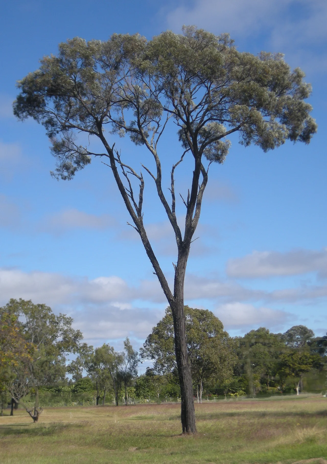

Brigalow Belt
The early settlers cursed it. Brigalow grew so dense, its slender grey-green trunks so tightly packed and so stubborn at resprouting, that clearing a paddock could feel like fighting the land itself. Cut a brigalow and it sends up suckers; drag a chain through a stand and it springs back. For tens of thousands of years this acacia scrub formed a soft silver wall across inland Queensland, a band of woodland threading between the wet coastal rainforest and the dry red interior. Then, in roughly a single human lifetime, most of it was gone.
The Country Between
The Brigalow Belt is a transition zone, and that is its whole character - a wide ribbon of acacia-wooded grassland running where the tropics meet the arid heart of the continent. Scientists split it in two. Brigalow Belt North covers more than 135,000 square kilometres, sweeping down from just above Townsville to Emerald and Rockhampton on the Tropic of Capricorn; Brigalow Belt South carries on to the New South Wales border and into the sandstone gorges of the Carnarvon Range. Beneath it lie the coal seams of the Bowen Basin and the fertile black soils of the Peak Downs. Great rivers drain it both ways - the Fitzroy, Belyando and Burdekin running east to the sea, the Maranoa, Warrego and Condamine flowing inland toward the distant Murray-Darling. It is undulating, complex, in-between country, neither jungle nor desert.
The Tree That Named It All
Everything here takes its name from one tree: brigalow, Acacia harpophylla, a tough, water-thrifty acacia that thrives on cracking clay soils and once carpeted the fertile lowlands. Brigalow rarely grows alone. It mixes with belah, with ooline in the moister valleys, with the swollen-trunked Queensland bottle tree - often spared the axe because its leaves make emergency cattle fodder in a drought. On higher ground stand eucalypt woodlands of silver-leaved and narrow-leaved ironbark, poplar box and coolibah. Scattered through it are rarer treasures: vine thickets, wetlands and softwood scrubs, pockets of unexpected richness in the sandstone gorges of Isla Gorge and the Blackdown Tableland. For all it has lost, the Northern Brigalow Belt is still ranked one of fifteen national biodiversity hotspots in Australia.
A Refuge for the Vanishing
What survives in the remnants is precious, because so little remains. In the vine thickets live the unadorned rock-wallaby and the black-striped wallaby, and in their leaf litter a wingless dung beetle found almost nowhere else. Two of Australia's most endangered mammals cling on here: the bridled nail-tail wallaby in Taunton and Idalia National Parks, once thought extinct and rediscovered by a fencing contractor who recognised it from a magazine; and the burrowing northern hairy-nosed wombat, one of the rarest large mammals on Earth, hanging on in the grasslands of Epping Forest National Park. The country still surprises science - in 2023 researchers described a giant armoured trapdoor spider, Euoplos dignitas, from the region. But the ledger also records loss: the white-footed rabbit-rat and the Darling Downs hopping mouse are already gone for good.
Ninety Percent
The number is stark. Since European settlement, around 90 percent of the original brigalow - roughly seven million hectares - has been cleared, most of it within the 20th century, turned over to grazing and grain. The brigalow ecological community is now reduced to a tenth of its former range, and the clearing has not entirely stopped. Together with the Mulga Lands, the Brigalow Belt is where most of Queensland's land clearing still happens; between 2019 and 2021 it accounted for nearly a third of all remnant vegetation cleared in the state. Barely two percent of the belt sits inside national parks, and most of those - Taunton, Epping Forest, Carnarvon, Blackdown Tableland - protect the rocky uplands rather than the fertile lowland clays where brigalow truly belonged. Introduced buffel grass and choking parthenium weed press in on what is left, while dams and weirs reshape the rivers. The silver wall that the pioneers fought so hard to fell is now the thing conservationists fight to hold.
From the Air
The Brigalow Belt is a vast bioregion rather than a single point; the reference coordinates of 21.98 degrees south, 148.12 degrees east fall in the Northern Brigalow Belt near the Bowen Basin coalfields of central Queensland, inland from Mackay. From altitude the landscape reads as a patchwork: rectangular cleared paddocks and cropland interrupted by darker ribbons and islands of remaining acacia and eucalypt woodland, threaded by the Fitzroy, Belyando and Burdekin river systems, with open-cut coal mines visible across the Bowen Basin. Useful airfields include Moranbah (YMRB) and Mackay (YBMK) to the east, with Emerald and Rockhampton serving the southern reach near the Tropic of Capricorn. The dry season (April to September) offers the clearest air and sharpest contrast between cleared and remnant country; the summer wet brings haze, storms and active fire and smoke across the grasslands.
Nearby Stories
- Sarina, Queensland 67 km away
- Bakers Creek Air Crash 104 km away
- Greenmount Homestead 112 km away
- Bowen River Hotel 141 km away
- Strathmore Homestead 174 km away
- Cullin-la-ringo Massacre 187 km away
- Canal Creek Air Crash 196 km away
- Lake Dunn 206 km away