.jpg)
Sarina, Queensland
A giant cane toad named Buffy guards the main street of Sarina, chained to a concrete slab so nobody can steal him again. He was built from fibreglass in the early 1980s for a sugar-festival parade float, named for the toad's scientific label, Bufo marinus, and he has been painted in team colours for State of Origin football, draped in Queensland flags, and carted off by pranksters more than once. The chain is the town's small joke on itself. Sarina sits just inland of the Coral Sea, thirty-four kilometres south of Mackay at the foot of the Connors Range, and the toad fits the place perfectly: a hardworking sugar town with a sense of humour about its own monument.
Yuwi Country
Long before the cane and the mill, this was Yuwi land. The Yuwi people, who spoke the Yuwibara language, occupied this stretch of central Queensland coast, and their country covers the landscape that now falls within the boundaries of the Mackay Region. Yuwibara belongs to a wider family of related Aboriginal languages and dialects across the region. The name survives in the language records and on the maps of traditional ownership that underlie the modern map of farms, highways, and rail. The country the Yuwi knew, well-watered creek flats running back to forested ranges, was precisely the land that European settlers would later read as ideal for sugar, and the town that grew here grew on Yuwibara ground.
The Mill on Plane Creek
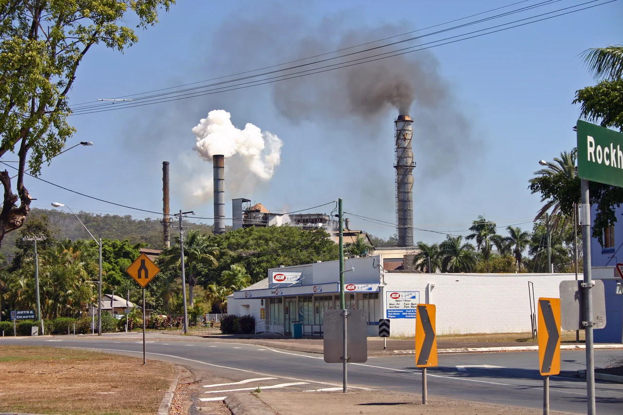
Sarina began as Plane Creek. In 1894 local sugar growers used government finance to build a central mill on the creek, and the town gathered around it; the mill opened in 1896 and is grinding still, now owned by Wilmar Sugar and crushing well over a million tonnes of cane a year into sugar and ethanol. Around 1908 the settlement traded the name Plane Creek for Sarina, taken from the nearby Sarina Inlet. That name had its own flourish: a surveyor, William Charles Borlase Wilson, had christened the inlet after a Greek mythological enchantress some time before 1882. So a sugar town in tropical Queensland carries the name of a siren, a small literary grace note in a landscape otherwise defined by cane trains and crushing seasons.
Sugar, Coal, and the Coast
Two industries meet at Sarina, and both move enormous tonnages. Sugar is the older trade, the cane farms and the Plane Creek mill that gave the town its reason to exist. The newer one runs on rails along the locality's eastern edge: the Goonyella line, hauling coal down from the inland Bowen Basin to Hay Point, about fifteen kilometres north. Opened in 1971, Hay Point is one of the largest coal-export terminals in the world, capable of shipping tens of millions of tonnes a year out across the Coral Sea. The contrast is stark and ordinary at once: a country sugar town whose horizon includes the loading arms of a global coal port, the sweet and the industrial side by side.
Sheds, Saints, and a Production Line of Footballers
In Railway Square, the Sarina Sugar Shed runs a working miniature sugar mill, showing visitors how cane becomes the array of products that the district has lived on for more than a century. The square also holds the Sarina Museum and an arts centre occupying three heritage buildings, among them a courthouse and a jail from 1906. But Sarina's most surprising export is athletes. For a town of a few thousand, its Sarina Crocodiles rugby league club has produced an improbable run of representative players, including Daly Cherry-Evans, who captained Australia, the dual international Wendell Sailor, and Dale Shearer. Down the coast road sits Sarina Beach, a quiet stretch of sand between the Sarina Inlet and the sea, where the working town meets the Coral Sea it has always faced.
From the Air
Sarina lies at roughly 21.42 degrees south, 149.22 degrees east, on the central Queensland coast 34 km south of Mackay and just inland of the Coral Sea at the foot of the Connors Range. From the air the town reads as a compact grid on the northern bank of Plane Creek, threaded by the Bruce Highway and the North Coast railway line, surrounded by the geometric green and gold of cane fields. The unmistakable navigational feature nearby is the Hay Point coal terminal about 15 km to the north, with its long loading jetties reaching into the sea and bulk carriers often queued offshore. The nearest airport is Mackay Airport (ICAO YBMK), roughly 30 km north. Expect tropical haze and showers in the December-to-March wet season; the dry winter offers the clearest visibility.
Nearby Stories
- Eungella National Park 26 km away
- Keswick Island 27 km away
- Pine Islet Light 47 km away
- Brigalow Belt 73 km away
- Proserpine 107 km away
- Canal Creek Air Crash 195 km away
- Great Keppel Island 247 km away
- Coral Sea Islands 252 km away