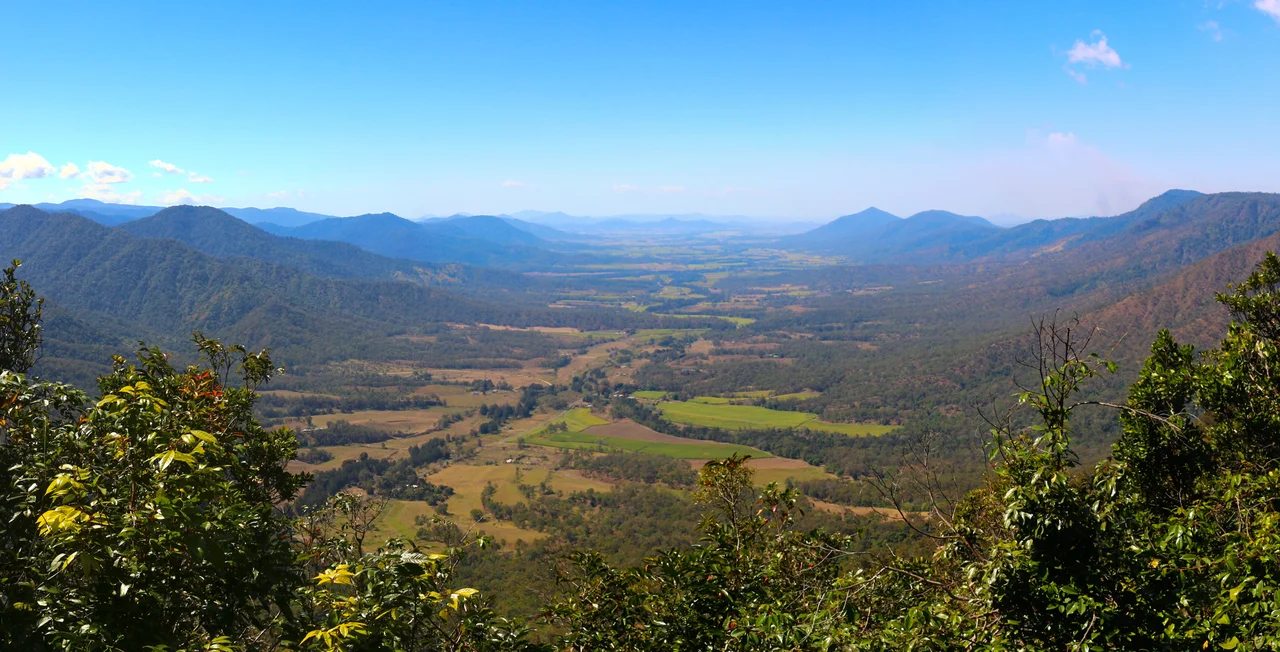

Eungella National Park
Stand on the timber platform at Broken River just before dusk and wait. The water is dark and slow, the air heavy with the smell of wet leaf litter, and then a line of bubbles breaks the surface. A platypus rolls up, dives, and is gone before you are sure you saw it. This is the quiet drama people drive eighty kilometres west of Mackay to witness, climbing out of the cane fields of the Pioneer Valley into a forest that the Widi and Yuwi peoples named for the clouds that settle on it. Eungella means "land of cloud," and with more than two metres of rain falling here in an average year, the name earns itself daily.
Land of Cloud
The plateau rises like an island out of the surrounding lowland, climbing past 1,200 metres at Mount Dalrymple along the Clarke Range. For most of its length the road clings to a wall of green, and mist drifts through the canopy even on bright mornings. This is the longest continuous stretch of sub-tropical rainforest in Australia, a tangle of vine forest and tall eucalypts that survives because the elevation traps moisture and the cloud rarely lifts entirely. When the rest of the continent dried out across past ice ages, pockets like this one stayed wet. The forest you walk through is a refuge, a green ark that outlasted the droughts that emptied the country around it.
The Platypus Hour
The platypus is one of only five mammals on Earth that lay eggs, and few places make it easier to meet one in the wild than Broken River. The free public viewing platforms here are open to anyone, and early morning and late afternoon are the hours to come. Watch closely and you understand how strange this animal is. It hunts with its eyes, ears and nose sealed shut underwater, sweeping its leathery bill side to side. Around forty thousand sensors in that bill read the faint electrical pulses of muscles twitching in worms and shrimp on the streambed. The platypus does not see its dinner. It feels the electricity of it, a sixth sense almost no other mammal possesses.
Species Found Nowhere Else
Long isolation breeds singularity, and Eungella is full of creatures that exist here and nowhere else on the planet. High in the canopy lives the Eungella honeyeater, a bird long mistaken for a relative until scientists Wayne Longmore and Walter Boles described it as its own species in 1983 - among the most recently named birds in Australia. In the cold streams hides the Eungella spiny crayfish, found only in these creeks on the Clarke Range. Even the frogs here are endemic, hopping along the rocky edges of fast water where their calls would be drowned out anyway.
The Frog That Vanished
One of those frogs carried a secret almost too odd to believe. The northern gastric-brooding frog swallowed its own fertilised eggs, switched off its stomach acid, and brooded its young inside its belly before bringing them up through its mouth as fully formed froglets - a method of reproduction unknown anywhere else in the animal kingdom. Scientists first studied it in the Eungella rainforest in 1984. By the following year it had vanished, and in 2015 it was declared extinct, most likely killed by a fungus that has devastated frogs worldwide. Researchers have since tried to revive it from frozen cells. For now, this remarkable animal survives only as a story the forest keeps.
Walking the Refuge
More than twenty kilometres of track thread the park, from short loops to lookouts that fall away into the Pioneer Valley far below. The Broken River picnic area is the natural base, with the platypus platforms a short stroll away and turtles and eels easy to spot in the clear pools. Rangers ask visitors to tread lightly, because everything that makes Eungella extraordinary - its endemic crayfish, its surviving frogs, its singular birds - depends on a forest that fire, weeds and introduced animals are slowly pressing against. It is a fragile inheritance, and standing in the cool green hush of it, you feel the weight of how rare it has become.
From the Air
Eungella National Park sits at 20.86 degrees south, 148.66 degrees east, on the Clarke Range about 80 km west of Mackay at the head of the Pioneer Valley. From the air the plateau reads as a dark forested massif rising abruptly above the cleared cane lowlands, frequently capped or wreathed in cloud - the feature that gave it its name. Mount Dalrymple at roughly 1,260 m is the high point. The nearest major airport is Mackay (YBMK / MKY) to the east; Whitsunday Coast Airport at Proserpine (YBPN / PPP) lies to the north-northeast. Best viewing is from 4,000 to 6,000 ft on clear mornings before cloud builds over the range; expect rapid low-cloud formation and orographic rain on the eastern slopes.
Nearby Stories
- Mackay 14 km away
- Collinsville, Queensland 17 km away
- Proserpine 19 km away
- Brampton Island 22 km away
- Collinsville Mine Disaster 40 km away
- Greenmount Homestead 52 km away
- Coral Sea Islands 253 km away
- Lake Dunn 294 km away