
Cape Hillsborough National Park
The kangaroos arrive with the sun. While the sky over the Coral Sea is still bruised pink and the tide has only just turned, eastern grey kangaroos and agile wallabies step out of the treeline and onto the open beach, noses down, working the wet sand for mangrove seed pods washed in overnight. It lasts only as long as the early light. By the time the sun is properly up they have drifted back into the bush, and the beach belongs to the crabs again. This is the small daily miracle of Cape Hillsborough, a volcanic headland forty kilometres up the coast from Mackay where the rainforest, the reef and the roos all meet at the waterline.
Where Two Worlds Meet
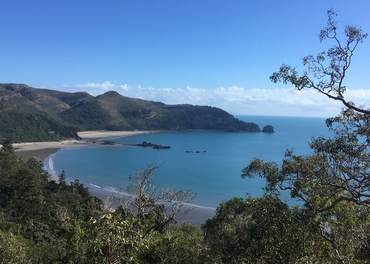
Cape Hillsborough is a peninsula born of old volcanoes, its dark hills rising to 267 metres and draped in rainforest that runs almost to the sand. That collision of habitats is the whole appeal. Few places let you stand with hoop pines and vine forest at your back, a fringing reef somewhere off the bow, and a string of rocky islands scattered across the horizon. The maximum elevation is modest, but the contrast is not. In the space of a short walk you pass from shaded forest to open headland to tidal flat, each with its own cast of creatures, all packed into one compact cape on the Central Mackay Coast.
The Sunrise Feeders
The famous beach foragers are not performing for anyone; they are simply hungry. Mangrove pods and seaweed drift ashore on the overnight tide, and the kangaroos and wallabies have learned that dawn is when the buffet is freshest. It is genuinely wild behaviour, which is why rangers ask visitors to keep their distance and never feed them - a fed kangaroo loses its wariness, and a crowded beach can break the spell that draws people here in the first place. Sit back on the dry sand, stay quiet, and let the animals set the pace. The reward is a scene almost no other coastline in the world can offer.
The Oldest Pantry
Long before the cape had a name on any chart, it fed people. This is Yuwibara country - also written Yuibera - and the Traditional Owners gathered shellfish from the mangroves here for countless generations, roasting them over fires and discarding the shells in piles that built up over time. Those middens still lie in the dunes, some of the oldest reaching back around five hundred years, a quiet archive of meals shared on this shore. Walking the cultural trail, you tread the same ground that has sustained the Yuwibara people far longer than any European map has existed, and the beach reveals itself as a place of belonging rather than mere scenery.
Cook's Passing Glance
On 1 June 1770, Lieutenant James Cook sailed past this coast aboard the Endeavour, naming landmarks as he went without ever setting foot here. He called the headland Cape Hillsborough after the Earl of Hillsborough, a British politician who oversaw the American colonies and the Board of Trade - a man who never saw the place that now carries his title. It was a fleeting act of naming from a passing ship, the kind that scattered British surnames across a coastline already richly named by the people who lived on it. The older names endure alongside the newer one, layered onto the same dark hills.
Reading the Sand
When the kangaroos retreat, look down. At low tide the sand fills with tiny patterns, perfect rosettes of rolled pellets fanning out from small holes. These are the work of sand bubbler crabs, which sift the wet sand for food and discard the cleaned grains in spiralling designs that vanish with the next tide. Around them, the rocky pools hold their own hidden life, glimpsed only by those who slow down and look. Roughly 140 bird species, along with mammals, reptiles and amphibians, share this small park - proof that a cape need not be vast to be teeming, only generous enough to let the land and the sea overlap.
From the Air
Cape Hillsborough National Park lies at 20.90 degrees south, 148.99 degrees east, a volcanic peninsula roughly 40 km north-northwest of Mackay on the Central Mackay Coast. From the air it presents as a dark, forested headland reaching about 267 m, jutting into the Coral Sea with a scatter of small rocky islands offshore and tidal flats along its shore. The nearest major airport is Mackay (YBMK / MKY) to the south-southeast; Whitsunday Coast Airport at Proserpine (YBPN / PPP) is further north. Recommended viewing altitude is 2,000 to 4,000 ft along the coast; light is best at sunrise, which is also when wildlife gathers on the beach below. Watch for sea breezes and afternoon cloud building over the ranges inland.
Nearby Stories
- Greenmount Homestead 18 km away
- Lindeman Island 20 km away
- Collinsville, Queensland 53 km away
- Collinsville Mine Disaster 70 km away
- Brigalow Belt 102 km away
- Pine Islet Light 104 km away
- Coral Sea Islands 226 km away
- Canal Creek Air Crash 263 km away