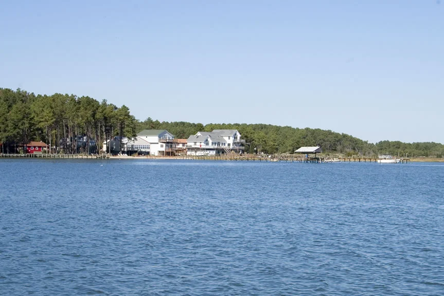

Mathews County, Virginia
Mathews County contains 252 square miles, of which 166 are water. That ratio - 65.9 percent under the bay or in tidal creeks - is the central fact about the place. Mathews is the second-smallest Virginia county by land area, has no traffic signals anywhere within its borders, and reaches a median age of 54.3 years, which means more retirees than children walking down to the dock. It sits at the tip of the Middle Peninsula, surrounded almost completely by the Chesapeake Bay, Mobjack Bay, and the Piankatank River. From the air, it looks less like a county than like a piece of land that has not yet decided whether to be an island.
Westville and the Port of Entry
In 1691, the Virginia General Assembly directed every county to designate an official port-of-entry. The community that became Westville rose around 1700 along Put-in Creek, a tidal tributary of the East River that drains into Mobjack Bay and then the Chesapeake. For nearly a century, Westville was a node in the colonial coastal trade. In 1791, after Virginia independence, the General Assembly split off this part of Gloucester County and created Mathews, named for Brigadier General Thomas Mathews, then speaker of the House of Delegates. Westville became the county seat - later called Mathews Court House, today simply Mathews. The town's center has been a National Historic District since 1977, and the broader downtown received state historic district recognition in 2016.
Lighthouses and Watermen
Seaborne commerce, fishing, and oyster farming have always shaped Mathews. Three lighthouses were built to guide ships toward Hampton Roads. Old Point Comfort Light, completed in 1802, joined the older Cape Henry Light at the mouth of the Chesapeake. New Point Comfort Light and Smith Point Light followed soon after. During the War of 1812, British ships raided up and down these shores. Through the 19th century, the oyster industry boomed and crashed in cycles, including an oyster war from 1882 to 1886 when out-of-state dredgers were arrested for destroying young oysters in local beds. By the 1930s, hurricane and 100-year flooding had devastated the county; Hurricane Sandy did much the same in October 2012. The waterfront houses on Horn Harbor and Mobjack Bay sit a little higher these days, and the watermen who work the bay keep careful eyes on the marine forecast.
Gwynn's Island
Where the Piankatank River meets the Chesapeake Bay, Gwynn's Island sits a few hundred yards off the Mathews mainland, connected by a small drawbridge along State Route 223 that is staffed twenty-four hours a day. The island is the county's recreational center now - sailboats, kayaks, a small museum - but it was also the site of one of the American Revolution's stranger episodes. In July 1776, the Continental Army drove Virginia's last royal governor, Lord Dunmore, off the island after a brief artillery duel. The deeper drama happened before the battle. Dunmore's forces, encamped on the four-square-mile island, were dying of smallpox and an unknown fever - particularly the African-Americans who had joined his Ethiopian Regiment seeking freedom from slavery. Hundreds died on Gwynn's Island, their bodies thrown overboard nightly or left unburied when the loyalists evacuated. The story is hard, and it belongs to the island as much as the sailboats do.
Jackey Wright's Freedom
In 1806, a Mathews County woman named Jackey Wright filed suit against the prominent landowner Holder Hudgins for her freedom. Her argument rested on her grandmother's Native American ancestry - which, under Virginia law, should have made the family free rather than enslaved. The case worked its way to the Virginia Supreme Court, where Judge George Wythe (one of the signers of the Declaration of Independence) ruled in her favor in one of his last decisions. The Virginia Supreme Court opinion was written by St. George Tucker. Wright's case is one of the rare freedom suits whose outcome survived in the records. Two Mathews County men were also caught up in the Easter Conspiracy of 1802 - a follow-on plot tied to the Gabriel's Rebellion network - and sentenced to transportation out of Virginia. These small legal records preserve people who otherwise would have left no trace in history.
Tour de Chesapeake and Lennon's Estates
Modern Mathews is a quiet place. The county hosts the annual Tour de Chesapeake bicycle ride, which works because there are almost no hills outside the northern Mathews-Gloucester border. Mathews Market Days draws regional artists, including the Virginia favorite P. Buckley Moss. Mathews High School has racked up state championships in wrestling (1990, 1991), baseball (2004), and volleyball (2011, 2012), and the crew team has taken home the Stotesbury Cup. Captain Sally Tompkins, who ran a Confederate hospital in Richmond and was the only woman commissioned as an officer in the Confederate Army, was a Mathews native. And in a piece of trivia almost no one expects: John Lennon and Yoko Ono once owned two historic waterfront estates in Mathews. The county that has no traffic light briefly hosted one of the most famous musicians in the world.
From the Air
Mathews County sits at 37.42°N, 76.28°W on the eastern tip of the Middle Peninsula. From cruising altitude, look for the broad mouth of Mobjack Bay opening into the Chesapeake, the Piankatank River separating Mathews from Middlesex County to the north, and Gwynn's Island just off the southeastern shore. New Point Comfort Lighthouse is visible offshore. Middle Peninsula Regional Airport (KFYJ) at West Point lies about 25 nm to the west; Newport News/Williamsburg International (KPHF) is 30 nm to the southwest across the York River. Best viewing at 3,000-5,000 feet.
Nearby Stories
- Camp Peary 3.7 km away
- Chesapeake Bay Bridge-Tunnel 7 km away
- USS Texas (1892) 12 km away
- Battle of the Chesapeake 14 km away
- Mid-Atlantic Regional Spaceport 26 km away
- SS Monroe (1902) 43 km away
- Menokin 46 km away
- Nat Turner's Rebellion 58 km away