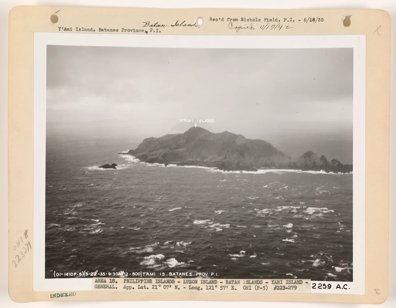

Mavulis Island
Draw a line from the southern tip of Taiwan straight south through the Luzon Strait, and you will intersect Mavulis Island before you reach the Philippine mainland. That geographic fact alone makes this small, uninhabited island one of the most strategically watched pieces of land in Southeast Asia. The northernmost point of the Philippines sits closer to Cape Eluanbi, Taiwan's southern cape, than it does to the northernmost point of Luzon — 142 kilometers to Taiwan's tip, roughly 200 kilometers to Luzon's. In the older Ivatan language of the Batanes people, the island's name says simply what it is: north.
An Island of Many Names
The Ivatan people of Batanes, whose seafaring culture has navigated these waters for centuries, called the island Dimavulis or Dihami — both meaning "north" in their language. Spanish colonial administrators used Diami. American colonial-era maps rendered it as Yami or Y'Ami, a name that requires a clarification: despite the phonetic resemblance, the Y'Ami of these maps should not be confused with the Yami people of Taiwan — the indigenous Tao — who live on Orchid Island further north. The Tao and the Ivatan are geographically, culturally, and linguistically related, sharing deep roots in an Austronesian world that predates the colonial boundaries drawn around them. Ilocano speakers added yet another name: Amianan, meaning "north" in Ilocano. Every culture that encountered this island named it for the same thing.
Rocky Coasts and Coconut Crabs
The island itself is small and rugged. It measures roughly a kilometer at its widest. The highest point, Y'Ami Hill, rises to 219 meters above the Luzon Strait. The coastline is rocky, offering few safe landings, but the interior slopes are covered in lush vegetation — mangroves at the lower edges, vuyavuy palms in the upper reaches, and native shrubs across the hillsides. Coconut crabs, the largest land arthropod on Earth, are found in large numbers on Mavulis, making use of an island where human competition for their habitat is almost nonexistent.
The island belongs to the Luzon Volcanic Arc, the same chain that runs through the Batanes Islands and continues north under the ocean toward Taiwan. The nearest inhabited land is Orchid Island, the Taiwanese island known to the Tao people as Pongso no Tao — "island of the people" — lying just 98 kilometers to the north.
A Sentinel in the Strait
Mavulis sits at the intersection of some of the most contested maritime space in the world. The Luzon Strait is the deep-water channel connecting the South China Sea with the Pacific Ocean, the route through which submarine and surface fleets must pass if they are moving between those two bodies of water. The Philippine government has understood this for decades, and the island's military significance has risen as tensions in the region have grown.
In 2016, the Armed Forces of the Philippines Northern Luzon Command formally pushed to establish a Marine detachment on the island. A detachment opened in 2018; a fishermen's shelter followed in 2019, turned over to the local municipality. In May 2021, the Department of Defense announced solar electrification through a station backed by a diesel generator, and commissioned a desalination plant for drinking water. In October 2023, a new naval detachment headquarters was inaugurated. General Fernyl G. Buca described Mavulis as "our watchful sentinel in the northernmost beaches of our maritime borders."
Watching the Strait
By 2024 the island had become a recurring location for Balikatan — the annual joint military exercises between the United States and the Philippines — and port upgrades were being planned across the Batanes chain to accommodate more cargo and to prepare contingency routes for Filipino workers in Taiwan in the event of a crisis across the strait.
None of this military infrastructure changes what the island actually is: a steep, coconut-crab-populated rock in the Pacific, closer to Taiwan than to the capital of its own country, named for its position by every people who ever came near it. The Philippine flag flies here at the northernmost flagpole in the nation. Below it, the Luzon Strait runs in both directions, deep and cold and strategically irreplaceable.
From the Air
Mavulis Island lies at 21.117°N, 121.950°E in the Luzon Strait, at the northern edge of the Philippine archipelago. The nearest airport is Basco Airport (RPUO) on Batan Island, approximately 180 kilometers to the south-southwest. Flying north from Basco, the island appears as a single rocky mass rising to 219 meters, with no settlement visible — only the military facilities on the lower slopes and the lighthouse on the hill. Approach from the south offers the clearest view of Y'Ami Hill and the rocky coastline. Recommend 2,000–3,000 feet AGL for the full context of the surrounding strait. Weather in the Luzon Strait can change rapidly; winds through the channel are frequently strong.
Nearby Stories
- Low-Level Radioactive Waste Storage Site 66 km away
- Cape Eluanbi 68 km away
- Eluanbi Lighthouse 92 km away
- 1991 Eruption of Mount Pinatubo 650 km away
- Lake Pinatubo 662 km away
- Sibuyan Island 946 km away
- Gigantes Islands 1071 km away
- Sinking of MV Sewol 1464 km away