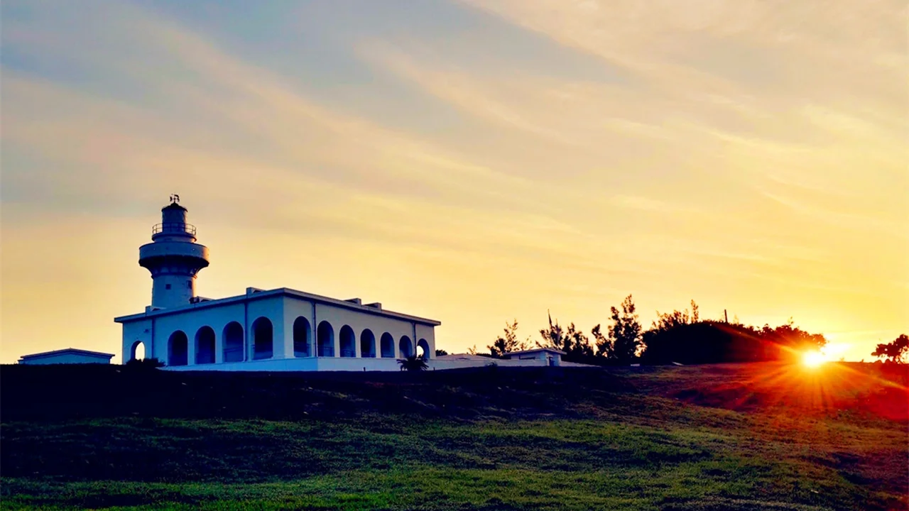

Eluanbi Lighthouse
It cost 71,248 Mexican dollars and took 500 soldiers to build. The lighthouse that stands at Cape Eluanbi — the southernmost point of Taiwan — was never meant to be merely a navigation aid. It was a statement. Erected between 1881 and 1883 under the supervision of Wang Fulu, protected by 18-pound cannons, Gatling guns, and a mortar, provisioned for three weeks against possible siege, the Eluanbi Lighthouse was conceived as a fortification that happened to have a light on top. The light, it turned out, was the thing that lasted.
Why a Fortress Was Necessary
The waters around Cape Eluanbi killed ships with some regularity. The Qixingyan reefs lay nearby, the currents ran strong, and when foreign vessels wrecked on this coast, the survivors faced confrontations with indigenous Paiwan communities. Two incidents rose to the level of international crises: the Rover affair in 1867, which prompted an American military expedition, and the Mudan incident of 1871, which led to a Japanese invasion of Taiwan in 1874. In the latter case, the Qing Dynasty publicly disavowed responsibility for indigenous-held territories on the island — a statement that created precisely the kind of power vacuum that threatened colonization. Following advice from Charles Le Gendre, the American consul at Xiamen, the Viceroy of Liangjiang, Shen Baozhen, launched the coastal defense programme that produced the lighthouse. The total cost was more than 200,000 silver taels.
The Light of East Asia
The lighthouse entered service in 1883. It earned a particular distinction among Taiwan's coastal lights: Eluanbi Lighthouse is also known as 'The Light of East Asia' because its luminous intensity is the greatest of any lighthouse on the island. The white cylindrical tower stands within a walled compound, the fortifications still visible even after the weapons they once housed are long gone. The Japanese, who occupied Taiwan from 1895, repaired the structure in 1898 after it was damaged — and partially demolished — during the retreating Qing forces of the First Sino-Japanese War. Under Japanese administration the lighthouse was elevated into an icon, commemorated as one of the Eight Views of Taiwan. On a stone memorial at the site, the name Eluanbi is rendered in calligraphy in the style of the Tang dynasty master Wang Xizhi.
Bombed, Rebuilt, Opened
World War II reached the lighthouse from the air. Allied bombing seriously damaged the structure; a Shinto shrine on the grounds — one of only five in the world that used baleen whale jawbones as torii gates, a testament to the cape's former importance as a Japanese whaling station — was destroyed entirely. The Nationalist government rebuilt the lighthouse in 1947. It was refurbished with a powerful Fresnel lens in 1962. The surrounding Eluanbi Park opened to the public on 25 December 1982; Kenting National Park, which encompasses the area, was officially established on 1 January 1984. The lighthouse itself began welcoming regular visitors a decade later. By 2014, the park was drawing more than 300,000 visitors annually.
Standing at the Tip of Formosa
The lighthouse and its park now occupy the southernmost accessible point of Taiwan's main island. A viewing platform and rock marker at the true southern tip have become a pilgrimage for tourists — the kind of geographic superlative that draws people to stand in a specific place and feel its specificity. The lighthouse stands slightly back from that marker but shares its significance. From the tower, the horizon to the south is open ocean, the Luzon Strait and ultimately the Philippines. To the west, South Bay curves toward Cape Maobitou. To the east, Banana Bay holds the Longkeng nature reserve with its coral reefs. The lighthouse that once needed cannons to survive is now the most visited structure on Taiwan's southernmost coast, and the light still turns.
From the Air
Eluanbi Lighthouse sits at 21.902°N, 120.853°E at the tip of the Hengchun Peninsula, Taiwan's southernmost point. The white walled compound is visible from the air at 3,000–5,000 feet; the lighthouse tower stands out against the green of Kenting National Park. South Bay is visible to the west, Banana Bay to the east. The nearest major airport is RCKH (Kaohsiung International Airport), approximately 90 km to the north. Provincial Highway 26 follows the coast and passes near the lighthouse. The Luzon Strait opens to the south; the Philippine island of Itbayat lies roughly 190 km beyond the horizon. Best visibility is in the northeast monsoon season, November through March.
Nearby Stories
- Mudan Incident 2 km away
- Lanyu Flying Fish Cultural Museum 30 km away
- Zhaori Hot Spring 59 km away
- Ten Drum Rende Creative Park 88 km away
- Mavulis Island 89 km away
- Barclay Memorial Park 121 km away
- 1991 Eruption of Mount Pinatubo 722 km away
- Scarborough Shoal 762 km away