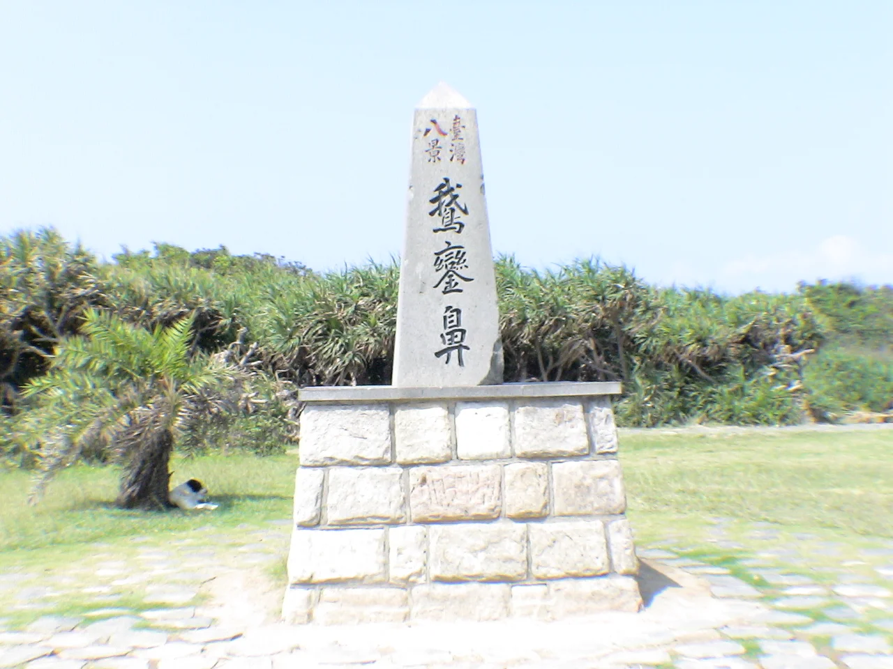

Cape Eluanbi
The name is a palimpsest of languages. The Paiwan people called this headland goran, meaning sail — an apt image for a point of land jutting into open water. Hokkien speakers rendered it Gô-lôan. The Qing administration had their own name. The Japanese called it Garanbi and made it one of their Eight Views of Taiwan. Today it is Cape Eluanbi, the southernmost point on the island of Taiwan, and the name carries all those layers at once. Standing at the rock marker that identifies the island's tip, you are looking south into the Philippine Sea and east across the boundary where East China Sea becomes Philippine Sea — a place where seas are named and measured.
Where the Seas Divide
Cape Eluanbi occupies a specific geopolitical position as well as a geographic one. Under current international convention, the boundary between the East China Sea and the Philippine Sea runs through this point. Proposals for a revised edition of the IHO's Limits of Oceans and Seas would also make Eluanbi part of the northern boundary of the South China Sea. The cape marks the southern tip of the Hengchun Peninsula, the long finger of land that extends from Taiwan's Central Mountain Range toward the Philippines. Its underlying geology is a Pleistocene stratum of yellow and brown sand, gravel, and clay — old material, pressed and layered over thousands of years. Archaeologists have found evidence of human habitation here dating to around 3100 BC, which means people were watching these waters from this point five millennia before anyone thought to build a lighthouse.
A Fortified Lighthouse
Shipwrecks were the problem. The Qixingyan reefs and strong currents made the waters off the cape treacherous, and in the 19th century the wrecks of foreign vessels led to confrontations with indigenous Paiwan communities — confrontations serious enough to prompt American and Japanese military expeditions in 1867 and 1874. The lighthouse became an urgent political project. British diplomat Robert Hart, inspector general of the Imperial Maritime Customs Service, sent agents to purchase the cape in 1875. Construction was overseen by Wang Fulu, with 500 soldiers providing protection; the site was defended with 18-pound cannons, Gatling guns, and a mortar, and provisions were stored for three weeks in case of siege. The lighthouse entered service in 1883. The total cost came to 71,248 Mexican dollars. It was not a lighthouse that expected peace.
War, Demolition, and Rebuilding
The Qing structure was damaged in the First Sino-Japanese War, with retreating Qing forces attempting to demolish it themselves. The Japanese repaired it in 1898 and elevated it into a cultural symbol — one of the Eight Views of Taiwan, popularized in travel literature and eventually commemorated in stone calligraphy rendered in the style of Wang Xizhi. During the Japanese occupation, the cape became a major whaling station targeting humpback whales in Banana and South Bays. A Shinto shrine was built on the grounds, one of only five in the world to use baleen whale jawbones as torii gates. Allied bombing during World War II seriously damaged the lighthouse again and destroyed the shrine. The Nationalist government rebuilt the lighthouse in 1947. Eluanbi Park opened on 25 December 1982; the lighthouse itself opened to regular visitors in 1992.
Land Crabs and Living Seas
More than 300,000 people visited Cape Eluanbi annually by 2014, many drawn by the southernmost-point marker and the sweeping coastal views. But the cape's biodiversity is its less-advertised distinction. The seas no longer hold the humpback whales that the Japanese whaling industry once targeted here; those populations are gone. What remains is a richly stocked marine environment: dolphins, sea turtles, and bull sharks inhabit the waters. On land, 26 species of terrestrial crabs have been documented at the cape, giving it the distinction of being the most biologically diverse location for land crabs in the world. The Longkeng nature reserve, around Banana Bay, protects coral reefs and old-growth forest. The cape is a place where superlatives — southernmost, most diverse — accumulate without anyone needing to embellish them.
From the Air
Cape Eluanbi sits at 21.902°N, 120.853°E at the southern tip of Taiwan's Hengchun Peninsula. From 3,000–5,000 feet, the lighthouse is visible as a white tower near the tip of the cape, with South Bay to the west and Banana Bay (Longkeng) to the east. The surrounding Kenting National Park fills the peninsula with green hills. The nearest major airport is RCKH (Kaohsiung International Airport), approximately 90 km to the north; Provincial Highway 26 follows the coast and is visible from the air. The Luzon Strait opens to the south, and on clear days the Philippine island of Itbayat may be visible on the horizon. Best visibility from the air is in the northeast monsoon season, November through March.
Nearby Stories
- Mudan Incident 2 km away
- Lanyu Flying Fish Cultural Museum 30 km away
- Zhaori Hot Spring 59 km away
- Ten Drum Rende Creative Park 88 km away
- Mavulis Island 89 km away
- Barclay Memorial Park 121 km away
- 1991 Eruption of Mount Pinatubo 722 km away
- Scarborough Shoal 762 km away