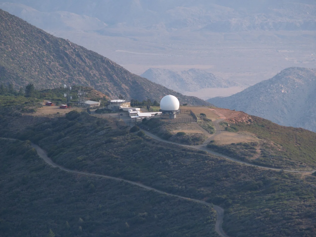
Mount Laguna Air Force Station
High on the Laguna ridge at 6,000 feet, above the marine layer and the desert haze, the Air Force built a radar station to watch the sky. The 751st Aircraft Control and Warning Squadron arrived in September 1951, a product of the Cold War imperative to detect incoming threats before they reached the cities below. For thirty years, the station tracked aircraft over the southwestern approaches to the continental United States. Then it closed, the FAA took over its air traffic functions, and the buildings that had housed 400 personnel were left to the wind, the graffiti artists, and eventually the demolition crews.
Standing Watch on the Laguna Ridge
The 751st Aircraft Control and Warning Squadron was assigned to Mount Laguna in September 1951, part of the Cold War buildup of radar detection infrastructure across the American interior. The ridge's elevation — among the highest in San Diego County — made it an ideal location for radar coverage of the surrounding region. The station's radar could see over the obstacles that blocked lower installations, providing the long-range detection capability that early warning doctrine required. At its peak, the facility housed approximately 400 military personnel, supporting the radar operations, communications, and administration necessary for continuous 24-hour coverage.
Joining the SAGE Network
In 1961, Mount Laguna Air Force Station was integrated into the Semi-Automatic Ground Environment, better known as SAGE — the Cold War's massive networked air defense system that linked radar stations across North America into a unified detection and response network. SAGE represented the era's cutting-edge approach to air defense: computers (enormous by mid-century standards) processed radar data from multiple stations simultaneously, theoretically providing national coverage that no single installation could achieve alone. Mount Laguna's integration into SAGE made it part of something larger than a local radar post — one node in a continental web of vigilance.
Thirty Years and Done
The station operated continuously until September 30, 1981, when it was decommissioned. The FAA assumed responsibility for the air traffic functions the military had performed, transitioning surveillance of the southwestern airspace from a military to a civilian mission. The handoff was clean in operational terms, but what it left behind on the Laguna ridge was less tidy: a collection of Cold War-era military buildings — barracks, operations centers, support facilities — that had been built for a specific purpose that no longer existed. The structures sat, increasingly deteriorated, in the state park that surrounded them.
Abandonment and Vandalism
Empty military buildings in remote locations attract a predictable sequence of visitors. First the curious, then the vandals, then the thieves stripping copper and fixtures, then the graffiti that accumulates in layers on every available surface. The Mount Laguna station buildings went through this progression over the decades following closure. Reports described them as gutted and graffiti-covered — structures that had housed a functioning military community reduced to shells that were becoming hazardous as well as unsightly within Anza-Borrego Desert State Park's viewshed.
Two Stimulus Dollars per Square Foot of History
The resolution came in 2009, when $18.2 million in federal stimulus funds were allocated to demolish the abandoned Cold War structures. The number represents the cost of properly disposing of buildings that contained asbestos, lead paint, and decades of accumulated contamination — the legacy of mid-century military construction practices that didn't account for eventual cleanup. The demolition erased the physical evidence of thirty years of Cold War vigilance from the Laguna ridge, leaving the site to be reclaimed by the surrounding forest and chaparral. The radar is gone, the barracks are gone, the network they served is history. What remains is the view the station was built to watch over.
From the Air
Mount Laguna Air Force Station sat at approximately 32.88°N, 116.42°W at about 6,000 feet elevation on the Laguna ridge in eastern San Diego County. The site is within Anza-Borrego Desert State Park's boundaries. The station's former location is identifiable from the air as a cleared area on the ridge, now largely revegetated. The Laguna Mountain Recreation Area and the community of Mount Laguna are nearby. The ridge offers excellent visibility in all directions — precisely why the Air Force chose it.
Nearby Stories
- Fish Creek Mountains Wilderness 1.7 km away
- Black Mountain Open Space Park 5 km away
- La Jolla Complex 7.6 km away
- Naval Amphibious Base Coronado 8.2 km away
- Temecula Massacre 8.6 km away
- Salton City: The Beach Resort That Became a Wasteland 10 km away
- Mountain Warfare Training Camp Michael Monsoor 10 km away
- Antique Gas and Steam Engine Museum 17 km away