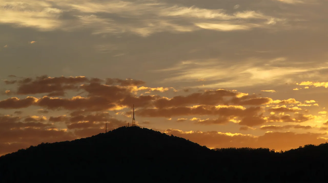

Mount Nardi
Mount Nardi did not always have a name of its own. Until the 1950s it was considered just a shoulder of neighbouring Mount Matheson, an unremarkable bump on the Nightcap Range above Nimbin. Then the two summits were formally separated, and this one was named for Angelo Nardi, a local shire councillor who served from 1956 to 1961. Today the peak rises 817 metres above sea level, its head bristling with broadcast masts and its flanks cloaked in subtropical rainforest - a strange marriage of telecommunications steel and World Heritage wilderness on the rim of a long-dead volcano.
Built from Lava
Mount Nardi belongs to the Nightcap Range, a spur of the Great Dividing Range that forms the southern rim of the Mount Warning, or Tweed, shield volcano. The range was raised over 23 million years ago by successive lava flows, and the rock beneath the rainforest still records that violence in three distinct layers: Lismore Basalt, Nimbin Rhyolite, and Blue Knob Basalt. Each represents a different pulse of the volcano, a different temperature and chemistry of molten rock. The mountain you climb today is the cooled, eroded leftover of an eruption that reshaped the entire region.
The Big Scrub and the Cedar Getters
The Bundjalung nation has long held this country, and the people who spoke the Widjabal language crossed the range by foot-tracks, keeping small grassed clearings in the forest for camping and hunting. European loggers came in 1842, drawn by red cedar - the prized "red gold" of the colonial timber trade. The lowlands below were once the Big Scrub, one of the largest stretches of lowland subtropical rainforest in eastern Australia, nearly 75,000 hectares of it. By 1900, after decades of clearing for dairy farms, less than one percent remained. The historic Nightcap Track that crosses the peak began as a path worn by postal workers carrying mail between Lismore and Murwillumbah.
A Crown of Antennas
In 1962 the first tower went up on the summit - RTN-8, now NRN-8 - to carry analogue television, and a bitumen road, Newton Drive, was cut up from Nimbin to reach it. More masts followed: the ABRN-6 tower in 1964, raised by the ABC and later switched from the Brisbane network to Sydney, and a Telstra tower in 1975, since demolished and rebuilt. Today the three structures push digital television, ABC and community radio, NBN wireless internet, and 4G and 5G mobile signal out across the Tweed, the Gold Coast, Lismore, and Byron Bay. The carriers share the ridge like neighbours: Telstra on its own mast, Vodafone borrowing space on the ABRN-6 tower, and the whole site run by a single operator. When analogue TV switched off in 2012, the original tower found new life broadcasting the community station Triple Z FM. It is an oddly fitting summit for the region - the same high ground that once carried mail on foot now carries the signals that bind the whole north coast together.
The View from the Top
For all its steel, Mount Nardi remains a place of quiet. A small picnic area near the summit offers shaded tables and shelters, toilets and information signs, and long views across Nightcap National Park and the neighbouring Whian Whian State Conservation Area - the surviving rainforest that the Terania Creek protesters fought to save in 1979, and that UNESCO recognised as World Heritage in 1986. Walking trails fan out from the top, including the Mount Matheson Loop and Pholi's Walk, both part of the historic Nightcap Track. This is fragile country: the same World Heritage forests have been scarred by bushfire in recent years, a reminder that even an ancient rainforest is not guaranteed against a warming climate. Stand among the antennas, turn your back on them, and you face one of the oldest forest lineages on the continent.
From the Air
Mount Nardi rises to 817 metres at 28.55 degrees south, 153.29 degrees east, in the Nightcap Range near Nimbin. The cluster of tall broadcast towers on the summit is a conspicuous visual and radar landmark, visible for many kilometres and useful for orientation over the otherwise uniform forested ranges. Recommended viewing altitude 3,000 to 4,500 feet, well clear of the masts and rising terrain. Nearest airport is Lismore (ICAO YLIS), about 20 km south; Ballina Byron Gateway (YBNA) lies roughly 45 km southeast and Gold Coast (YBCG) around 80 km northeast. The towers carry obstruction lighting, but caution is warranted: terrain is steep and prone to orographic cloud and sudden visibility loss in moist easterly conditions.
Nearby Stories
- Richmond River Massacres 7.2 km away
- Fingal Head Light 16 km away
- Spicers Gap Road 56 km away
- Allan Cunningham Monument 78 km away
- Washpool National Park 83 km away
- HMS Porpoise (1799) 693 km away
- Wreck Reefs 722 km away
- SS Elingamite: Gold, Fog, and a Captain Wrongly Blamed 1809 km away