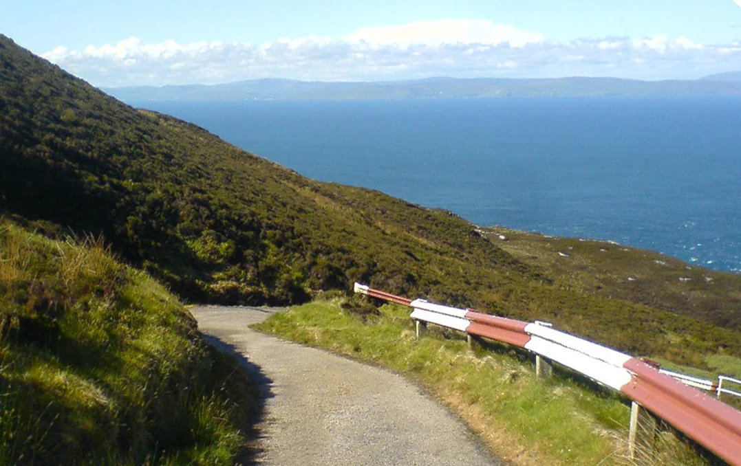

Mull of Kintyre
From the lighthouse on the cliff edge, on a clear day, the Antrim coast of Northern Ireland is so close that you can pick out individual houses without binoculars. Twelve miles of open water — sometimes less — separate two countries that have spent fifteen hundred years sending people, ideas, and trouble back and forth across it. The Mull of Kintyre is the place where Scotland leans toward Ireland and almost reaches it.
The Headland Country
Maol Chinn Tìre is the Gaelic name: the rounded, bare headland of the head land. Mull, from maol, means bald — a hill or promontory without trees, polished by wind. Kintyre, the long peninsula it tips, takes its name from ceann tìre, head of the land, and the old anglicisation Cantyre is the closer to the original. The Mull proper is the southwestern tip itself, reached from Campbeltown by ten miles of single-track road that runs past the southernmost village, Southend, with its tea room and its beaches, and then climbs another eight miles into country that is almost empty of houses. The road ends at the lighthouse. Beyond is the cliff, and then the sea.
The Lighthouse on the Cliff
The lighthouse here was the second commissioned in Scotland, lit for the first time on 1 November 1788. Robert Stevenson — grandfather of Robert Louis Stevenson — would later supervise its modernisation, but the original tower was the work of Thomas Smith of Edinburgh, who had won the Northern Lighthouse Board's first contracts in 1786. The light guards shipping in the North Channel, the narrow neck of water that connects the Irish Sea to the Atlantic. Currents here are notoriously strong, and the combination of fast tidal streams, sudden sea mists, and shallow rocks has piled up wrecks for centuries. The SS New York, a steamship converted to sail, went ashore at the south end of the Mull on 13 June 1858. Lighter craft come to grief still.
Mull of Kintyre, by Paul McCartney
Paul McCartney bought High Park Farm on Kintyre in 1966, retreated there with Linda and the children after the Beatles broke up, and stayed. In 1977 he and Denny Laine wrote a song about the place — a slow waltz with bagpipes, recorded with the local Campbeltown Pipe Band — and released it as a single by his band Wings. "Mull of Kintyre" went to number one in the UK, sat there for nine weeks, and became the first single in British history to sell two million copies, outselling the Beatles' previous record-holder. The bagpipes, the Campbeltown choir, the steady McCartney melody — none of it was supposed to be a hit. It became one anyway. For a generation of Britons, the words "Mull of Kintyre" mean a pipe band coming in on the second verse.
The Land Bridge
The strait between Kintyre and Antrim has functioned as a bridge for as long as humans have lived on either side. Stone-age hunters crossed it on the way from continental Europe to Ireland via Scotland. In the fifth and sixth centuries, the Scotti — the Gaelic-speaking people of northeastern Ireland — used the same crossing in reverse to establish the kingdom of Dál Riata in what is now Argyll. The kingdom they founded eventually gave Scotland its name. The Mull is also a graveyard for aircraft. The cliffs that rise abruptly from the sea, combined with frequent low sea-mist, have caught dozens of military and civilian flights since the 1930s; wreckage from some still litters the slopes. The worst loss was an RAF Chinook helicopter on 2 June 1994, which struck the Mull in fog and killed all 25 senior intelligence and police personnel aboard along with the four crew. The cause was disputed for two decades.
The Joke About the Censor
For many years a piece of British film-industry folklore held that the British Board of Film Classification used what was called the Mull of Kintyre test: an unofficial rule that no depiction of an erect penis could be passed for general release if it deviated from the vertical by more than the apparent angle of the Kintyre peninsula on a map of Scotland. The BBFC has firmly denied that any such rule ever existed. It survives anyway, in pub conversations and in articles like this one, because it is the kind of story that is too good to die. The Mull of Kintyre is many things — a lighthouse, a song, a coastline, a graveyard for aircraft, the home of the Beatle who stayed. It is also, accidentally, a unit of measurement nobody is willing to admit using.
From the Air
Coordinates 55.311°N, 5.804°W mark the lighthouse at the southwestern tip of the Kintyre Peninsula in Argyll and Bute. Best viewed from 1,500-3,000 ft AGL on the seaward side, where the cliff face and the lighthouse compound are visible together; the Antrim coast of Northern Ireland sits 12 nm south-southwest across the North Channel. Strong winds and frequent sea fog make low-level flight hazardous. Nearest airport: Campbeltown (EGEC, the former RAF Machrihanish) approximately 10 nm north-northeast. Belfast International (EGAA) is the nearest major airport, approximately 50 nm south.
Nearby Stories
- Isle of Arran 4.1 km away
- Carrick-a-Rede Rope Bridge 4.9 km away
- Ailsa Craig 11 km away
- Glenarm Castle 12 km away
- Achamore House 14 km away
- River Bann 16 km away
- Portpatrick Lifeboat Station 22 km away
- Bruichladdich Distillery 25 km away