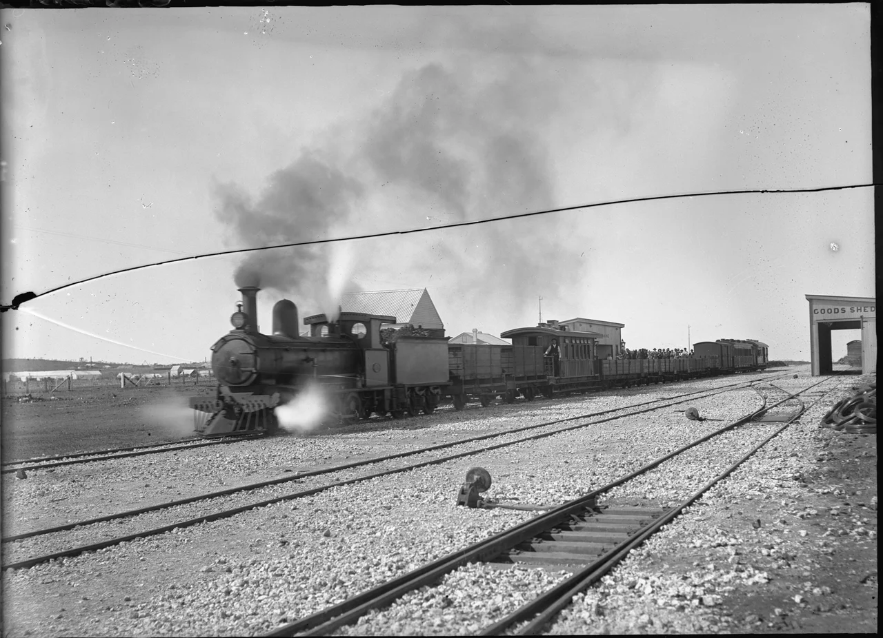

Mullewa–Meekatharra railway
Gold was the reason. In the 1890s prospectors striking it rich in the Murchison desert had a problem money could not immediately solve: everything they needed had to come hundreds of kilometres across waterless country, and everything they dug had to go back out the same way. The answer was a single ribbon of narrow-gauge steel pushed north from the wheat town of Mullewa toward the diggings. The Mullewa–Meekatharra railway was never glamorous and never fast, but for eighty years it was the spine that held a string of remote goldfields towns to the rest of Western Australia.
A Line Born of a Gold Rush
In 1894 a syndicate of interstate investors led by Charles G. Lush proposed building a private line into the goldfields. Premier John Forrest had other ideas: that May he announced the government would build it instead, and in November Parliament passed the Mullewa–Cue Railway Act. The contract for the first stretch, Mullewa to Cue, went to Baxter and Prince in 1895, and the line opened on 1 July 1898. It crept north in deliberate stages over the next dozen years, each extension chasing the next field. Cue reached Nannine by 1903. The final push from Nannine to Meekatharra opened on 11 August 1910, and the rails finally stopped only when they reached Wiluna, far to the east, in the 1930s.
The Towns It Made
Where the line went, towns lived; where it bypassed, they often died. Mullewa became the head of the line almost overnight, a transfer point where goods and people bound for the Murchison changed trains. Mount Magnet grew into an important junction once the Sandstone branch split off there. Cue, Nannine, and Meekatharra all owed their reach to the timetable. The railway carried wool out, ore out, and brought in the timber, machinery, food, and water that a desert settlement could not produce for itself. For an inland town in this country, the question of whether the rails came was not a matter of convenience. It was a matter of survival.
Branches Into the Scrub
From this trunk, smaller lines reached out toward whatever the desert promised. At Mount Magnet the Sandstone branch peeled off east. From Cue, a branch ran to the Big Bell mine, built in the 1930s under an agreement with the American Smelting and Refining Company. North of Meekatharra the line eventually pushed on to Wiluna. Strangest of all was a private railway authorised in 1920 to run from Meekatharra to the Horseshoe manganese mine; it lasted only from 1927 to 1933, when the mining company collapsed into receivership and the rails fell silent. Each branch told the same story in miniature: a line laid in hope, worked while the ore held out, and abandoned when the ground gave up its riches or the price fell away.
Floods on the Iron Road
The Murchison is bone-dry until, abruptly, it is not. The line was plagued by washaways: rare but violent rains would tear the ballast out from under the track and leave the rails hanging in the air, severing the goldfields from the coast until gangs could rebuild. Maintaining a railway across hundreds of kilometres of flood-prone, sun-blasted scrub was a slow, expensive, unending fight against the land itself. Yet for decades there was simply no alternative. The steam locomotives kept running, the water tanks along the route kept the boilers full, and the line endured washaway after washaway because the towns at the far end could not survive without it.
Vanishing From the Map
What killed the railway was not flood but the road. After the Wiluna line closed in 1957, Meekatharra's rail yards actually grew busier for a time, becoming a hub for shifting heavy equipment north to the developing Pilbara iron-ore mines. Then, through the 1970s, the region's roads improved, road trains took over the freight, and the trains lost their purpose. The Mullewa–Meekatharra line closed on 1 May 1978. Today almost every trace has been erased from the railway maps, the steel lifted and sold off. But the ghosts remain. Heritage-listed station buildings, goods sheds, water tanks, and stationmasters' houses still stand at Mullewa, Yalgoo, Cue, Mount Magnet, and Meekatharra, weathered markers of the iron road that built the Murchison.
From the Air
The former alignment runs roughly north-south through the Mid West, from Mullewa near 28.5°S, 115.5°E up toward Meekatharra near 26.6°S, 118.5°E, with the mapped reference point about 27.5°S, 117.0°E near Cue and Mount Magnet. From the air, trace the chain of small grid-pattern towns strung along the old route, and watch for the wide main streets and surviving water tanks that mark the former stations. Nearest airfields with scheduled service are Mount Magnet (YMOG) and Meekatharra (YMEK), both former rail junctions. The country is flat, arid, and reliably clear for navigation, though the same rains that once washed out the track can still produce sudden low-visibility dust and storm cells.
Nearby Stories
- Wooleen Station 27 km away
- Big Bell, Western Australia 30 km away
- Wilgie Mia 38 km away
- Boolardy 46 km away
- Mount Magnet, Western Australia 53 km away
- Mount Narryer 112 km away
- Ajana 171 km away
- Sandstone Gold Mine 234 km away