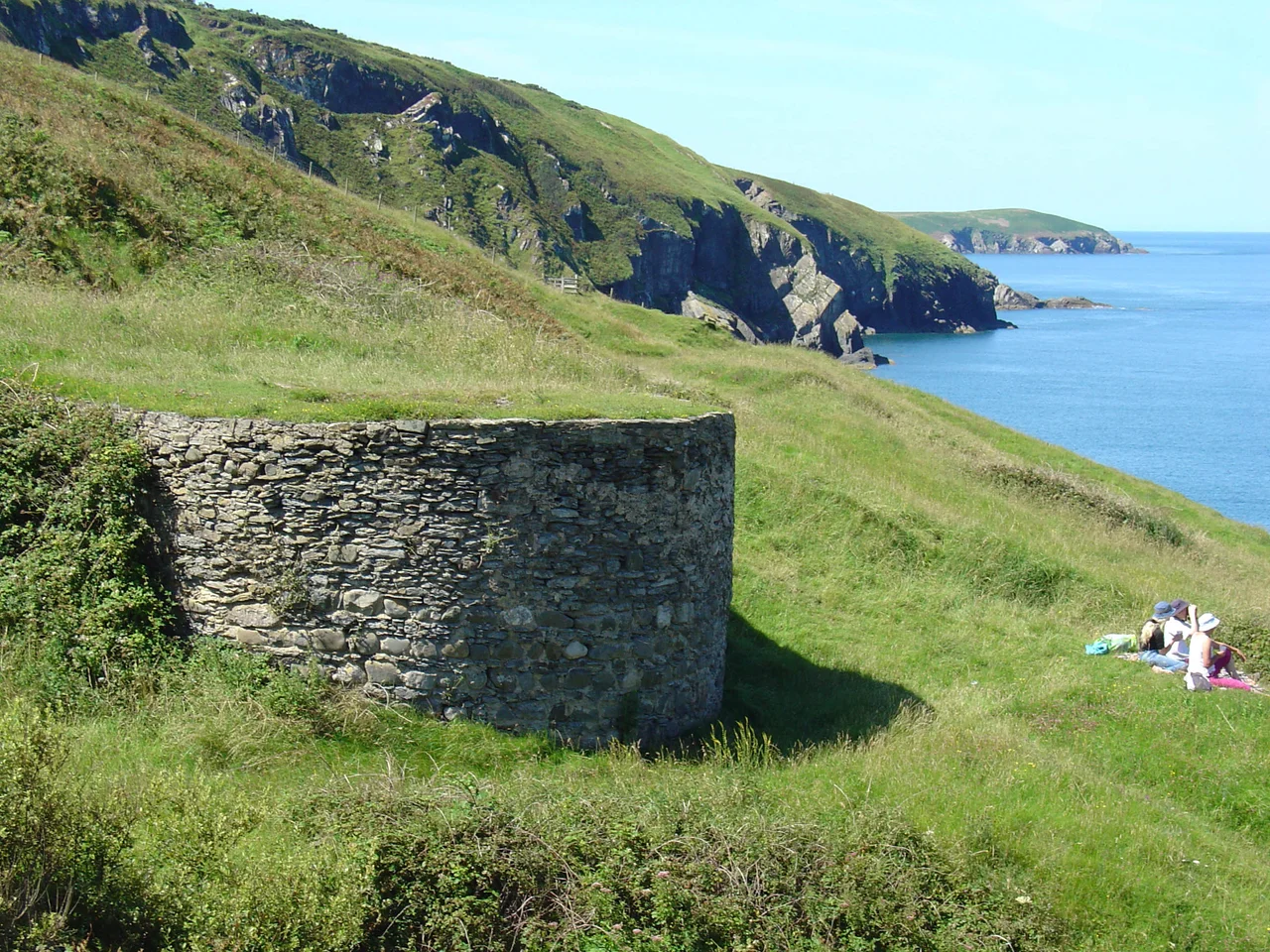

Mwnt
Foel y Mwnt is a near-perfect cone, 76 metres or 249 feet of grass rising from the cliff above the beach. From much of Cardigan Bay it works as a navigation mark; sailors have been steering by it for at least a thousand years. The Welsh word mwnt simply means a mound, anglicised on older maps as Mount. The hill gives the place its name, and the place gives the hill the kind of dramatic setting — green slope plunging down to white-sand beach plunging into Atlantic blue — that explains why summer holidaymakers reach for their cameras within ninety seconds of arrival.
The Conical Hill
Foel y Mwnt is a glacial mound — a residue of the last ice age, when the ice sheets that ground out Cardigan Bay left behind small rounded hills of harder rock. Geologically it is nothing special. Scenically, in context, it is extraordinary. From the top the view runs north up Cardigan Bay past Aberporth and on toward Aberystwyth, and south back past the Teifi estuary to the cliffs of Cemaes Head. On a clear summer day the bay shows the kind of colour that maps usually print as turquoise: pale sand under shallow water, deeper indigo where the depth increases, with dolphins surfacing in patches of disturbed water. The Wales Coast Path runs through the small settlement at Mwnt — barely a hamlet, a handful of buildings, a National Trust car park, and the small whitewashed church on the cliff.
Traeth-y-Mwnt
The beach below the cliff has been awarded a Green Coast Award — the rural equivalent of a Blue Flag, recognising water quality and natural beauty rather than urban amenities. Swimming conditions here are generally safe; the small cove is sheltered, and there is no lifeguard. Bottlenose dolphins from Cardigan Bay's resident population work the waters offshore in summer, with porpoises and Atlantic grey seals making up the rest of the marine cast. The National Trust owns the beach and the surrounding land, though not the church on the cliff above. The beach is reached by a steep grass path; in summer the descent is studded with families carrying buckets and windbreaks, in winter with walkers and dogs on the Coast Path.
Red Sunday
In 1155, a group of Flemish settlers from Pembrokeshire attempted to invade and seize the Mwnt area. They were beaten so decisively that the victory was celebrated for centuries afterwards. Until at least the 18th century, the first Sunday in January was kept locally as Sul Coch y Mwnt — Red Sunday of Mwnt — a games meeting commemorating the blood shed on that day. Within living memory, human bones and skeletons have been turned up by the plough or exposed by erosion in the area, and the brook running near the beach is called Nant y Fflymon, the Flemings' Brook. The Flemish settlement of south Pembrokeshire is well documented: refugees from flooding in Flanders were resettled by Henry I in the early 12th century, in what is now still called Little England Beyond Wales. The invasion of Mwnt in 1155 was an attempt to extend that Flemish territory north. It did not work.
The Sailors' Church
On the cliff above the cove stands the Church of the Holy Cross — a Grade I listed medieval sailors' chapel, whitewashed rubble walls under a slate roof, with deep-set windows and a 13th-century baptismal font carved from Preseli stone. The site has been used since the Age of the Saints, the early Christian period when Irish and Celtic missionaries spread along this coast. The present building is probably 14th-century. Mwnt was an independent civil parish for several centuries before becoming a detached chapelry of Llangoedmor and then, since 1934, part of the parish of Y Ferwig. The church was a stopping place on the medieval pilgrim route to St Davids and a place of comfort for fishermen working a notoriously hard piece of coast. The National Trust owns the beach but the church remains in the care of the Church in Wales.
What Mwnt Is
Mwnt is a hamlet in name only. There is no shop, no pub, no village proper — just a small group of dwellings, a car park, a small church, a cove and a hill. The Wales Coast Path passes through; the parking gets full in July; the National Trust manages the beach and surrounding grass. Outside the summer season, Mwnt is one of the quietest places on the Ceredigion coast, with the wind in the grass and the gulls riding the updraft and Foel y Mwnt rising green against grey sea. The 1155 battle is, like the Welsh parrots of Cardigan Island, a small piece of history that the place quietly keeps. The brook still runs. The pilgrim church still stands. And the conical hill still draws the eye from miles away, the way it has for the better part of a thousand years.
From the Air
Mwnt sits at 52.14 degrees north, 4.64 degrees west, on the Ceredigion coast about 4.5 miles north of Cardigan. From the air the conical hill of Foel y Mwnt (76 m / 249 ft) is the unmistakable landmark — a near-perfect grassy cone visible from most of Cardigan Bay. The small whitewashed church sits on the cliff just south-east of the hill, with the curving Traeth-y-Mwnt beach immediately below. Best viewed at 1,000-2,000 feet AGL on a coastal pass. Nearest airfield is Haverfordwest (EGFE), about 25 nm south; Aberporth lies 5 nm to the east-northeast. Cardigan Bay weather can change quickly; the coast here is fully exposed to westerly weather systems.
Nearby Stories
- HMS H47 4.6 km away
- National Botanic Garden of Wales 5 km away
- Narberth 6.3 km away
- Aberystwyth Lifeboat Station 9.3 km away
- Skomer 13 km away
- Diamond (1823 ship) 21 km away
- Talley Abbey 22 km away
- HMS Tyler 32 km away