.jpg)
Najd
Out here the word for the place is also a description of it. Najd means "highland" in Arabic, and the name fits: this is the raised central plateau of the Arabian Peninsula, a tableland of gravel plains, sand seas, and limestone cliffs walled off from the coasts on every side. The Hejaz mountains block it from the Red Sea to the west. The Nafud sands close it off to the north, the Dahna desert to the east, and the vast Empty Quarter to the south. For most of recorded history that isolation kept Najd poor, remote, and largely beyond the reach of the empires that ruled the rest of Arabia. It also made it the one place stubborn enough to eventually unify the whole peninsula under a dynasty born among its mudbrick walls.
The Edge of the World
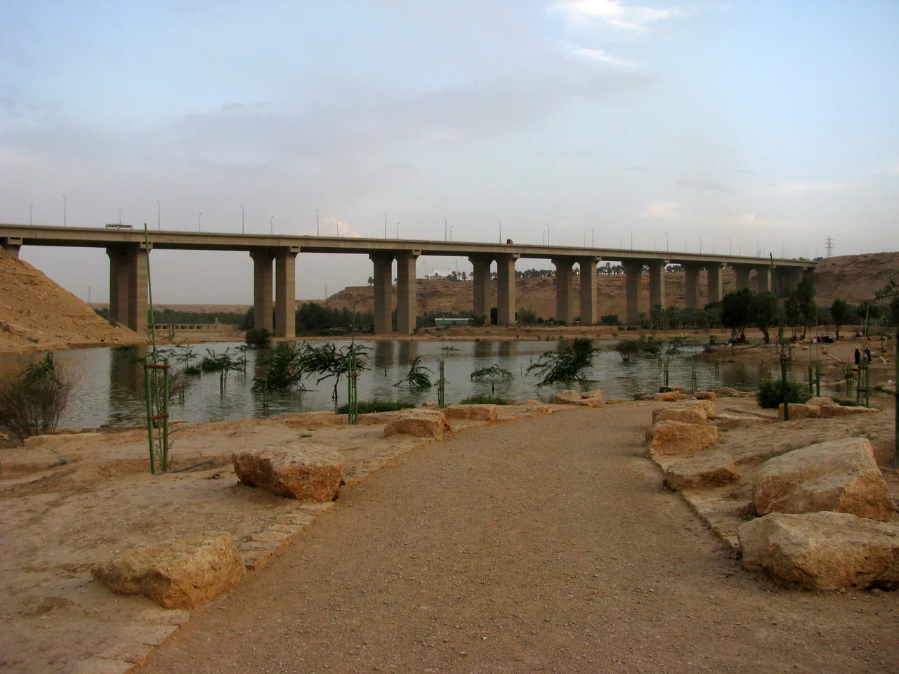
The defining landmark of central Najd is the Tuwaiq, a limestone escarpment that snakes roughly 800 kilometers across the plateau like a frozen wave. Built of Jurassic-age rock laid down when this desert was an ancient seabed, its western face drops away in sheer cliffs while its eastern slope eases down gently. Northwest of Riyadh, one stretch of that cliff line plunges so abruptly into the haze that Saudis call it Jebel Fihrayn, the Edge of the World. Stand at the rim and the desert simply ends; the plateau falls away hundreds of meters to a flat plain that runs to the horizon. The wadis that thread the escarpment, chief among them Wadi Hanifa, carried the rare runoff that made settlement possible. Wherever water gathered, towns grew.
Capital on a Dry River
Riyadh sits where several of those wadis meet, and its name carries the memory of water: it comes from the Arabic for gardens or meadows, the green patches that fed early settlers. The Saud family made the area their seat in 1824, and the modern city has since swollen into a metropolis of millions, glass towers rising from ground that for centuries supported little more than date palms and mudbrick. Today roughly a third of Saudi Arabia's population lives in the Najd region. Yet the older grammar of the place survives in the architecture: the Najdi style, refined over centuries, favored thick earth walls, shaded courtyards, triangular and rectangular wall openings, and toothed battlements along the rooflines, an entire vocabulary built to defeat the heat.
The Dynasty in the Mudbrick Town
A few kilometers northwest of Riyadh, in a bend of Wadi Hanifa, stands Diriyah, founded in 1446 and later the cradle of the Saudi state. Its old quarter of At-Turaif, a labyrinth of restored mudbrick palaces and towers, is now a UNESCO World Heritage Site. Here Muhammad bin Saud, emir of Diriyah from 1727, made an alliance in 1744 with the religious scholar Muhammad ibn Abd al-Wahhab, who had been born in the nearby village of 'Uyayna and preached a strict reformist interpretation of Sunni Islam. The pact joined political and religious authority and gave the first Saudi state its driving force. That state expanded rapidly across Arabia before an Egyptian army acting for the Ottomans destroyed Diriyah and ended it in 1818. A second Saudi state rose in 1824 and faded; a third, launched when the young Ibn Saud retook Riyadh in 1902, endured. In 1932 his unified kingdom of the Hejaz and Najd became Saudi Arabia.
Deeper Time on the Plateau
Long before any of that, Najd belonged to people whose names are lost. At Al-Magar in the southwest, archaeologists uncovered a Neolithic culture dated to roughly 9,000 years ago, including a large carved stone fragment shaped like a horse, hints of one of the earliest places where humans may have begun managing the animal. To the north, at Qaryat al-Faw, the Kingdom of Kinda built a caravan capital that thrived in the centuries before Islam, its kings ruling by prestige and alliance rather than walls and garrisons. The plateau's deep isolation left its own quiet mark on language: many linguists consider Najdi Arabic among the least foreign-influenced of all modern Arabic dialects, a desert-preserved tongue shaped more by distance than by conquest.
From the Air
Najd centers near 24.29°N, 43.59°E, a vast plateau best appreciated from cruising altitude where the Tuwaiq escarpment shows as a long pale ridge cutting across the gravel plains. The Edge of the World cliffs lie about 100 km northwest of Riyadh. The primary gateway is King Khalid International Airport (OERK / RUH), about 35 km north of Riyadh; the city's lights make an unmistakable nighttime landmark in the otherwise dark interior. Daytime visibility is often excellent but can drop sharply during spring and summer dust storms, when the whole plateau vanishes into haze.
Nearby Stories
- Mahd Al-Dhahab 216 km away
- Hejaz 227 km away
- Battle of Turubah 374 km away
- Mustatil 379 km away
- Khaybar 433 km away
- Tuwaiq Escarpment 483 km away
- Qaryat al-Faw 522 km away
- Battle of 73 Easting 610 km away