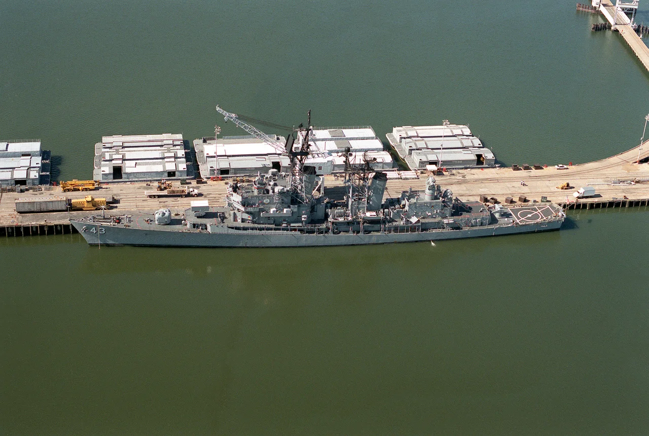
_at_NWS_Yorktown_1990.JPEG)
Naval Weapons Station Yorktown
On August 7, 1918, a few months into America's involvement in World War I, the United States Navy bought a 4,000-acre DuPont dynamite plant on the York River. Before the company's production line could start, the Navy needed somewhere on the Atlantic seaboard to store, assemble, load, and test the mines for the planned North Sea Mine Barrage - and Yorktown fit perfectly. Eighteen square miles became Navy Mine Depot, Yorktown. Then the depot kept growing. Today Naval Weapons Station Yorktown sprawls across 20.7 square miles - roughly a fifth of York County's total land area of 108.5 square miles, with 14 miles of York River shoreline - and conceals beneath its forests a 17th-century brick house, the remains of a vanished town called Penniman, and the ground where Algonquian-speaking Kiskiack people lived before the English arrived.
Before It Was the Navy's
Long before the depot existed, the Kiskiack lived along this stretch of the York River. They were Algonquian-speaking members of the Powhatan Confederacy, displaced through the 1630s as English settlement expanded west from Jamestown. The English took the village's name for their own settlement, sometimes spelled Kiskiack and sometimes Cheesecake - Cheesecake Road and Cheesecake Cemetery still exist inside the base, the name an English mangling of an Indigenous word. The oldest structure on the weapons station is the brick Kiskiack (Lee House), built in the late 17th century by English immigrant Henry Lee or his near descendants. The Bellfield Plantation - sometimes called the E.D. Plantation for Edward Digges - sat on the east side of Felgate's Creek. The land had been granted in 1630 to John West, a Virginia governor, and held by Digges descendants from 1650 to 1769. It ran as an agricultural operation, on enslaved labor, right up until the Navy bought it on August 7, 1918.
DuPont, Dynamite, and Mines
Around 1914 the DuPont Company assembled 4,000 acres on the York River and built a dynamite plant. The community of Penniman grew up around it. Before production could begin in earnest, the war intervened. The Navy needed a place to lay the North Sea Mine Barrage - a massive ocean minefield to protect Allied commercial shipping from German U-boats - and that required a coastal facility where mines could be stored, assembled, loaded, tested, and issued to ships. Yorktown sat near the Norfolk Navy Yard, the Hampton Roads operating base, and the Fifth Naval District fuel depots. The Chesapeake and Ohio Railway ran along one boundary. Five miles of navigable York River waterfront could accommodate the largest vessels afloat. The president signed the proclamation in August 1918. The Bureau of Ordnance took possession a month later. At its World War I peak, 10,000 personnel worked the facility, many living in Penniman.
The Reservation
Building the depot meant taking land. The government used eminent domain to acquire properties along the former Yorktown-Williamsburg Road through the community of Lackey, Virginia - an area whose landowners and tenants were primarily African American Virginians and which had been locally known since the late 19th century as 'the Reservation.' A self-educated farmer named John Tack Roberts, born around 1860, helped many displaced Lackey residents negotiate better financial compensation for their properties. Many relocated to the community of Grove in adjacent James City County. Another settlement called Lackey developed along the Yorktown Road a few miles away. These were people whose families had often lived on this land since emancipation, building communities of farms and churches and schools that the Navy's expansion erased. The 1992 ethnohistorical study 'Cast Down Your Bucket Where You Are' documents what was taken. After World War I, when the Navy shifted away from mines, Penniman also vanished as workers moved on. Halstead's Point, another worker community near the present main gate off Route 143, faded in the same way.
An Explosive Corridor
The Navy never closed the gate. The Mine Depot became the Naval Weapons Station, supporting the Atlantic Fleet through the Second World War and the Cold War and into the present. On October 1, 1998, as part of a Mid-Atlantic consolidation, Cheatham Annex - acquired by the Navy on June 21, 1943, and located in the Historic Triangle near Jamestown and Williamsburg - was incorporated into the station. Cheatham Annex includes the former site of Penniman. The station today hosts 25 tenant commands: the Navy Munitions Command, the Naval Ophthalmic Support and Training Activity, a Marine Corps Fleet Antiterrorism Security Team, Riverine Squadron Three, expeditionary medical and logistics groups, and others. From the air, the base reads as a vast forested zone bordering the river - one of the Navy's 'explosive corridors' to the sea. The Lee House still stands. So do Cheesecake Road and the ghost outlines of vanished communities under the trees.
From the Air
Naval Weapons Station Yorktown covers approximately 37.2359 N, 76.5492 W, a 20.7-square-mile complex along 14 miles of York River shoreline northwest of Yorktown. This is an active Navy installation with prohibited and restricted airspace; check NOTAMs and avoid overflight without coordination. From 5,000 feet, the base reads as a vast forested expanse between Newport News and Williamsburg, with the York River as its northeast boundary. Felker Army Airfield (KFAF) at Fort Eustis is 5 nm south. Newport News/Williamsburg International (KPHF) is 8 nm south. Williamsburg-Jamestown (KJGG) is 5 nm west. Restricted areas R-6609 series cover the station.
Nearby Stories
- Hungars Church 1.3 km away
- Cape Charles Lighthouse 6.7 km away
- CSS Virginia 11 km away
- White House (plantation) 12 km away
- Flowerdew Hundred Plantation 17 km away
- Battle of Gwynn's Island 17 km away
- Nat Turner's Rebellion 22 km away
- False Cape State Park 37 km away