
Neugrund crater
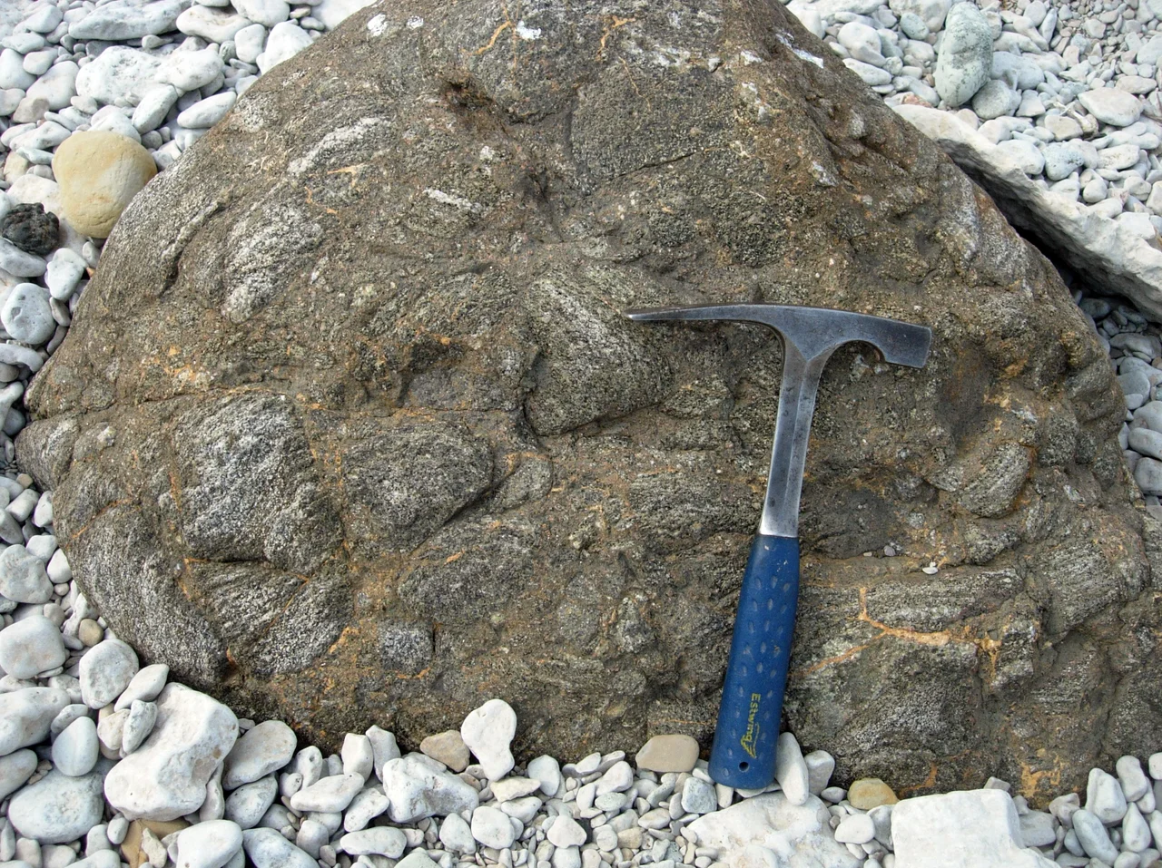
You cannot see the Neugrund crater. It is eight to nine kilometres across and it is completely underwater, buried under sediment, with nothing at the surface to mark it - a hole in the Earth that no photograph will ever show you. What you can do is put your hand on it. Scattered along the shores of Osmussaar, half-sunk in the shallows and standing in the junipers, are roughly sixty enormous boulders of a rock that exists almost nowhere else: gneissic breccia, shattered basement stone welded back together by an impact, quarried out of the seabed a few kilometres offshore and delivered to this beach. They are the crater, turned inside out.
The Rock That Should Not Be There
Neugrund breccia is unmistakable once you know it. Fragments of gneiss and amphibolite - deep crystalline rock from far below the limestone that surfaces in this part of Estonia - are jumbled together and cemented, the texture of something violently broken and then instantly glued. The island's most famous specimens have names. Skarvan, near the western shore, is the largest known. The pair called the Osmussaare Kaksikud, the Osmussaar Twins, were once considerably bigger than they are today: Soviet troops on the island quarried them for wartime construction stone and took perhaps half of them away. How the boulders arrived is credited to two very different forces. The impact itself flung material outward; the ice sheets that came much later dragged breccia across an area of more than 10,000 square kilometres of northwestern Estonia. Both processes had a hand in what now lies on the shore.
A Ring on the Seafloor
The structure sits between Osmussaar and the smaller island of Krassi, under 40 to 70 metres of water. Surveys of the seabed have mapped a classic complex crater: a raised rim ring roughly nine kilometres across, the rim itself two and a half to three kilometres wide and rising fifty to a hundred metres above the surrounding seabed. Its original depth is unknown, because the bowl has been filling with sediment for an unimaginable length of time, but estimates run past 500 metres. Its meteoritic origin was scientifically confirmed in 1998. Because it was drowned almost immediately and then sealed under sediment rather than scoured away by weather, it is now regarded as one of the best-preserved shallow-marine impact craters anywhere on Earth.
The Argument About Its Age
How old is the crater? The honest answer is that the number has moved a long way. Neugrund was long dated to the Ordovician, around 470 million years ago, which put it in excellent company. Around 468 million years ago a 150-kilometre asteroid in the main belt appears to have broken apart, and Earth spent the following tens of millions of years absorbing the debris - the Ordovician meteor event, recorded in fossil meteorites quarried out of Swedish limestone and in chromite grains sprinkled through sediments worldwide. Neugrund was slotted into that story as one of its craters. More recent work has pushed the impact back into the Cambrian, to roughly 535 million years ago. If that date holds, Neugrund predates the great asteroid breakup by some 65 million years and cannot be part of it at all. It is a good reminder that the tidiest explanations are usually the ones a new measurement dismantles.
What Actually Happened Here
Reconstruct the moment and the scale becomes uncomfortable. An asteroid roughly a kilometre in diameter came down into open sea, about a hundred kilometres from the nearest coast, where the water was somewhere between a hundred and two hundred metres deep. That water offered no meaningful cushion. The object punched straight through it into crystalline basement rock, excavated a cavity that briefly may have been half a kilometre deep, and threw shattered gneiss outward in every direction. Then the sea closed over the wound, and it has been quietly filling in ever since - through the Cambrian, the entire age of fish, the dinosaurs, the ice ages, and the arrival of the people who now sail over it without noticing.
Estonia's Other Holes
Neugrund is Estonia's largest and oldest confirmed impact structure, but it is not alone. Off Hiiumaa, the Kardla crater is about four kilometres wide and dates to the Late Ordovician, roughly 455 million years ago; it too is buried, and it has been reached only by drilling. For a country of this size, that is a striking concentration - a function partly of chance and partly of geology, since flat, undisturbed Baltic basement rock preserves and records these events unusually well. Since 1996 the boulders on Osmussaar have had formal protection within the island's 486-hectare landscape reserve, which lists the gneiss breccia among the features it exists to safeguard. The crater below the water needs no protecting. It has managed half a billion years on its own.
From the Air
Crater centre approximately 59.33 N, 23.52 E, between Osmussaar and Krassi island at the mouth of the Gulf of Finland, Estonia. Nothing breaks the surface, but on a calm clear day from 3,000-6,000 ft the structure gives itself away as a broad tonal ring: the shallow rim (40-70 m of water over it) reads distinctly paler green than the deeper water inside and outside it. Best light is high sun with little wind - any chop kills the contrast entirely. Use Osmussaar's black-and-white banded lighthouse at 59.30 N, 23.36 E as the reference point and look east-northeast. Nearest airfields: Amari (EEEI) about 45 km southeast, Tallinn Lennart Meri (EETN) about 85 km east, Kardla (EEKA) about 65 km southwest - the latter conveniently near a second Estonian impact crater. Visibility here is best in late spring and early summer.
Nearby Stories
- Russian cruiser Pallada (1906) 2.8 km away
- Haapsalu Castle 16 km away
- Padise Abbey 17 km away
- Finnish minelayer Louhi 19 km away
- Koluvere Castle 21 km away
- Hitis 66 km away
- Saaremaa 75 km away
- Military Museum of Finland 87 km away