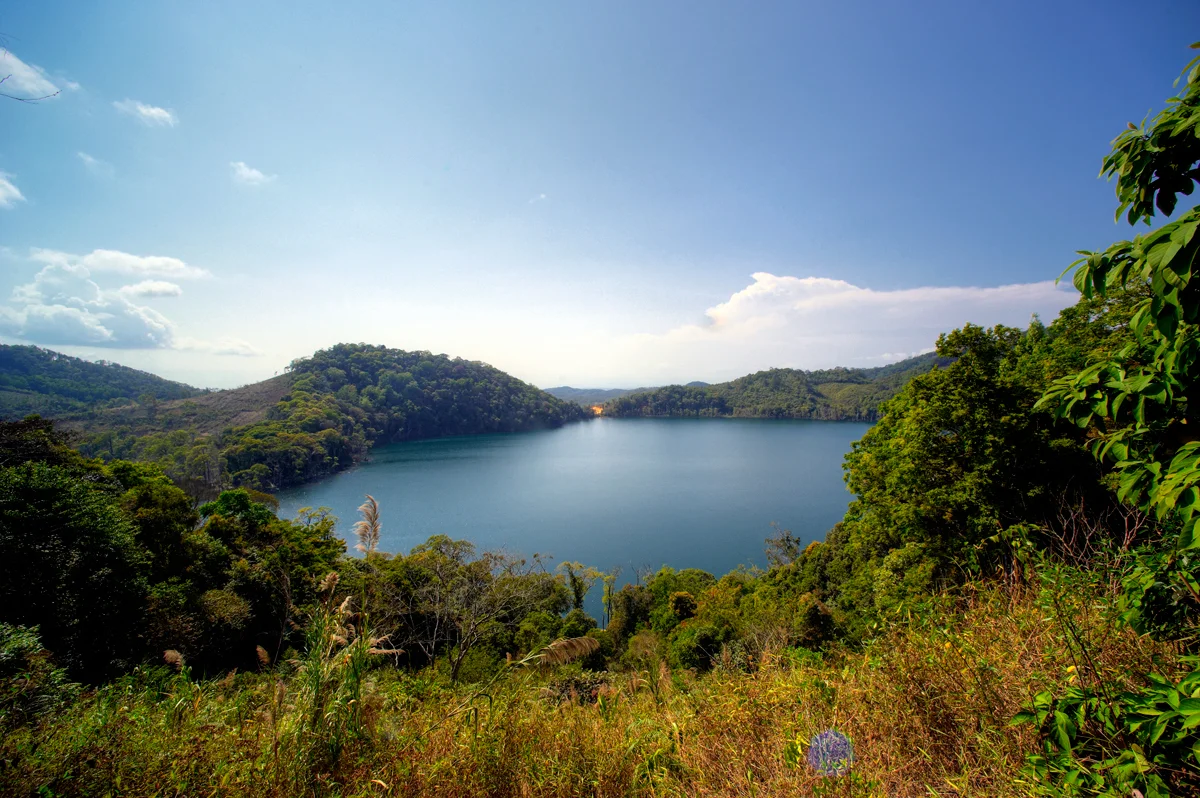

Nong Fa Lake
American pilots flying over the jungle ridges of southeastern Laos gave it a practical name: Dollar Lake. Seen from the cockpit at altitude, its near-perfect circular form made it one of the few reliable landmarks in a sea of green — a coin dropped into the canopy. What those pilots likely did not know was that below them, North Vietnamese soldiers resting from the punishing journey down the Ho Chi Minh Trail were finding quiet solace at the same shore. The lake had a way of drawing people to it, whatever their reasons for being there.
A Crater's Secret Depth
Nong Fa Lake — also called Nongphatom, meaning 'Blue Lake' in the local language — sits at 1,154 metres above sea level in the mountains of Sanxay District, Attapeu Province, a dozen kilometres from the Vietnamese border. It is a volcanic crater lake, born from ancient geological violence that left behind a bowl of extraordinary depth. The maximum depth is officially recorded at 78 metres, but local fishermen have long contested that number. They say that bamboo poles lowered into the dark water never found the bottom. Whether or not that is strictly true, the lake's edges drop away steeply, its dark water absorbing light rather than reflecting it, giving the surface an opaque, almost ink-like quality on overcast days and a deep sapphire intensity when the sky is clear.
The Road That No Map Showed
During the Vietnam War, this remote corner of Laos became one of the most strategically contested landscapes on earth, even though officially no war was supposed to be happening here. The Ho Chi Minh Trail — the vast network of paths, roads, and river crossings threading through eastern Laos — carried soldiers and supplies southward under the canopy. For North Vietnamese troops wounded or exhausted by American bombing raids, the lake offered a pause. Its clean water, its isolation, and its shade made it a rest stop on one of the deadliest journeys of the twentieth century. Meanwhile, American pilots logged it as a navigation fix, marking it on their charts with the name that captured its shape from the sky. The same piece of water served both sides, knowing nothing of their conflict.
Legends That Outlast Wars
Long before any army passed through, the hill tribes living near Nong Fa built a careful relationship with the lake. They do not swim in it. The reason, passed down through generations, is that the lake is home to a creature — part snake, part pig — that will devour any person bold enough to enter its waters. The warning has proved persuasive. But the legend carries a contradictory offer as well: some traditions hold that those who do swim in the lake will be rewarded with eternal youth. The contradiction — death or immortality, with no way to know in advance which you'll receive — has kept the shores largely undisturbed. Lonely Planet, whose writers tend toward the earthly rather than the supernatural, simply called the lake 'magical,' which may be as close as a travel guide can get to acknowledging that some places resist ordinary description.
Where Borders Meet the Wild
Nong Fa lies inside the Dong Ampham National Biodiversity Conservation Area, one of the most ecologically intact regions remaining in Laos. The surrounding forests are dense, the terrain rough, the roads few. The lake is not easy to reach — which is partly why it has stayed so quiet. Its protected status means the watershed above it remains forested, the water clear. The biodiversity of this corner of southeastern Laos is exceptional, part of the larger Indo-Burma hotspot where species lists are still being written. The lake itself sits just inside a country that spent decades sealed off from the outside world, which may explain why something this extraordinary remained largely unknown beyond its immediate neighbors until well into the twenty-first century.
From the Air
Nong Fa Lake sits at 15.1075°N, 107.4244°E, at an elevation of approximately 1,154 metres (3,786 ft) in the mountains of southeastern Laos near the Vietnamese border. The lake's near-perfect circular shape — the result of its volcanic crater origin — makes it an excellent visual landmark from the air, which is exactly how American pilots used it during the Vietnam War, naming it 'Dollar Lake' for its round profile. From a cruising altitude of 5,000–8,000 ft, it appears as a dark disc set in dense green forest. The nearest airport is Attapeu (VLAP), approximately 60 km to the southwest. The mountainous terrain between the lake and the coast rises to over 1,800 metres in places — maintain terrain clearance and be alert to valley cloud formation, particularly during the monsoon season (May–October).
Nearby Stories
- Ngọc Linh 7.1 km away
- Battle of FSB Mary Ann 19 km away
- Ngoc Hoi 22 km away
- 2018 Laos Dam Collapse 29 km away
- Măng Đen 43 km away
- 1968 Kham Duc C-130 Shootdown 45 km away
- Tadlo 70 km away
- Veun Sai-Siem Pang National Park 85 km away