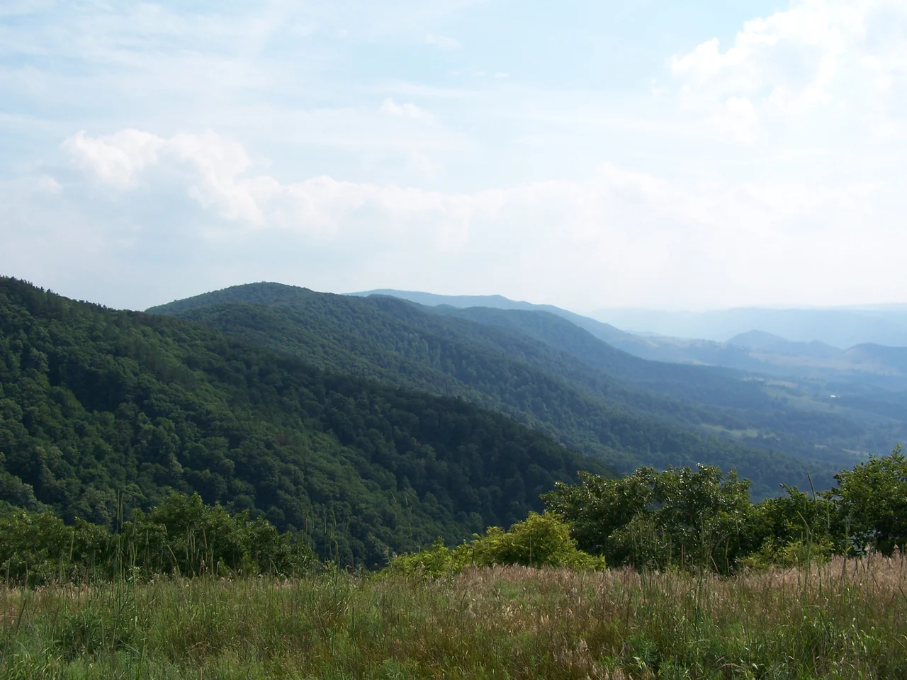

North Fork Mountain
Outside magazine once called the North Fork Mountain Trail the best trail in West Virginia. It runs along the spine of a 34-mile quartzite-capped ridge in the Allegheny Mountains, with cliffs and overlooks that drop hundreds of feet to the Smoke Hole Canyon and the South Branch of the Potomac River below. The same hard caprock that holds up this ridge - the Tuscarora quartzite - bends downward sharply along the mountain's slopes, and where weather has exposed it elsewhere, it forms the dramatic vertical face of Seneca Rocks. North Fork Mountain is the long ridge from which Seneca Rocks broke off. Stand at the right overlook and you can see the geology continuing for miles.
An Anticline in Stone
Geologically, North Fork Mountain is the heart of the Wills Mountain Anticline - a fold in the Earth's crust where ancient rock layers were arched upward by tectonic compression. The strata across the ridge top are nearly flat, capped by the resistant Tuscarora quartzite that has protected the underlying softer rock from erosion. On the east and west slopes, that same quartzite is bent down nearly vertically, exposed in places as cliffs and broken outcrops. Kile Knob, the mountain's highest point, reaches 4,588 feet (1,398 meters). The ridge runs through Grant and Pendleton counties in West Virginia's Potomac Highlands, mostly within the Monongahela National Forest. The Nature Conservancy owns and manages preserves at Pike Knob and Panther Knob along the southern end of the ridge.
Pine Barrens in the Mountains
In 1926, Per Axel Rydberg of the New York Botanical Garden hiked Panther Knob and was astonished. The vegetation he found on the mountaintop - especially the presence of beach heather, Hudsonia tomentosa - looked uncannily like the Pine Barrens of New Jersey, hundreds of miles away. Beach heather is a small mat-forming shrub typically associated with sandy coastal habitats, not Appalachian summits. Subsequent botanists, including Paul J. Harmon in 1981, surveyed the entire ridgetop and confirmed an unusual assemblage of plants - shale barrens species, ridge-top oaks, and remnants of vegetation that may represent leftovers from cooler post-glacial climates. The Monongahela National Forest has designated 10 acres of old-growth red pine on the mountain as a botanical area. An elfin forest of yellow birch, mountain ash, and mountain holly grows in pockets along the windswept upper slopes.
Cal Nelson and the Fires
In the early 20th century, a moonshiner named Cal Nelson lived on the western slopes of North Fork Mountain. Local lore preserves his story - sometimes outrageous, often colorful - and a section of the modern trail bears his former name, the Cal Nelson Trail. Nelson Sods, an opening on the ridge, also carries his name. In March 1930, after a dry winter, an enormous wildfire ravaged the entire mountain. It burned for eleven days before rain finally extinguished it. The Forest Service responded by hiring fire wardens, building a 90-foot steel fire tower on Pike Knob, and conducting 24-hour surveillance during fire season. Smoke Holers - the families who lived on the gentler eastern slope - resented the change. The fire-suppression program harmed the forage their free-ranging hogs and sheep depended on, and reduced the huckleberry patches they harvested. In 1941, locals secretly started another fire. Suppression took five days and ten square miles burned. The same men who had set the fire happily took the wages they earned helping put it out.
The Best Trail in West Virginia
The North Fork Mountain Trail runs nearly the full length of the ridge, with its southern terminus at U.S. Route 33 - the only major road crossing the mountain - and its northern terminus on Smoke Hole Road. Much of the southern portion crosses private land; hiking is permitted, but hunting and bikes are not. The views are not subtle. The trail traces the edge of overlooks above Germany Valley to the east and the South Branch valley to the west. The Pike Knob fire tower is gone, but its foundations and the ruins of the watchman's cabin still sit on the summit. The Wilderness Coalition and other groups have proposed federal wilderness designation for portions of the mountain, or its inclusion in a new national park unit. Future Generations Graduate School operates its main campus on top of the ridge near Route 33 - a small academic outpost in the highlands.
From the Air
Located at 38.6675N, 79.4378W in the Allegheny Mountains of eastern West Virginia. The 30-mile ridge runs roughly north-south through the Monongahela National Forest, with Kile Knob at 4,588 feet as the highest point. Recommended viewing altitude is 6,500 to 8,500 feet for views of the ridge and the parallel valleys on either side. U.S. Route 33 is the only major road crossing. Nearest commercial airport is Eastern WV Regional (KMRB) about 50 nm northeast; smaller airports include Grant County (W99). Watch for ridge-induced turbulence and rapid weather changes along the higher elevations.
Nearby Stories
- Smoke Hole Canyon 1.5 km away
- Durbin and Greenbrier Valley Railroad 4.9 km away
- Elkins 9.1 km away
- Fort Edward Johnson 9.6 km away
- Jackson's Valley Campaign 10 km away
- Pocahontas County, West Virginia 18 km away
- Albemarle Barracks 32 km away
- Belle Grove Plantation 43 km away