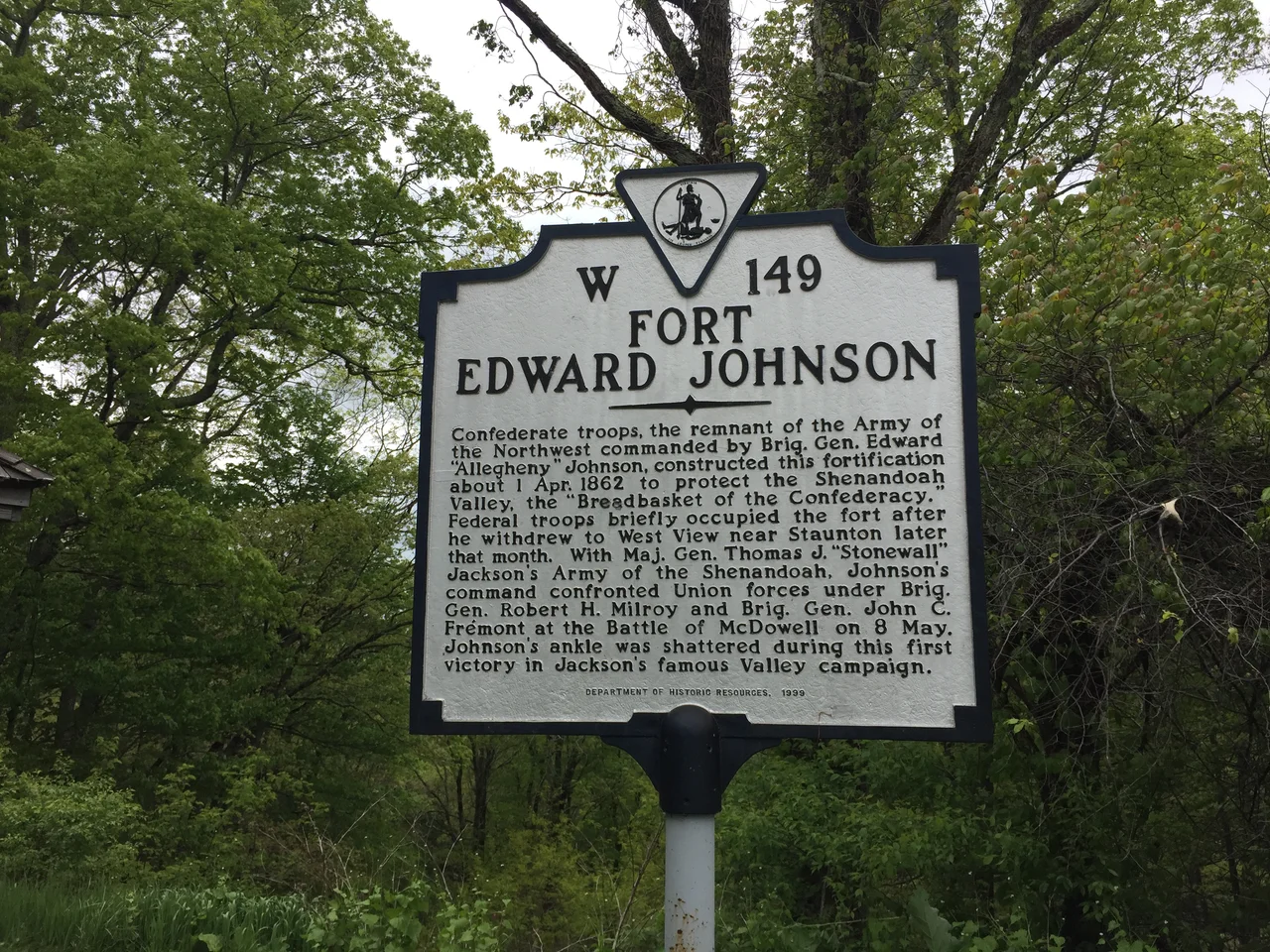

Fort Edward Johnson
Four thousand men dug them with hand tools in April 1862. The breastworks - low earth-and-log fortifications meant to shelter Confederate riflemen behind cover - snaked along the crest of Shenandoah Mountain on top of the Staunton-Parkersburg Turnpike, 26 miles west of Staunton, Virginia. They were dug at the order of Colonel Edward "Alleghany" Johnson, who had already earned his nickname holding the high ground at Camp Allegheny four months earlier. The Union army that the breastworks were meant to stop never tested them. By summer 1862, the strategic situation had shifted, the Army of the Northwest had moved east to support Stonewall Jackson's Valley Campaign, and the fort was abandoned. The earthworks remain. You can still walk them today, sheltered inside the George Washington and Jefferson National Forests.
The Hill Above the Turnpike
The Staunton-Parkersburg Turnpike was the principal east-west road across the central Alleghenies, authorized in 1838 and built in stages through the 1840s to connect the Shenandoah Valley with the Ohio River. Whoever controlled the turnpike controlled the flow of supplies and troops across the mountains. In the early Civil War, the Union and Confederacy fought a slow, miserable campaign back and forth across the turnpike, with the Confederate forces eventually pulling back to defensive positions on the high ridges. Fort Edward Johnson was sited at the mountain pass where the turnpike crested Shenandoah Mountain - the natural defensive position, where the road was forced into a narrow corridor between rising ground on either side. The Army of the Northwest, a 4,000-man brigade that was the remnant of the Confederate Army of the Northwest disbanded in February 1862, was assigned to hold it.
Alleghany Johnson Returns
Colonel Edward Johnson, the same officer who had defended Camp Allegheny on December 13, 1861, commanded the brigade. The Camp Allegheny defense had earned him the nickname "Alleghany Johnson" - a permanent part of his military reputation for the rest of his career. At Camp Allegheny, Johnson had held his ground with five regiments through cold, hunger, and a Union attack. At Fort Edward Johnson, with twice as many men and the experience of a winter spent fortifying mountain positions, he ordered the construction of a more extensive system: a series of breastworks running along the ridge, supported by trenches, with cleared fields of fire down the slopes the Union would have to climb to reach them. The fort was, by 1862 Confederate standards, a serious defensive position.
Never Attacked
The fortifications were finished in late April 1862. They were never attacked. The Union army that had been threatening the Staunton-Parkersburg Turnpike turned its attention east toward the Shenandoah Valley itself, where Stonewall Jackson had launched the campaign that would make his reputation. Johnson's brigade was needed to support Jackson. The Army of the Northwest moved east to participate in the Battle of McDowell on May 8, 1862 - the first Confederate victory of the Valley Campaign. The breastworks Johnson's men had dug on Shenandoah Mountain were left empty. They sat through the rest of the war without seeing combat. After the war, they sat through more than a century of forest regrowth, gradually softened by leaf fall and frost but never erased. The land became part of the national forest system in the 20th century, which protected the earthworks from development.
Walking the Breastworks Today
A half-mile interpretive walkway leads from a parking area adjacent to U.S. Route 250 - the modern highway descended from the Staunton-Parkersburg Turnpike - through the surviving breastworks. The path is gentle, suitable for casual visitors as well as students of Civil War military engineering. The earthworks themselves are now low, vegetated ridges in the forest floor, easily missed if you don't know to look. With interpretive signage, the layout becomes legible: the firing positions facing west down the turnpike, the connecting trenches, the cleared fields of fire that the forest has gradually reclaimed. The parking area also provides access to the Shenandoah Mountain Trail and to Ramsey's Draft Wilderness, a roadless area of the national forest covering one of the largest intact old-growth forests left in the central Appalachians. The fort that was never attacked is now a quiet stop on a tourist drive, surrounded by some of the wildest country in the eastern United States.
From the Air
Located at 38.31 degrees north, 79.39 degrees west, at the crest of Shenandoah Mountain along U.S. Route 250, on the border of Augusta and Highland counties, Virginia. The fortifications sit at about 3,500 feet MSL where US-250 climbs over the mountain pass between Churchville and Hightown. Best identified from VFR altitudes of 6,500 to 8,500 feet AGL where the long ridge of Shenandoah Mountain runs north-south through the landscape. The closest airport is Shenandoah Valley Regional (KSHD) at Weyers Cave about 25 nautical miles east. Ramsey's Draft Wilderness lies to the south. The area is within the U.S. National Radio Quiet Zone - check NOTAMs. Watch for mountain wave activity in the surrounding ridges.
Nearby Stories
- Durbin and Greenbrier Valley Railroad 5.9 km away
- Murder of Hannah Graham 13 km away
- 2023 Virginia Cessna Citation Crash 16 km away
- Fort Dinwiddie 17 km away
- Jackson's Valley Campaign 19 km away
- Pendleton County, West Virginia 22 km away
- Albemarle Barracks 26 km away
- Alleghany County, Virginia 28 km away