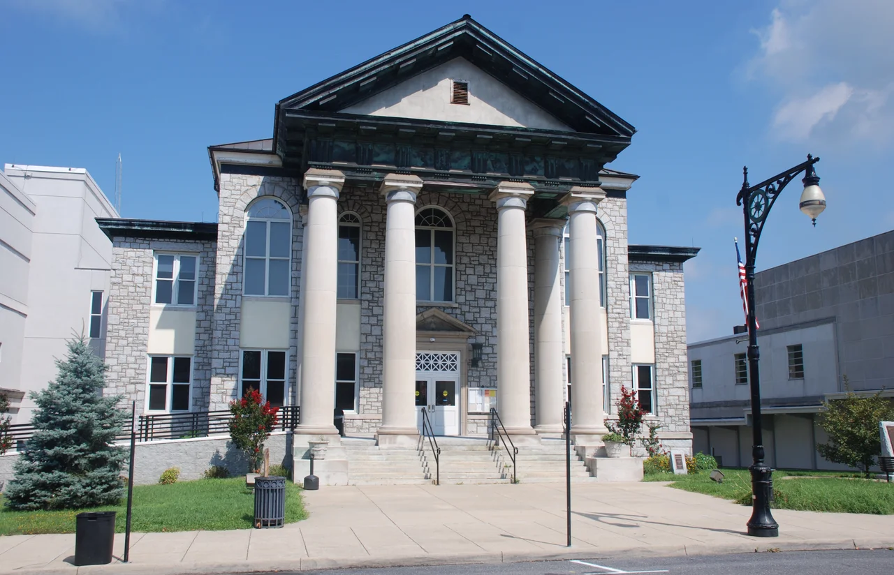

Alleghany County, Virginia
When you cross into Alleghany County from the east, the ridges start telling you where you are. The Allegheny Mountains rise along the western edge of the county and give it both its name and its limits. Beyond that line is West Virginia. Below the ridges, the Cowpasture River drops down from the north and the Jackson River winds south, and where they meet, just past the county line near a place called Iron Gate, they become the James River. That confluence is essentially the headwaters of one of the great American rivers - and almost nobody driving by notices. Alleghany is the northernmost county of the Roanoke Region. As of the 2020 census, 15,223 people lived here. Most of them work, in one way or another, around the paper mill in Covington.
From Hemp to Hardwood
Alleghany County was established by an act of the Virginia General Assembly on January 5, 1822, from parts of Bath County, Botetourt County, and Monroe County - the last of which is now in West Virginia. When the county was founded, the principal export was hemp, grown for rope production in the warehouses of Richmond. As demand and prices declined, Alleghany farmers shifted to grain, hay, and livestock. The valley land is narrow and bordered everywhere by ridge, so agriculture has always been constrained. Today the dominant economic force is Smurfit WestRock (formerly WestRock, merged with Smurfit Kappa in 2024), which operates a paperboard mill in Covington that is the largest bleached paperboard mill in North America, along with an extrusion and converting facility in nearby Low Moor. The mill is the kind of presence that defines a small Appalachian city: it both employs and pollutes, it both sustains and limits what the place can become.
The Towns That Almost Were Cities
Alleghany County has a complicated relationship with the towns inside it. The county seat is Covington - but Covington is an independent city under the Virginia constitution and therefore not technically part of the county. Clifton Forge has a stranger history still. It was once a city in its own right, but in 2001 it reincorporated as a town within Alleghany County, joining a small number of Virginia cities that have voluntarily downgraded their status. As a result, Clifton Forge is now simultaneously subject to the county government and to its own town charter. The county also sits within the United States National Radio Quiet Zone, the federally designated area established to protect radio telescopes from interference. Cell signal can be patchy. Wireless networks can be limited. The astronomers thank you.
Amtrak's Cardinal Calls
Three days a week, in each direction, the Amtrak Cardinal pulls into Clifton Forge - one of the more romantic small-town stops on the long passenger run between Chicago and New York. The Cardinal route winds through the New River Gorge and the Allegheny highlands; Clifton Forge serves as a major locomotive fuel facility for CSX Transportation, the freight railroad whose tracks the Cardinal shares. The station building is small. The view of mountains is large. East-west traffic on Interstate 64 and north-south traffic on U.S. 220 fill in the rest of the connections to the wider world. Beyond commerce, Alleghany sits near two of the more famous historic resorts in the East: the Homestead in Bath County to the north, and the Greenbrier in West Virginia to the west. Both have weathered booms, bankruptcies, and rebuilds. Both still receive guests.
Greater Appalachia
Colin Woodard, in his book American Nations, places Alleghany squarely within what he calls Greater Appalachia - the cultural region defined by Scots-Irish settlement, hard mountain agriculture, and a deep skepticism of distant authority. The county lives that identity. Politically it was once a bellwether, voting for the national presidential winner in every election from 1888 to 2004 except 1904 and 1980. Since 2000, it has shifted hard toward the Republican Party, giving Donald Trump a 45-point margin in 2020 - the largest Republican margin in the county since Herbert Hoover's victory in 1928. The county is part of the 423 counties served by the Appalachian Regional Commission, the federal agency created in 1965 to address chronic Appalachian poverty. Covington has a team in the Valley Baseball League called the Lumberjacks - a name that explains, in two syllables, what kind of place this is and what kind of work has built it.
From the Air
Alleghany County sits at 37.78 N, 80.01 W on Virginia's far western edge along the Allegheny ridge. Cruise at 6,500 to 9,500 feet MSL for terrain clearance - this is true ridge country and weather can change quickly. The Cowpasture-Jackson confluence near Iron Gate marks the headwaters of the James River. Covington's Smurfit WestRock paperboard mill produces visible plume in cool weather. The county lies within the United States National Radio Quiet Zone - certain radio transmissions may be restricted. Nearest airports: Ingalls Field (KHSP) at Hot Springs about 15 miles north, Greenbrier Valley (KLWB) about 20 miles west in West Virginia. The Greenbrier resort lies just west of the county line.
Nearby Stories
- 2020 Williamsburg Massacre 2.6 km away
- Battle of Galudoghson 8 km away
- Hollins University 10 km away
- The Omni Homestead Resort 14 km away
- Monroe County, West Virginia 16 km away
- Draper's Meadow Massacre 20 km away
- Poplar Forest 20 km away
- Elliott Knob 25 km away