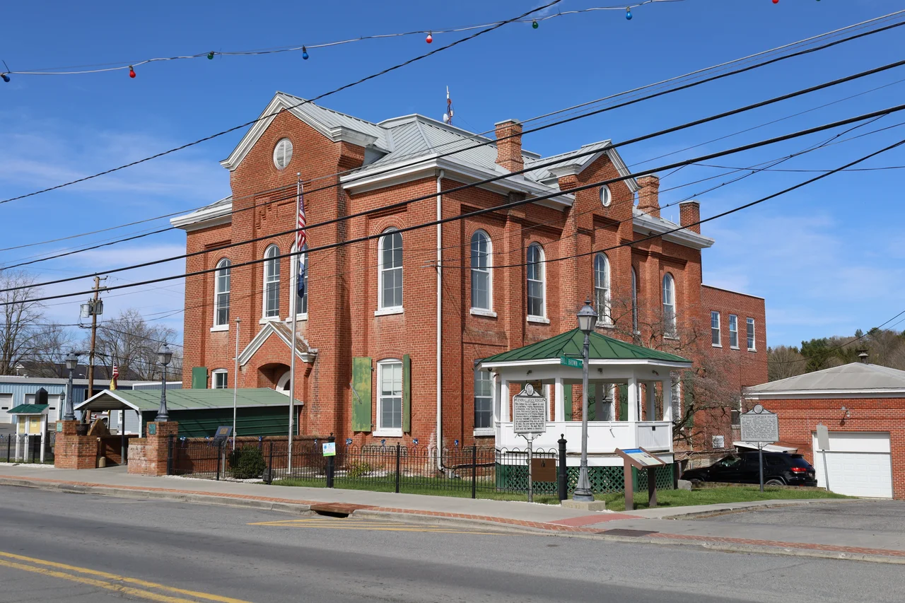

Monroe County, West Virginia
Two men were pitching horseshoes near Peterstown in 1928 when one of them noticed something glinting in the grass. The stone turned out to be a 34.46-carat diamond - later known as the Jones Diamond or the Punch Jones Diamond, named for William Jones, on whose property it lay. It remains the largest alluvial diamond ever found in North America. The story is the kind of thing that happens in Monroe County, a quiet corner of southeastern West Virginia that keeps producing oversized claims for a place of just 12,376 people. James Monroe lent the county his name in 1799, three years before he became the fifth President of the United States. Almost everything else worth knowing about Monroe County is older than that, or stranger.
Where Paleontology Began
At the end of the 18th century, saltpeter miners working in Haynes Cave near Sweet Springs broke through to a chamber full of strange bones. The diggers crated some up and shipped them to a man who liked that sort of mail - Thomas Jefferson. Jefferson, then Vice President, examined the bones and wrote them up for the American Philosophical Society in 1797. He believed they came from a giant lion-like predator he called Megalonyx, the great-claw. The actual animal turned out to be a giant ground sloth - long extinct, more interested in leaves than in lions' prey - but Jefferson's careful description of an animal that no living person had ever seen is often called the founding paper of American vertebrate paleontology. The species still carries his name: Megalonyx jeffersonii is West Virginia's official state fossil.
The Union Hole and the Civil War
When Virginia seceded in 1861, Monroe County's white men were overwhelmingly pro-Confederate - the western secession movement that created West Virginia in 1863 included Monroe by Congressional decree, not local vote. But pockets of Union sympathy survived in the rougher country along the Virginia line. The community of Paint Bank, just over the modern Virginia border, hosted Order of the Heroes of America chapters - the Red Strings - whose members helped Union deserters and resisters cross the lines. Confederate guerrillas and Union sympathizers shadowed each other through these hollows for four years. After the war, Monroe County remained Democratic into the 1890s, then turned Republican with William McKinley in 1900 - a partisan trajectory that prefigured much of rural Appalachia's twentieth century.
Sweet Springs and the Soldier of Garcia
Andrew Summers Rowan was born in Gap Mills in 1857 and would not have entered American folklore at all except for a single mission. In 1898, on the eve of the Spanish-American War, the U.S. Army needed to contact Cuban insurgent leader Calixto Garcia somewhere in the mountains of Cuba. Rowan, a lieutenant, was handed the assignment, slipped into Cuba, and after weeks of jungle travel made contact. Elbert Hubbard's 1899 essay A Message to Garcia turned the mission into a Victorian-era parable of duty - the man who took the message and did not ask why. The essay sold tens of millions of copies and was distributed to soldiers, factory workers, and railway employees for decades. Rowan himself spent the rest of his life modestly explaining that the actual message had been less dramatic than the legend.
Alderson, Saltpeter, and the Federal Prison
The Federal Bureau of Prisons' Federal Prison Camp at Alderson - which straddles the Monroe-Summers county line - was the first federal prison for women in the United States, opened in 1927. Its most famous inmate was Martha Stewart, who served five months there in 2004-2005 after a securities conviction. The camp's history runs deeper than its celebrity inmates: it was designed by social reformers as an alternative to the brutal mixed-sex prisons of the early twentieth century, with cottage-style housing and an agricultural program. The same Monroe County soils that hide diamonds and giant sloth bones also hid saltpeter, mined from Greenville Saltpeter Cave - now a National Natural Landmark - to make gunpowder during the War of 1812. The cave is in private hands now, but the landmark designation, granted in 1973, preserves both the geology and the labor history below ground.
Living Memory and Farmers' Day
Monroe County's modern county seat, Union, sits on the rolling karst pastureland that defines the county - a landscape of dairy farms, covered bridges, and limestone bluffs. Every first Saturday in June, Union hosts Farmers' Day, founded by Louie H. Peters and now stretching into a full weekend of dances, a 3K run, a pancake breakfast, and a parade. Henry Reed - the old-time fiddler and banjo player whose Appalachian tune repertoire was extensively recorded by folklorist Alan Jabbour in the 1960s - was born in Monroe County in 1884, and the county's strong fiddle tradition still surfaces at festivals across the region. The Indian Creek Covered Bridge and Laurel Creek Covered Bridge survive from the nineteenth century, and Rehoboth Church - built in 1786 - is the oldest Methodist church west of the Alleghenies.
Aviator's Notes
Monroe County sits at 37.56 N, 80.54 W, on the rolling plateau between the Greenbrier Valley and the Virginia state line, with terrain reaching 3,862 feet on the eastern ridges. The nearest commercial airport is Greenbrier Valley Regional (KLWB) at Lewisburg, about 15 nautical miles north. From altitude the county reads as a pastoral patchwork of farms and small towns - more open than the mountain counties to the north and west, with limestone karst pastureland dominant. Look for the Greenbrier River meandering along the northern county line and U.S. 219 running north-south through Union.
From the Air
Centered at 37.56 N, 80.54 W in southeastern West Virginia, with terrain rising to 3,862 feet on the Virginia border. Nearest airport: Greenbrier Valley Regional (KLWB) at Lewisburg, approximately 15 nm north. Recommended viewing altitude 6,500-8,500 feet. The Greenbrier River traces the northern county line as a useful visual marker; U.S. 219 runs north-south through Union, the county seat. Mountain weather can change quickly - watch for icing in winter and afternoon thunderstorms in summer.
Nearby Stories
- Bluefield, West Virginia 0.8 km away
- New River and Greenbrier Valleys 3.9 km away
- WDBJ 7.8 km away
- Radford University 18 km away
- Battle of Lewisburg 21 km away
- Hollins University 27 km away
- Bluefield State University 30 km away
- Watoga State Park 35 km away