
Watoga State Park
The name means "starry waters" in Cherokee, and the park has finally caught up with its name. In the 21st century, the International Dark-Sky Association certified Watoga State Park as one of the few places in the eastern United States where the Milky Way is still routinely visible to the naked eye - a darkness rare enough on this side of the Mississippi to be worth driving for. The Cherokee who named the place would have taken that darkness for granted. The Pocahontas County visitors who come today drive up the West Virginia mountain roads precisely because they cannot find it where they live.
From Forest Plan to State Park
The land that forms the heart of Watoga was first acquired in January 1925, with the intention of making it a state forest - a working timber reserve. By May 1934, the plan had changed. The deep ridges and hollows around Two Mile Run looked more like recreation than logging country, so West Virginia chose to develop the site as a state park instead. Today Watoga covers more than 10,100 acres - the largest state park in the West Virginia system - sitting near Seebert in Pocahontas County, where the Greenbrier River cuts through. The terrain is classic central Appalachian: hardwood forests, sandstone outcrops, cold springs, and ridgelines that fold back on themselves until you stop trying to count them.
The CCC Built It
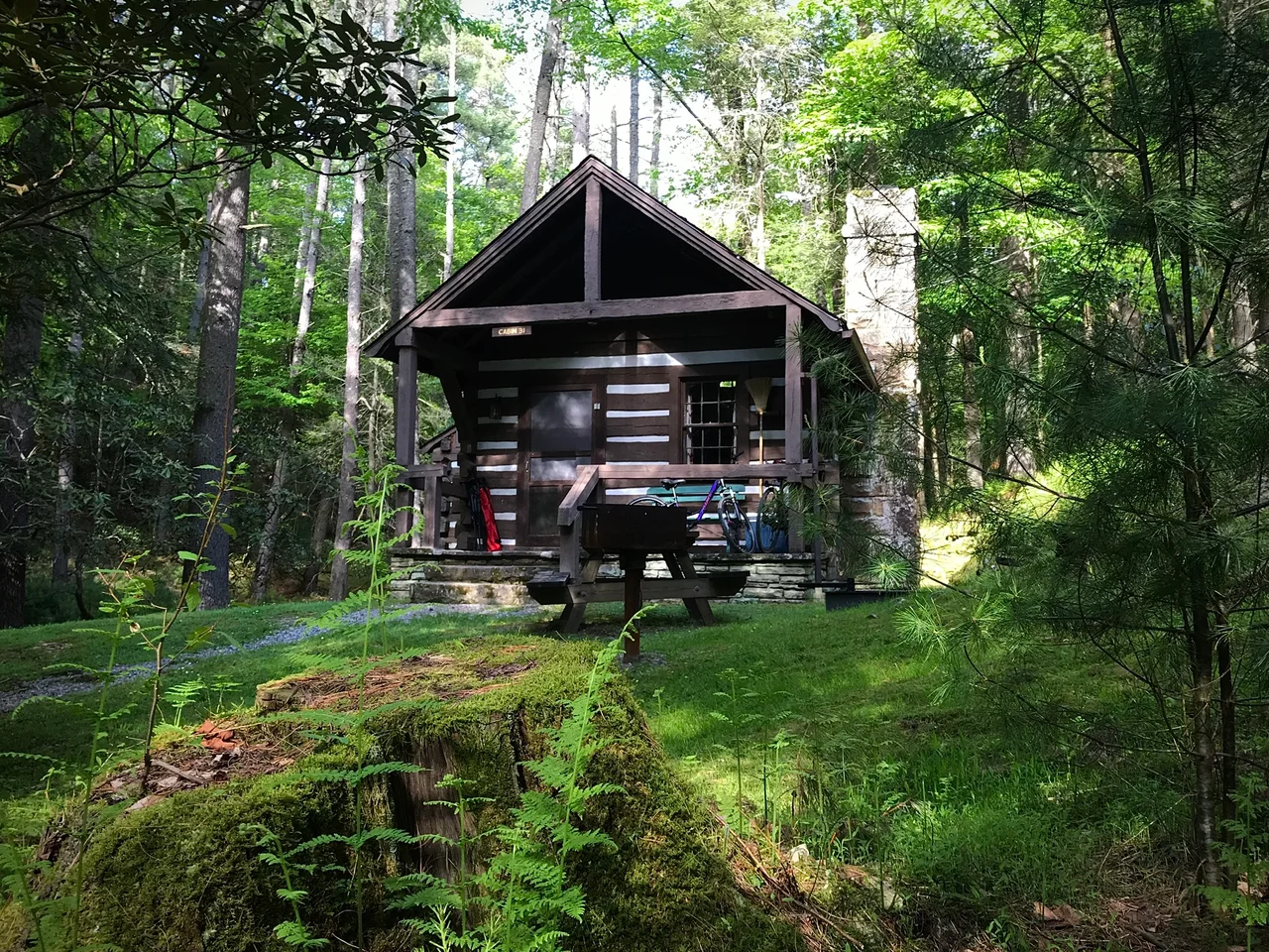
Most of what visitors see at Watoga today was built between 1933 and 1937 by the Civilian Conservation Corps. Roosevelt's New Deal program had put young, mostly unemployed men into uniformed work camps across the country, and West Virginia got more than its share of camps because of its terrain and its Depression-era unemployment numbers. At Watoga, CCC crews built stone water fountains, a swimming pool, a reservoir, rental cabins, picnic shelters, and miles of trails - the kind of slow, careful stonework that distinguishes Depression-era park architecture wherever you find it. The park opened on July 1, 1937. The buildings have outlasted the men who built them, but the workmanship still tells you something about the kind of pride a young man might take in a job during a year when work itself was a privilege.
The Brooks Arboretum
Within the park lies the Fred E. Brooks Memorial Arboretum, a 400-acre tract that encompasses the drainage of Two Mile Run. Brooks was a noted West Virginia naturalist who died in 1933 - one of the entomologists and botanists who had cataloged the Appalachian biota in the days before professional ecology was a stable career. The arboretum was begun about 1935 and dedicated in 1938, in part as a working memorial to a man who had spent his life paying attention to what grew in these mountains. The arboretum's trails wind through the same hardwood forest types Brooks studied - oak-hickory ridges, cove forests with tulip poplar and sugar maple, hemlock-rhododendron creek bottoms. Whether visitors recognize the species or not, they walk through what amounts to a living memorial.
Trails, Stars, and the Historic District
Watoga's trail network has grown into the kind of system that takes a foundation to maintain. The Watoga Foundation looks after the Allegheny Trail, the Ann Bailey Trail, Arrowhead, Bearpen, Buck and Doe, Burnside Ridge, Honeymoon, Jesse's Cove, Kennison Run, the Lake Trail, Monongaseneka, North Boundary, Pine Run, T. M. Cheek, Ten Acre, and South Burnside trails - plus the Brooks Memorial Arboretum trails. The New Deal Resources in Watoga State Park Historic District was added to the National Register of Historic Places in 2010 and includes 59 contributing buildings, 35 structures, two sites, and 11 objects. After dark, the same trails become an observatory. The park's location, deep inside the Monongahela National Forest's footprint and far from any major city's light dome, gives it a Bortle-2 sky - the second-darkest classification used by astronomers. The Cherokee word for starry waters has held up remarkably well.
From the Air
Located at 38.10 degrees north, 80.15 degrees west, in the central Allegheny Mountains of Pocahontas County, West Virginia, just east of the Greenbrier River near the community of Seebert. Best identified from VFR altitudes of 5,000 to 7,500 feet AGL where the forested ridges of Watoga and the surrounding Monongahela National Forest dominate the landscape. The closest airports are Greenbrier Valley Airport (KLWB) about 28 nautical miles south at Lewisburg and Marlinton Airport (W99) about 10 nautical miles north. The Green Bank radio quiet zone is just north and east - pilots should be aware that some avionics use is restricted there. Watch for mountain wave and rotor activity in the Allegheny ridges.
Nearby Stories
- Washington and Lee University 1.1 km away
- Alleghany County, Virginia 3 km away
- 2020 Williamsburg Massacre 7.1 km away
- Ramsey's Draft Wilderness 9.5 km away
- Cass Scenic Railroad 9.8 km away
- Elliott Knob 17 km away
- Monroe County, West Virginia 26 km away
- Westsylvania 40 km away