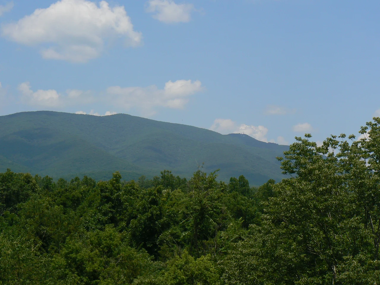

Elliott Knob
At the top of Elliott Knob, in a small grassy cove on the summit, grow trees that should not be here. A natural stand of red spruce - a species characteristic of the boreal forests of Maine, the Adirondacks, and the Canadian Maritimes - persists at 4,463 feet in the central Virginia Blue Ridge country. Yellow birch and sugar maple keep the spruce company. They are all relicts of the last Ice Age, when boreal forest descended deep into the central Appalachians and the central Appalachians felt like northern New England. As the climate warmed at the end of the Pleistocene, those northern forests retreated to the highest, coldest peaks. On Elliott Knob, on a few other high knobs of the Allegheny ridge, the spruce hung on. They are still there, growing on a Virginia mountaintop, because the elevation gives them enough cold to survive.
Highest in Northern Virginia
Elliott Knob is the highest peak in the northern portion of Virginia. The summit sits at 4,463 feet, on the long ridge known as Great North Mountain that runs along the western boundary of Augusta County. A subpeak called Hogback rises to 4,447 feet, half a mile southwest of the main summit. To the south, the town of Augusta Springs sits 2,800 feet below the summit. The mountain is entirely within the George Washington and Jefferson National Forests, which means the public can access the summit but private development cannot. The trailheads reach the summit by various routes, each averaging about five miles in length and gaining up to 2,400 vertical feet from start to top. The hike is sustained, never quite technical, and rewards effort with views that on a clear day stretch across most of central Virginia.
The Mountain Forest's Layers
Walking up Elliott Knob is a tour through American forest types. The lower slopes are dominated by oak and hickory - the classic deciduous hardwood forest that covered most of the unglaciated eastern United States before logging and agriculture cleared so much of it. As elevation increases, the species mix changes. Yellow birch starts to appear above 3,500 feet. Sugar maple joins higher up. Near the summit, the red spruce emerges - small trees, sometimes only ten or fifteen feet tall, growing in the cold pocket of the summit. The species transition is the same one you would see if you drove from Virginia north to the Adirondacks, except that on Elliott Knob it happens vertically over a few thousand feet rather than horizontally over several hundred miles. The relict spruce stand is small but ecologically important - a piece of Pleistocene forest preserved by altitude.
The Closed Fire Tower
A primitive jeep trail ascends the mountain from the east, rising over 2,000 feet in less than 2.5 miles - one of the steepest service roads in the George Washington National Forest system. The trail is closed to public vehicles and used only by the Forest Service to access a closed fire lookout on the summit. The lookout tower is enclosed by a fence with barbed wire on top. The enclosure has not deterred determined visitors - there are holes dug under the fence and loose sections where the fence can be pulled up high enough for a person to crawl through. The illicit entries are illegal but common enough that the wear patterns on the grass tell the story. Just beside the base of the fire tower sits a National Geodetic Survey triangulation station disk - a small brass marker set into the rock that records the mountain's exact location for the federal survey system.
The Hikers and the Runners
Elliott Knob is a popular day hike. Boy Scouts attending Camp Shenandoah make a 14-mile loop that includes the summit - a substantial all-day effort that takes scouts up the mountain and back down. The Grindstone 100 Miler ultramarathon, one of the toughest 100-mile foot races in the eastern United States, includes Elliott Knob's summit in its route. Runners pass through the summit at various hours during their 30-plus-hour race, sometimes in daylight, sometimes in the middle of the night with headlamps. The fauna of the surrounding ridges - black bears, white-tailed deer, the elusive bobcat - generally manage to stay out of the way of Boy Scouts and ultramarathoners, but encounters happen. The black bear population in this part of the Alleghenies has grown substantially since the mid-20th century, and hikers regularly report seeing them at lower elevations. The bears tend to stay out of the spruce stand at the top, which has no berry bushes or other food sources worth the climb.
From the Air
Located at 38.17 degrees north, 79.31 degrees west, on the ridge of Great North Mountain along the western edge of Augusta County, Virginia. The summit at 4,463 feet MSL is one of the higher peaks of the central Virginia Alleghenies and is identifiable by the closed fire tower at its top. Best viewed from VFR altitudes of 6,500 to 9,500 feet AGL. The closest airport is Shenandoah Valley Regional (KSHD) at Weyers Cave about 17 nautical miles east. Eagles Nest (W13) is closer to the south. The summit is within the U.S. National Radio Quiet Zone - check NOTAMs for any radio restrictions. Watch for mountain wave activity and rotor turbulence on the ridges.
Nearby Stories
- Durbin and Greenbrier Valley Railroad 5.9 km away
- Murder of Hannah Graham 13 km away
- 2023 Virginia Cessna Citation Crash 16 km away
- Fort Dinwiddie 17 km away
- Jackson's Valley Campaign 19 km away
- Pendleton County, West Virginia 22 km away
- Albemarle Barracks 26 km away
- Alleghany County, Virginia 28 km away