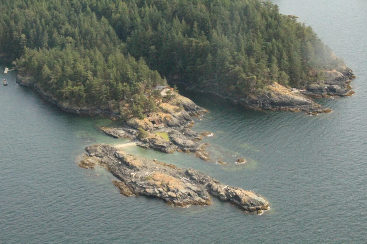

North Thormanby Island
In 1860 a horse called Thormanby won the Epsom Derby, and a Royal Navy surveyor working the far side of the world was apparently paying attention. Captain George Henry Richards put the name on a pair of islands off what is now British Columbia's Sunshine Coast that year, and he was not finished: the following season a horse named Buccaneer took the Royal Hunt Cup at Ascot, and the wide sandy bay between the two islands became Buccaneer Bay. A racing form from Victorian England is legible, permanently, on a Canadian marine chart.
sxwelap
The islands have a much older name. In she shashishalhem, the shishalh language, both are sxwelap, and they lie within the shared territories of the Tlaamin Nation and the shishalh Nation, seventeen kilometres west of Sechelt. At least five archaeological shell middens are known on South Thormanby - the durable, layered evidence of generations returning to the same shorelines for the same reasons people still come: shelter, sand, and food arriving twice a day with the tide. Jose Maria Narvaez was the first European to reach the islands, on 12 July 1791, and he called this one Isla de San Ignacio. The name lasted sixty-nine years, which on this coast counts as a decent run.
Walking the Whole Island
At low tide, a sand bridge emerges and joins North Thormanby to South Thormanby, and it is possible to walk the beach all the way around the island without trespassing anywhere - in British Columbia the foreshore, the intertidal zone between the tide lines, is not private property. It is a strange and generous piece of law to encounter in a place otherwise divided into recreational lots. Twice a day the boundary between public and private slides down the sand and then climbs back up it. The island sits within the Gulf Islands and is a favourite anchorage for small boats working the Salish Sea; Buccaneer Bay Provincial Park occupies the southern tip, and the community of Vaucroft the northern one, reached by private water taxi from Halfmoon Bay on the mainland.
Rare Ground
The beaches are not merely pretty. The coastal sand ecosystem on the Thormanby Islands is a rare habitat type in British Columbia, supporting several provincially Red-listed ecological communities - the designation the BC Conservation Data Centre applies to those considered endangered or threatened. Two sites carry it. On the south island, Gill Beach in Buccaneer Bay holds a large sand plain and a salt marsh, with sand ecosystem running the length of the bay northward. On North Thormanby's northeastern side lies Vaucroft Beach, a crescent-shaped sand deposit with a dock at its middle and barge landings just south of it. Water birds and migratory songbirds lean hard on this habitat for nesting, foraging and shelter during storms. Roughly three hundred Columbian black-tailed deer live on the islands, and the surrounding water is well known for its fishing, salmon above all.
Jack Vaughan's Corner
The island was uninhabited and forested until 1905, when John William Vaughan - Jack - built the first cabin and a wharf. Around the time of the First World War he sold the northeastern corner to the BC Telephone Company, which put up a small resort there: a lodge, cabins, boat houses, rowboats and a telephone. Vaughan came home from the war in 1919 and bought the whole development back, opening it to the public as a resort in 1923, with the Union Steamship Company running daily service to the island. Through the 1930s a cottage community grew along Vaucroft Beach. The steamships stopped calling in 1946; logging crews then took the old-growth timber off the top of the island; and from the late 1960s the land was gradually subdivided into recreational properties. What was once a day's steamer ride from Vancouver is now a water taxi and a private key.
From the Air
North Thormanby lies at 49.5028 N, 124.0025 W in the Strait of Georgia, off the Sunshine Coast. Fly it at 1,500-3,000 ft: the two islands read as a single pale-edged mass, and at low water the sand bridge between North and South Thormanby shows clearly as a bright bar. Other cues are the crescent of Vaucroft Beach on the northeastern shore, the broad sweep of Buccaneer Bay on the southwest side, and Halfmoon Bay and Smuggler Cove on the mainland shore opposite. Sechelt is 17 km east. Vancouver International (CYVR) is roughly 70 km southeast and Nanaimo (CYCD) about 50 km southwest across the strait. Summer brings afternoon northwesterlies down the Strait of Georgia and choppy water in the channel; winter southeasters bring low cloud and rain, and the low, wooded islands can disappear into grey very quickly.
Nearby Stories
- Skookumchuck Narrows 1.1 km away
- Pacific Biological Station: A Century of Counting Fish 2.3 km away
- Bowen Island 11 km away
- Powell River, British Columbia 11 km away
- Qualicum National Wildlife Area 13 km away
- Iona Island (British Columbia) 14 km away
- Alberni Inlet 30 km away
- Garibaldi Provincial Park 50 km away