
North Uist
It is not picturesque in the way Skye is picturesque, and the Wikivoyage entry will tell you so directly: the landscape is undeniably stark. But on a summer evening when the sea breeze moves through the marram grass behind a long empty beach, or on a winter night when the dark skies fill with stars and the aurora occasionally throws green curtains across the north, North Uist becomes something Skye cannot be. It becomes itself.
The Hundred-Loch Island
Twenty miles north to south, twenty-five east to west, with a population that was 1,619 in the 2011 census. North Uist is mostly bog, machair, and small lakes - so many small lakes that the map looks dappled. Some are sea inlets, twisted and narrow. Others are peaty freshwater ponds, sometimes barely larger than a swimming pool. The terrain holds water the way a sponge does. The east coast is rocky and complicated, the west coast a string of white-shell sand beaches that gleam astonishingly bright when the sun finds them. Drivers, the local guide warns, should observe Highland etiquette: always give way to mad fellows in white vans driving at Mach 2 to catch the ferry.
Getting On and Off the Rock
Benbecula Airport sits south across the causeway; Loganair flies daily from Glasgow in about an hour, and weekday from Stornoway in 35 minutes. CalMac ferries run from Uig on Skye to Lochmaddy at one or two sailings daily, taking 1 hour 45 minutes. Another route comes in from Mallaig on the mainland to Lochboisdale on South Uist, then up the chain of causeways. Berneray to the north has a car ferry from Leverburgh on Harris. The Uists have long been linked by causeways well clear of the sea, passable in all but the worst Atlantic weather, threading the islands into one driveable archipelago. You can travel by bus in a single day from Stornoway on Lewis to Castlebay on Barra, though only one daily service makes the entire journey.
What There Is to See
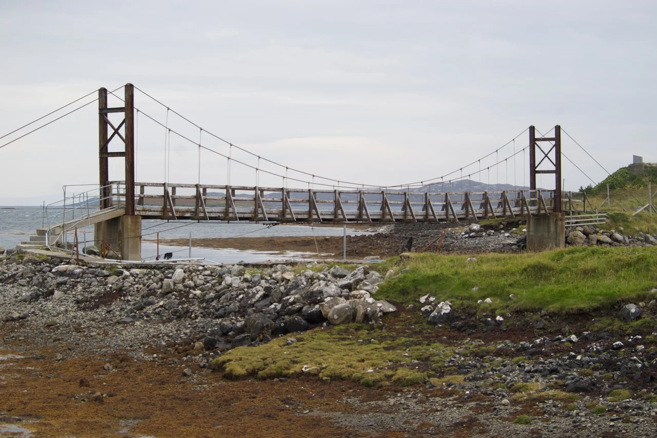
Several sights sit on tidal islets - bring tide tables. Sponish Suspension Bridge carries a footpath across a sea inlet north of Lochmaddy to the Hut of Shadows, a camera obscura. Loch Portain has over 200 islets and a mix of saltwater and freshwater habitats. The military Remote Radar Head at Clettreval was originally operated by RAF Benbecula and is now run remotely from Northumberland; in clear weather it offers a distant view of St Kilda. There is a Hercules sculpture and cairn near Langass commemorating the tame grizzly bear that escaped during a 1980 Kleenex commercial shoot and disappeared for 24 days before being recaptured. He was re-interred at the woodland spot in 2015, a wholly unlikely memorial that has become a local landmark.
Quiet Things to Do
The terrain is low and easy for cycling, though the breeze is often stiff. All roads are single-track with passing places. The Hebridean Way's Stage 6 starts at Carinish near the Benbecula causeway and heads north past the prehistoric monuments at Langass into Lochmaddy; Stage 7 continues to the Berneray ferry. Beaches are sandy but exposed - the shore shelves gradually, which means no surf. The fishing is mostly from shore by the many freshwater and sea lochs. The North Uist Highland Games happen at Balelone Farm near Scolpaig Tower, the agricultural show at Hosta a mile south. Taigh Chearsabhagh in Lochmaddy has a cafe and a gallery, and the Westford Inn bar is open seven days a week.
What to Know About the Sabbath
The island's Protestant Sabbatarians were unable to block the introduction of Sunday ferries in 1989, but the cultural compromise still holds: all shops in North Uist are shut on Sundays, while some on Benbecula, South Uist, and Eriskay open Sunday afternoons. Two-thirds of the island's population speak Gaelic, supported by European funding for indigenous minority cultures and a sympathetic Scottish parliament. The North Uist Distillery is actually on Benbecula, two miles south of the airport, making gin and whisky. The Bank of Scotland closed its Lochmaddy branch in February 2024, leaving the ATM as the last automated trace of high-street banking. None of these are inconveniences if you have planned for them.
From the Air
Located at 57.60N, 7.33W in the Outer Hebrides. The island sits at the northern end of the Uist causeway chain, with Berneray to the north and Benbecula to the south. Distinctive landmarks from altitude include the bright sand beaches of the west and north coasts, the deeply indented east coast around Loch nam Madadh, and the central highland mass of Eaval (347m). Nearest airport is Benbecula (EGPL) about 12 nautical miles south. The radar dome at Clettreval is a visual landmark in clear conditions. Atlantic weather changes rapidly; expect significant turbulence on the lee side of higher ground when winds are strong.
Nearby Stories
- Trumpan Church 2.7 km away
- Eilean Glas Lighthouse 3.6 km away
- South Uist 7.8 km away
- Talisker 14 km away
- Amhuinnsuidhe Castle 19 km away
- St Kilda, Scotland 58 km away
- German submarine U-516 155 km away
- The Laki Eruption: The Volcano That Changed World History 893 km away