_Castle.jpg)
Northburgh Castle
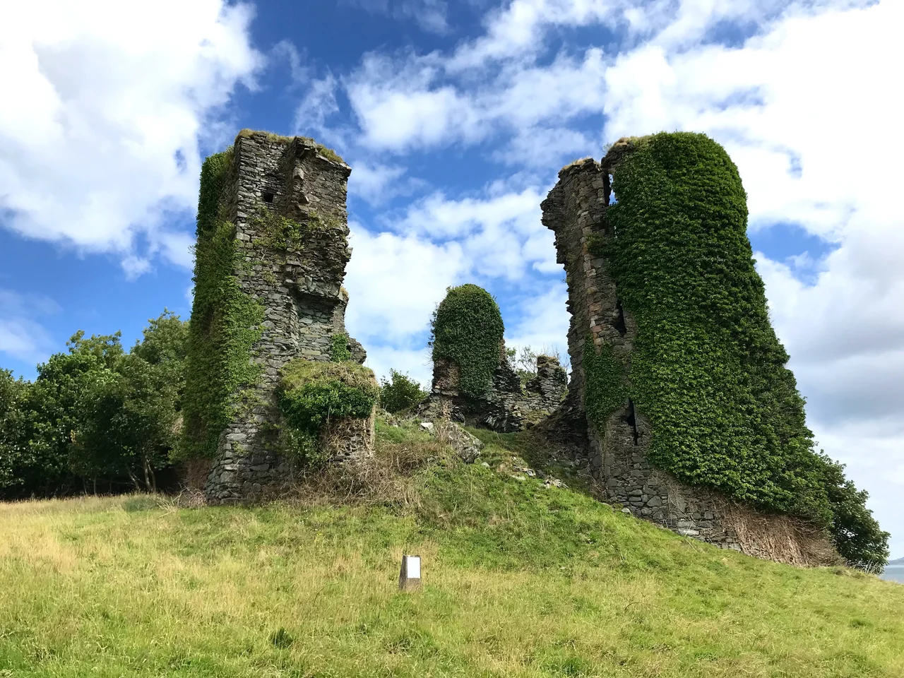
Walter Liath de Burgh died in this castle in February 1332, locked in a tower while his own cousin starved him to death. Derry's coat of arms still bears a skeleton in his memory. The stones that imprisoned him are still here too, looking out across Lough Foyle from a low rock platform on the north shore of Inishowen, where a fishing port called Greencastle now keeps the same view the medieval garrison once watched. The walls are roofless, the floors are sky, and the gatehouse leans into the wind like a stranded ship.
Built to Watch the Lough
Richard Óg de Burgh, the second Earl of Ulster, completed Northburgh Castle in 1305 to keep one eye on Lough Foyle and the other on his own ambitions further west. He had been knighted by Edward I at Rhuddlan, in north Wales, and he brought Welsh ideas home with him. Architectural historians read the twin polygonal gatehouse as a cousin of Harlech, and the curtain-wall construction as a relative of Caernarfon, two of Edward's great chains of stone around Snowdonia. Sweetman, writing on Irish castles, calls Northburgh's gatehouse "most commodious" - a great hall, a north tower, a west tower, accommodation for a household that intended to govern as well as to defend. The rock outcrop was awkward, though. There was not enough room for the design as drawn, so the gatehouse sits below the main castle, with its first floor at courtyard level - a small lower yard, then steps up to the great enclosure above. Function bent to geology.
Edward Bruce and the Brown Earl
In 1316, in the middle of the Bruce invasion of Ireland, Edward Bruce captured Northburgh. He held it for two years until his death at Faughart in 1318, after which Richard Óg took the castle back. The de Burgh family kept it - and kept turning on itself. In 1331, Richard's grandson William, the third Earl of Ulster, known as the Brown Earl, imprisoned his cousin Walter Liath de Burgh here. Walter died of starvation in February 1332. The family did not forget. Walter's sister and her allies are believed to have arranged William's assassination near Belfast the following year, and William's own sister was later found dead beneath the battlements at Northburgh. The skeleton on Derry's coat of arms is the city's quieter way of marking that February. After William's death, the castle passed to the O'Doherty family, lords of Inishowen, and stayed in their hands until cannon and the upheavals of the seventeenth century finished it as a working fortress.
What the Wind and Cannon Left
Cannon fire in the seventeenth century did most of the damage you see today. By the time peace returned, the castle was a shell. A large polygonal tower added in the fifteenth century stood ruined at one end of the oval enclosure; the twin-towered gatehouse stood ruined at the other. The Office of Public Works now looks after the site for the Government of Ireland, and you can reach it from the village or up from the shore. The basalt outcrop beneath the walls is the same one Richard Óg chose because it was hard to climb and impossible to undermine. The Foyle still runs grey and green past the harbour, and the ferry to Magilligan Point still crosses the water that the de Burghs once watched for sails.
A Crossing Between Ireland and Wales
Northburgh sits inside a larger story that the great Edwardian castles also tell. "Stylistic ideas were clearly moving between north-western Ireland and Wales in the late 1200s and early 1300s," one survey notes, with Ballintubber in Roscommon and Greencastle in Donegal as the two Irish witnesses. Castles in this period were turning from purely defensive works into something more layered - administrative centres, comfortable seats, statements of power. Northburgh's gatehouse, with its hall and chambers, belongs to that change. From the air, the oval enclosure on its rock platform reads as both a fortification and a piece of architectural fashion that crossed the Irish Sea twice - out with knights returning from Wales, back in the form of stones laid by Irish masons who had learned what their masters wanted them to build.
From the Air
Located at 55.2052°N, 6.9755°W on the Inishowen Peninsula in County Donegal, on the south shore of the entrance to Lough Foyle. The ruin is visible from cruising altitude as a small dark outline on a low rocky promontory beside the village of Greencastle. Magilligan Point sits across the water to the east. Nearest airport is City of Derry (EGAE), about 18 nautical miles southeast; Belfast International (EGAA) is about 60 nautical miles east. North Atlantic weather can close the Foyle approach quickly.
Nearby Stories
- Ballyliffin 0.7 km away
- Grianan of Aileach 3.2 km away
- HMS Drake (1901) 7.2 km away
- County Londonderry 11 km away
- Port Ellen Distillery 13 km away
- German submarine U-155 (1941) 17 km away
- County Antrim 18 km away
- Bruichladdich Distillery 39 km away