
Nyero Rock Paintings
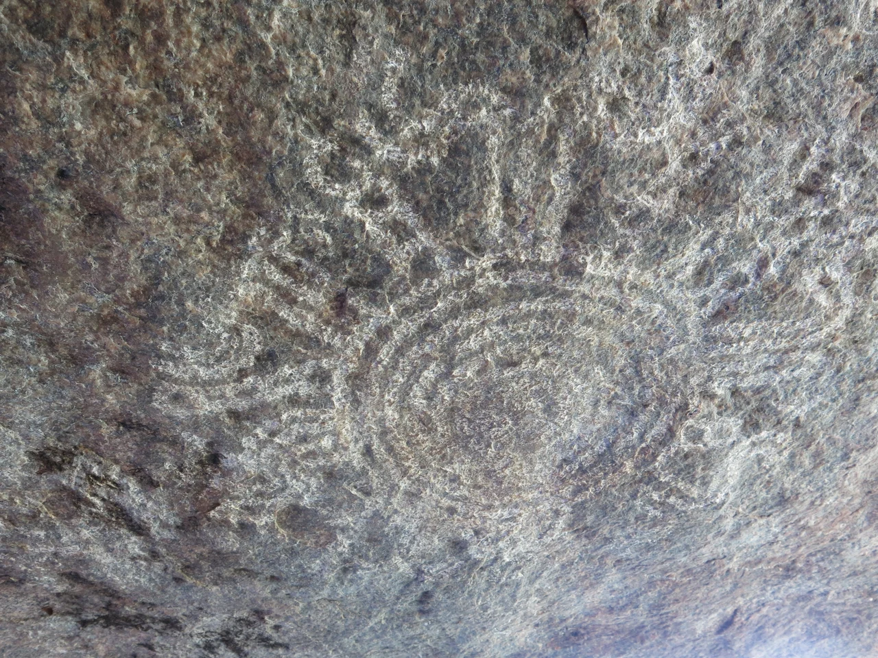
Look up under the great overhang at Nyero 2, and the granite is covered in circles. Rings inside rings, painted in the deep red of ochre, more than forty of them crowding the rock face beneath a boulder that weighs an estimated twenty thousand tons. Nobody can read them. The people who painted them left no writing and no descendants who can explain what the circles meant, and the rings keep their meaning to themselves. What survives is the gesture itself: a hand, a pigment, a wall of stone in eastern Uganda's Kumi District chosen carefully enough that the paint has lasted more than seven centuries.
The Hands That Held the Brush
The paintings predate 1250 CE, and they belong to a wider tradition. Across eastern, central, and southern Africa, the same red geometric style appears again and again, tracking the old range of Late Stone Age hunter-gatherers. Researchers attribute this art to the Batwa, sometimes called Twa, foraging communities who once lived across far more of the continent than they do now. Today, in this part of Africa, the Batwa survive only in small groups near the Rwanda-Uganda border and in eastern Congo. Long before the Nilotic, Luo, and Bantu farmers who live here today arrived, Batwa communities likely moved through these hills, and at some point one of them stood at this rock and began to paint. The circles are not crude. Made with both brush and fingertip, they were placed by people who knew exactly what they were doing.
Six Shelters in the Stone
The site spreads across a granite inselberg in six shelters. Nyero 1 carries six sets of concentric circles in white, alongside shapes the guides call acacia pods. Nyero 2 is the masterpiece, its red rings sheltered from rain by the overhang and from sun by the boulders flanking it. One large design has been read as a pod by some and a canoe by others. Tucked into a narrow passage on the shelter's south-eastern side lies a small dark cavity the local people call the pocket. The higher shelters, three through six, demand a crouch or a climb and reward it with more circles, more crosses, the occasional oval, and views across the surrounding countryside. Some of the paint is exfoliating now, peeling slowly from rock left open to weather.
A Place Still Sacred
The circles may be unreadable, but the rock never stopped being holy. For generations the Iteso people treated these shelters as places of the gods, bringing offerings and prayers for rain, for children, for relief from misfortune. At Nyero 3 in particular, clans gathered to make their petitions through the turning of the seasons. Traces of smoke from old sacrifices still darken some of the caves. In the 1970s the government of the day forbade people from praying here, severing a living thread, yet the attachment endured. Members of the community still leave small amounts of money in the pocket at Nyero 2, before or after a prayer is answered, continuing a conversation with the rock that began long before anyone recorded it.
Protected, but Still a Mystery
Uganda recognised what it had. The 1995 constitution obligates the state to preserve the nation's heritage, and the older Historical Monuments Act of 1967 makes damaging a site like this a punishable offence. In 1997 Uganda placed Nyero on UNESCO's World Heritage Tentative List, the waiting room for full recognition. A guide meets visitors at the gate and walks them through the shelters, reciting the history as far as anyone knows it. But the central fact never changes. The painters are gone, their language unknown, their reasons unrecorded. You can stand exactly where they stood, look at exactly what they made, and still not know what they were trying to say. That gap, more than the paint, is what gives Nyero its weight.
From the Air
The Nyero rock paintings sit at 1.283°N, 33.504°E in eastern Uganda's Kumi District, roughly 250 km northeast of Kampala. The granite inselberg rises from gently rolling farmland near Kumi town; the shelters themselves are too small to spot from altitude, but the bald grey rock outcrops of the Teso region are a useful visual marker against the surrounding green. Nearest major airport is Entebbe International (HUEN), about 270 km southwest near Kampala; Soroti Airport (HUSO) lies far closer, roughly 50 km to the north. Equatorial weather brings afternoon convective cloud and haze, especially in the wet seasons; clearest light is early morning.
Nearby Stories
- Eastern Uganda Campaign of 1979 28 km away
- Kitum Cave 53 km away
- Bujagali Hydroelectric Power Station 79 km away
- Basilica of the Uganda Martyrs, Namugongo 87 km away
- Uganda Museum 121 km away
- Murchison Falls National Park 162 km away
- Budongo Forest 226 km away
- Kanapoi 233 km away