.jpg)
Palisades Fire
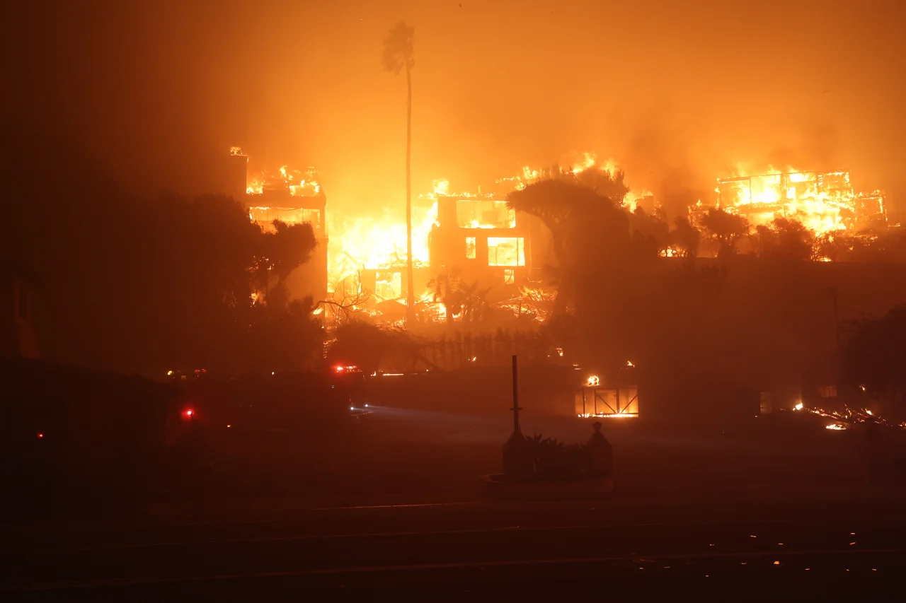
The area had not seen measurable rainfall in eight months. Santa Ana winds were arriving at extraordinary velocity. When a fire was first reported near Pacific Palisades at around 10:30 a.m. on January 7, 2025, a CAL FIRE battalion chief told the Los Angeles Times that conditions represented 'the perfect recipe for a large wildfire.' Within hours, the Palisades Fire had spread beyond what any prediction model had prepared residents to expect.
What the Fire Consumed
The final count was 6,837 structures destroyed and 12 people killed. The Palisades branch of the Los Angeles Public Library burned. Palisades Elementary and Marquez Elementary Schools were destroyed. Palisades Charter High School was badly damaged, with roughly 40 percent of the campus affected. The Theatre Palisades burned. The house of art dealer Ron Rivlin was destroyed along with a collection of more than 200 artworks, including pieces by Andy Warhol and Keith Haring. The house on Alma Real Drive where Robby Krieger wrote 'Light My Fire' for The Doors was destroyed. The historic Topanga Ranch Motel burned. The Will Rogers State Historic Park lost the main house and its stables, though staff evacuated the horses and removed some exhibited memorabilia. Across two parks, 30 buildings were destroyed including staff housing. The fire burned simultaneously with the Eaton Fire at the San Gabriel Mountain foothills, and the two fires together constituted one of the most destructive wildfire events in California history.
Water and Wind
The fire's speed exposed infrastructure limits that had not been fully tested before. Fire hydrants in the more elevated parts of Pacific Palisades began running dry — ultimately, 20 percent of hydrants in those higher elevations lost pressure during the sudden demands of firefighting. Residents had been warned in the days before to use extreme caution with anything that could spark a fire, and those near forests were advised to be prepared to evacuate. The warning proved insufficient. The combination of extreme drought, powerful Santa Ana winds, and topography that channeled wind through the canyons produced fire behavior that outpaced suppression capacity. The fire burned through January 31, 2025, when it was fully contained, having grown to destroy one of the most recognized residential communities in Los Angeles.
The Getty Villa and What Survived
Vegetation at the Getty Villa caught fire, but the buildings and the 44,000-piece antiquities collection inside were unharmed. The Villa closed for remediation — deep cleaning, system flushes, air and water filter replacements, the removal of more than 1,300 fire-damaged trees — and reopened on June 27, 2025. Some iconic structures survived the fire through a combination of luck, construction material, and the work of fire crews who made calculated decisions about where to direct resources. Other structures, including architecturally significant homes by Richard Neutra, A. Quincy Jones, and Conrad Buff, were lost. The modernist Keeler House was destroyed. The 1949 Freedman House, designed by Neutra, burned.
Arson and Investigation
In October 2025, federal authorities arrested a man in Florida and charged him with three felony counts of arson. Investigators alleged that he had set an earlier fire on January 1 using a combustible material that was not fully extinguished and later reignited to become the Palisades Fire. The claim — that one of the most destructive wildfires in California history may have started with an act of deliberate human ignition — added a different dimension to the disaster's legacy. Whether that specific theory holds up in court, the fire's consequences are fixed: thousands of people lost their homes in a community that had been built slowly across a century, and the landscape they knew does not exist in the same form it did before January 7, 2025.
From the Air
The Palisades Fire burned through approximately 34.073°N, 118.543°W and spread across the Santa Monica Mountains between Pacific Palisades, Topanga, and Malibu. The burn scar is visible from altitude as a large swath of darkened terrain west of Los Angeles. Nearest airports: Van Nuys Airport (VNY) about 12 miles northeast, Camarillo Airport (CMA) about 25 miles northwest.
Nearby Stories
- Grandma Prisbrey's Bottle Village 4.8 km away
- Battle of San Buenaventura 11 km away
- Historic Wintersburg in Huntington Beach, California 13 km away
- Point Hueneme Light 15 km away
- USS Ingersoll (DD-652) 22 km away
- Mount Lowe Railway 22 km away
- San Nicolas Island 64 km away
- Edwards Air Force Base 73 km away