Paramaribo swamp forests
The fires underground can burn for months. Peat doesn't behave like wood. When dry weather and human activity ignite the peat soils of the Paramaribo swamp forests, flames move slowly through the waterlogged earth itself, sometimes meters below the surface, smoldering without flame and producing smoke that filters through root systems to reappear kilometers from wherever the fire started. This strip of coastal Suriname - 777,000 hectares of permanently flooded freshwater forest between the mangroves at the Atlantic edge and the submontane forests of the interior - is shaped by water that almost never drains. Most of Suriname's population lives in or beside it. Paramaribo itself, the national capital, sits within the ecoregion.
A Narrow Belt Across a Country
The Paramaribo swamp forests form a ribbon along the northern edge of Suriname, running from the Guyana border at the Corantijn River all the way east to the French Guiana border at the Marowijne River. Both neighboring countries also contain elements of the same swamp system, but Suriname holds the center. The coastal plain formed from marine sediments during the Holocene epoch, and elevations run only from about one meter above sea level to barely four. The soils are hygromorphic - waterlogged essentially year-round - and during the rainy season, water in the southern parts of the ecoregion can exceed three and a half meters in depth. Imagine standing in a forest where the water is over your head and trees taller than houses continue up past the waterline. This is that forest.
Two Wet Seasons, Two Dry
The climate classifies as Köppen Af - equatorial, fully humid, meaning no month is truly dry. But the rainfall pattern is unusual even for the tropics. Four distinct seasons interleave: a major rainy season in December-January, a shorter dry spell in February-April, a second rainy season running May through August, and a second drier period from August into November. Mean temperatures range from 25.9 degrees Celsius in January to 27.8 in September - a two-degree variation that feels negligible compared to the 2,200 millimeters of rain spread unevenly across the year. May brings the heaviest rain, averaging 278.7 millimeters. October is the driest month with 70.8 millimeters. The double rainy season makes the hydrology unusually complex and the peat soils unusually stable.
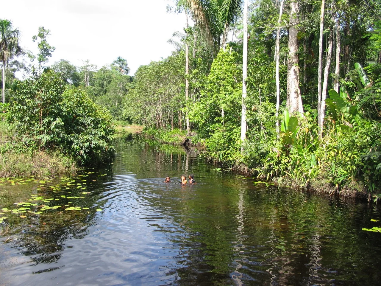
Trees That Drink All Year
The forest is shorter and less species-rich than the terra firme forests farther inland, but what grows here is specialized for a life underwater. In the shallower northern swamps, climax species include baboonwood (Virola surinamensis), chewstick (Symphonia globulifera, whose sap was once used as chewing gum), and açaí palm (Euterpe oleracea). In the deeper southern swamps, fewer species can survive the permanent flooding - Crudia glaberrima, arapari, and piritu palm dominate. Where water runs shallower still, stands of purple coraltree or dragon-blood tree grow with white cedar. Paradise plum trees cluster with pond apple, buriti palm, or mulato tree. In scrub areas and herbaceous swamps, cattails and giant spikerush and golden beaksedge form dense mats where a boat can't push through. The buriti palms (Mauritia flexuosa) produce the orange-scaled fruit that supports countless bird species.
Scarlet Ibis and Manatees
Mammal diversity is fairly good though the ecoregion holds no endemic species. Five primate species move through the canopy: red-handed tamarin, common squirrel monkey, white-faced saki, tufted capuchin, and Venezuelan red howler, whose calls carry for kilometers at dawn. Jaguars prowl the higher ground. Giant otters hunt fish in the deeper channels, and West Indian manatees - endangered throughout their range - still appear in the estuaries. Birds are where the ecoregion really shines. The coastal plain is a critical stopover for migratory waterfowl traveling the Americas. Scarlet ibis gather by the thousands, their feathers stained red by the carotenoids in the shrimp they eat. Semipalmated sandpipers pass through in flocks. The endemic arrowhead piculet - a tiny woodpecker found nowhere else - works the tree trunks, alongside the brilliant crimson-hooded manakin.
Vulnerable and Close to People
The World Wildlife Fund lists the Paramaribo swamp forests as Vulnerable. The swamps themselves are inhospitable enough that vast areas remain relatively intact - water too deep for easy access, soils too unstable for agriculture without significant drainage. But the waterways, roads, and colonial-era dykes that do penetrate the region are used extensively for logging, for capturing primates and birds to sell as pets, and for drainage schemes that convert swamp into rice paddy or pasture. Peat and grass fires - sometimes set deliberately, sometimes escaped from farming burns - damage soils that took millennia to form. Bauxite mining, a major Suriname industry, chews at the southern edge. Urban sprawl from Paramaribo itself expands into the forest year by year. Protected areas exist: the Galibi, Wia Wia, Peruvia, Boven Coesewijne, Copi, and Wanekreek nature reserves preserve fragments. But most Surinamese live here, and the tension between livelihood and conservation is constant. Most of a country's population concentrated within a single ecoregion means the ecoregion changes faster than anywhere else.
From the Air
Coordinates 5.623°N, 55.843°W. Recommended viewing altitude 3,000-6,000 feet to observe the coastal mosaic of swamp forest, mangrove, and open water. Landmarks: Paramaribo (capital, within the ecoregion), the Suriname River estuary, the Corantijn River on the Guyana border, and the Marowijne River on the French Guiana border. Nearest airports: Johan Adolf Pengel International (SMJP) near Paramaribo, Zorg en Hoop Airport (SMZO) within the capital. Weather: equatorial, humid; double rainy-season pattern May-August and December-January. Peat smoke from underground fires occasionally visible during dry months.
Nearby Stories
- Saint-Laurent-du-Maroni 129 km away
- Oyapock 403 km away
- Guyana-Venezuela Territorial Dispute 435 km away
- Oiapoque 459 km away
- Orinoco 577 km away
- Orinoco Delta Swamp Forests 721 km away
- Pitinga Mine 796 km away
- The Sinking of the Titanic: The Unsinkable Ship That Sank 4028 km away