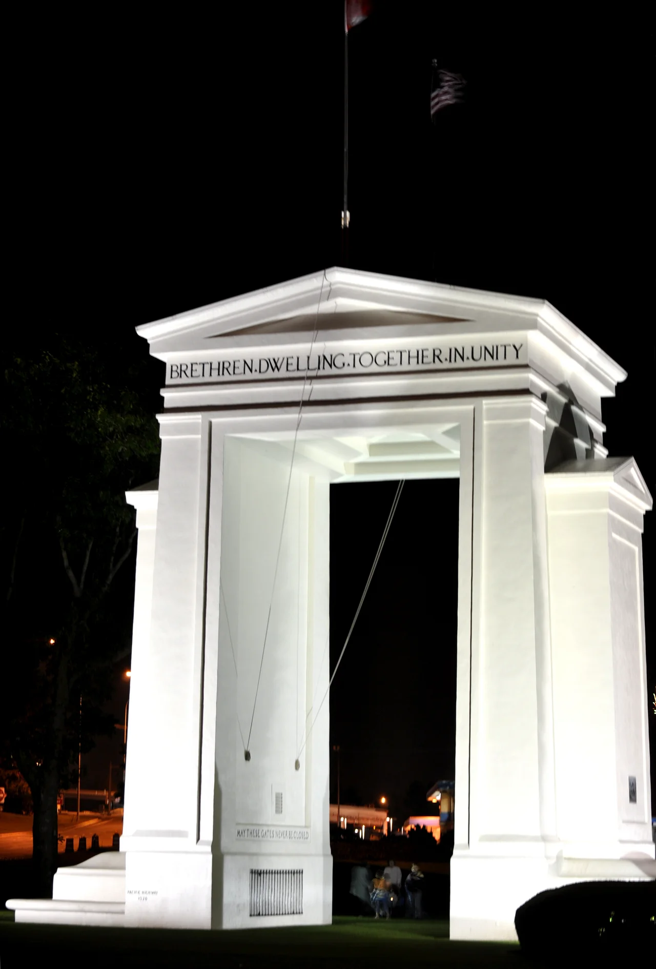

Peace Arch
Sealed inside the cornerstone is a box hammered from the steel of a captured slave ship. Sam Hill, a lawyer for the Great Northern Railway and a restless promoter of causes, filled that box with fragments of two vessels before the concrete went over it. One piece came from the Mayflower. The other came from the Beaver, the Hudson's Bay Company paddle steamer that was the first steamship to work the Pacific Northwest and that ended her days aground off what is now Stanley Park. Two founding stories, carried in the metal of a slaver, buried on the precise line where one country becomes another. The drivers idling in the queue a few metres away have no idea it is under them.
The Man Who Wanted an Arch
Hill launched his international fundraising campaign in 1914, a hundred years after the Treaty of Ghent ended the War of 1812 and set the two countries on a course neither has since abandoned. The American architect Harvey Wiley Corbett donated the design. Volunteers from both sides began building in 1920, and on September 6, 1921, the arch was dedicated: 20.5 metres, sixty-seven feet, white and square-shouldered, rising out of a lawn with no fence around it. It was regarded at the time as one of the first earthquake-resistant structures in North America, which in a corner of the continent that sits above a subduction zone was less sentiment than foresight. Schoolchildren on both sides of the border sent money to buy the land around it. The park exists because of nickels.
Children of a Common Mother
Read the frieze from the American approach and it says "Children of a common mother" - an acknowledgement that both nations came out of the same empire. Walk through and read the Canadian face, and it says "Brethren dwelling together in unity," a line lifted from Psalm 133. Inside the arch hang two iron gates, mounted on either side of the boundary and left standing open. The inscription above one reads "May these gates never be closed." The other is dated: "1814 Open One Hundred Years 1914." There is something bracing about a monument that states its own terms so plainly. It is not a victory arch. Nothing was won here. It commemorates the absence of an event - a century in which two neighbours declined to fight - and asks, in stone, that the streak continue.
A Lawn With a Line Through It
The grounds are two parks pretending to be one. The Canadian half became Peace Arch Provincial Park in 1939; the American half is Peace Arch Historical State Park, open from eight in the morning until dusk. Together they hold broad lawns, a lily pond, and a flower bed planted in the shape of the Canadian flag. Roughly half a million people come each year, many of them for the unusual freedom of walking from one country into the other across mown grass, without a booth or a stamp - though officers may still ask who you are and where you belong. The parking lot on the Canadian side sits on Semiahmoo First Nation land, subleased for public use. That detail matters. The 49th parallel was ruled across a homeland that was here long before either of the nations celebrating themselves in the frieze.
Concerts, Paint, and a Torch
In 1952, Paul Robeson came to the border because he could not cross it. The singer and activist had been stripped of his passport during the Red Scare, so he stood on a flatbed truck on the American side and sang to a crowd standing in Canada - a performance he repeated over several years, the arch behind him insisting on an openness his own government had denied him. Not every gathering here has been gentle. On May 9, 1970, Canadian demonstrators protesting the Cambodian campaign splashed the monument with paint and carried the disturbance into Blaine. And on February 9, 2010, with the Vancouver Olympics days away, the torch relay stopped at the north side of the arch while Premier Gordon Campbell and Governor Christine Gregoire spoke to a crowd of several hundred. Celebration, grievance, and longing, all delivered to the same patch of grass. The gates stayed open through every one of them.
From the Air
The Peace Arch stands at 49.0021 N, 122.7565 W, in the median where Interstate 5 becomes British Columbia Highway 99. Best viewed from 2,000-3,000 feet AGL, where the white arch reads as a bright rectangle against the park's lawns and the long lines of vehicles stacked on either side of it. The strongest navigational cue is the border itself: a cleared swath running dead east-west along the 49th parallel, cutting through the forest and subdivisions with a straightness nothing natural produces. Semiahmoo Bay and the curving spit that encloses Drayton Harbor lie immediately southwest; the mudflats of Boundary Bay open to the northwest. Nearby airports: Bellingham International (KBLI) about 15 nm south-southeast, Boundary Bay (CZBB) about 11 nm west-northwest, Vancouver International (CYVR) about 20 nm northwest, and Abbotsford International (CYXX) about 16 nm east. Vancouver's terminal airspace begins just north, and any actual crossing of this line requires customs arrangements on the far side. Summer mornings often bring a marine layer off the strait that hides the whole park until mid-morning; the clearest light is a late afternoon in autumn.
Nearby Stories
- Swartz Bay ferry terminal 0.9 km away
- Maillardville 2.1 km away
- Nooksack, Washington 3.5 km away
- Galiano Island 4.5 km away
- Orcas Island 4.8 km away
- Hatzic Valley 8.2 km away
- St. Augustine's Indian Residential School 38 km away
- Everett-Pacific Shipbuilding: The Yard That Built a Floating Navy 79 km away