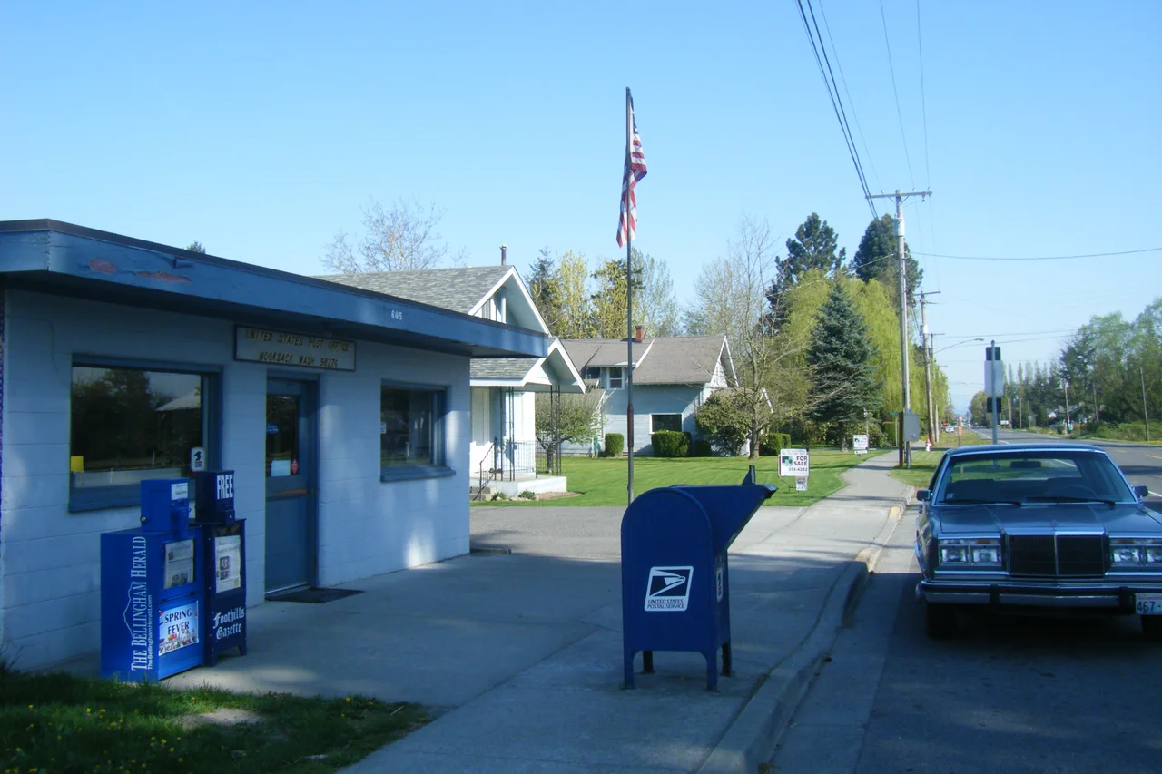

Nooksack, Washington
Nooksack is not on the Nooksack River. The nearest bank lies a little over a mile southwest; the water running past the town is the upper Sumas, headed the other way, toward Canada. The name itself came from somewhere older than the survey stakes - Noxwsʼáʔaq in Lhéchalosem, the language of the Nooksack people, usually translated as 'always bracken fern roots.' Five miles south of the border, on eight-tenths of a square mile of valley floor, a city of about fifteen hundred people carries a name that describes a food plant and points at the wrong river. Both facts are more interesting than they sound.
Always Bracken Fern Roots
Lhéchalosem belongs to the Salishan family and sits closer to Halkomelem, spoken across the line in coastal British Columbia, than to anything spoken to the south - a reminder that the international border cut sideways through a world that had been organized around rivers and kinship instead. The Nooksack people are still here, headquartered near Deming about twelve miles south along the river that bears their name. Federal recognition came in 1973, three years after the tribe acquired a single acre of land, and the land base has since grown past three thousand acres of fee, trust and allotted parcels. The language nearly went with the generation that held it: by 2016 researchers could document only one remaining fluent elder. Revival work continues, which is a quieter kind of persistence than it sounds.
Built, Burned, Bypassed
The city incorporated on 6 December 1912 and grew quickly, helped by a rail station that plugged it into the national network. Then it burned. A string of serious fires in the early twentieth century took out much of what had gone up, and the momentum never really returned. What followed was a long stretch of being the smaller neighbour. In 1992 the Postal Service moved the postmaster to Everson, and Nooksack found itself sharing ZIP code 98247 - a bureaucratic detail with teeth, since sales tax revenue apportioned by ZIP code began flowing to the wrong town. Nooksack eventually got 98276 of its own. When a citizens' group proposed in February 2009 that the two cities simply merge, with 'Nooksack Valley' floated as the name of the combined place, the council voted unanimously in May to drop it after hearing what residents thought.
The Man Who Photographed Trees
Darius Kinsey came west from Missouri in 1890 and met Tabitha May Pritts in Nooksack; they married in 1896 and opened a studio at Sedro-Woolley the following year. What he made there became one of the great records of the Pacific Northwest: loggers standing on springboards driven into trunks wider than a room, whole crews arranged on the undercut face of a single cedar. His camera was an 11-by-14-inch Empire State view, carried with a custom tripod that could rise twelve feet. Tabitha ran the other half of the business, developing the negatives and printing images that went back out to the camps, where the loggers themselves bought them. In October 1940, Kinsey fell from a stump and stopped photographing. He spent his last five years putting his negatives in order, died in 1945, and is buried in Nooksack beside Tabitha. The valley also raised Louie Gong, the Nooksack artist who founded Eighth Generation in 2006 and built it by putting Coast Salish design onto shoes and blankets - and by arguing, loudly, that Native art should pay Native artists.
When the River Came Anyway
For a town that isn't on the Nooksack, the river still has the last word. On 15 November 2021 an atmospheric river parked over the border country and the Nooksack rose over its banks, flooding the valley communities and forcing hundreds of people out of their homes with the schools closed behind them. Sumas, a few miles north, lost an estimated 85 percent of its housing stock to flood damage. A freight train derailed near Sumas at the height of it; road access to Lummi Nation was cut entirely; the governor declared a state of emergency across fourteen western Washington counties. Then, on 28 November, more rain sent the river over again. The valley's soil is this productive precisely because the river has been depositing it here for thousands of years, which is the bargain: the same water that makes the berry fields makes the flood maps.
Valley Town
State Route 9 runs straight through, and most of what defines daily life here is shared with the neighbours - Nooksack, Everson and Sumas together support the Nooksack Valley School District, with one high school, one middle school and three elementaries between them. This is a young town by American standards, its median age hovering under thirty, with nearly half of households raising children. The population has climbed steadily, from 851 at the 2000 census to 1,338 in 2010 and 1,471 in 2020. Around it spread the dairy farms and raspberry fields of the Nooksack Valley, and on a clear day Mount Baker sits on the southeastern horizon, close enough to look like a local feature rather than a volcano.
From the Air
Nooksack lies at 48.9283 N, 122.3194 W, on the flat floor of the Nooksack Valley about 5 statute miles south of the Canada-US border. Fly it at 2,000-3,000 ft AGL: the town is a compact grid astride State Route 9, set in a checkerboard of dairy pasture and berry field, with the silver thread of the Nooksack River looping past a mile to the southwest and the upper Sumas draining north toward Abbotsford. Abbotsford International (CYXX) sits about 6 nm north-northwest and is the dominant nearby field; Bellingham International (KBLI) is roughly 12 nm southwest, and Vancouver International (CYVR) about 38 nm northwest. The unmissable landmark is Mount Baker, 10,781 ft, some 22 nm southeast - use it to orient the whole valley. Watch for low stratus and valley fog in autumn and winter, and be aware that the Canadian border runs due east-west immediately north of town.
Nearby Stories
- Birch Bay, Washington 4.6 km away
- Hatzic Valley 5 km away
- Riverview Hospital 8.6 km away
- Cypress Island 13 km away
- Galbraith Mountain 14 km away
- North Cascades National Park 59 km away
- Manning Provincial Park 64 km away
- Okanagan 151 km away