
Swartz Bay ferry terminal
In December 1981 a cutting torch set the terminal alight. The fire took out part of the passenger walkway and a wingwall and did half a million dollars in damage before terminal staff and firefighters got the better of it - with help from an unexpected direction. The Queen of Nanaimo was inbound on her scheduled run, and rather than stand off and wait, she came in and turned her own fire hoses on the dock she was about to tie up to. There is something about that image that captures Swartz Bay exactly. This is not a scenic overlook or a heritage site. It is a working machine at the north end of the Saanich Peninsula, and when something goes wrong the next sailing is still due.
Seventy Years of Waiting
The idea was old before it was built. In 1889 Amor De Cosmos, by then a former premier of British Columbia, became the first person known to have publicly proposed Swartz Bay as a workable ferry terminal for connections to the Lower Mainland. Nobody acted on it for seven decades. When the search for a site north of Victoria finally got serious in 1959, the obvious alternative was Sidney, where facilities already handled the San Juan Islands run. Sidney lost on two counts: its waters were not sheltered enough, and the extra distance meant longer crossings and more fuel burned on every sailing. Swartz Bay won partly because a small private dock, run by the Gulf Islands Ferry Company, was already operating there. De Cosmos had been right, which he did not live to see.
Five Berths and a Floating Ramp
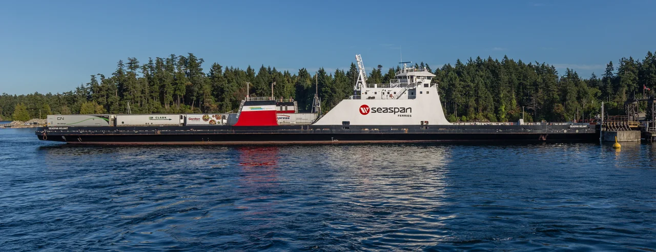
Today the terminal occupies 22.7 hectares and works five berths. The heavy engineering is mostly invisible to anyone in the queue, but it matters: in 2006 the Berth 2 project replaced ageing marine structures and an old counter-weighted ramp lift with a $25 million floating berth that rises and falls with the tide instead of being winched against it. A broader renovation had already gone through in the mid-1990s. From here BC Ferries runs the main crossing to Tsawwassen on the mainland along with service to all the major southern Gulf Islands, and Seaspan Ferries operates a freight terminal on the same water - the less photogenic half of what keeps the island supplied.
The End of Highway 17
Swartz Bay is where the highway stops, which gives the place its particular character: everyone arriving is on their way to somewhere across water. Victoria International Airport is about ten minutes down Highway 17, and transit Route 70 runs an express bus into downtown Victoria in roughly an hour. For anyone in no hurry at all, the Lochside Regional Trail runs 29 kilometres south from here to the city, following the old rail grade through farmland and along the shoreline. Inside the main building there is a cafeteria and a coffee shop, and through the warmer months local artisans set up kiosks in the concourse. One small distinction the terminal holds: it is the only major southern terminal in the BC Ferries system with no traffic signal at its entrance or exit. The queue simply flows.
A Working Seaway
It is easy to treat the crossing as scenery - and it is spectacular scenery, threading out past the Gulf Islands with the Coast Mountains ahead. But these are busy, constrained waters shared by vessels of wildly different sizes, and the terminal's history includes the reminder. On 14 September 2000, just off Swartz Bay, the Spirit of Vancouver Island struck a pleasure craft and two people were killed. Ferry crews on this route run it hundreds of times a year in fog, in wind, in December darkness, threading between islands and small boats on a schedule. The queue on the tarmac, the gulls on the pilings, the announcement over the tannoy - all of it rests on that being done properly, every single sailing.
From the Air
Swartz Bay ferry terminal sits at 48.6882 N, 123.4100 W at the northern tip of the Saanich Peninsula in North Saanich, British Columbia, about 32 km north of Victoria. From the air it is easy to identify: a broad apron of parking and vehicle lanes at the very end of Highway 17, with five berths and their ramp structures projecting into a small sheltered bay, and large white ferries either alongside or standing off. The Gulf Islands scatter northeast across Haro Strait toward the mainland, with Salt Spring, Pender and Saturna prominent; Sidney and its harbour lie a short distance south along the shore. Victoria International Airport (CYYJ) is roughly 5 nm south and its Class C airspace covers the approach, so coordinate before descending for a look; Victoria Harbour Water Aerodrome (CYWH) lies about 17 nm south, and Vancouver International (CYVR) sits across the strait to the east. A viewing altitude of 2,000 to 3,000 feet MSL takes in the terminal, the peninsula and the island channels beyond. Watch for heavy floatplane and helicopter traffic between the islands and the mainland, and for morning fog in the straits during autumn.
Nearby Stories
- Yellow Island 1.7 km away
- Scia'new First Nation 2.5 km away
- San Juan Spruce 6.5 km away
- Kolponomos 8.5 km away
- Wallace Island Marine Provincial Park 8.6 km away
- Cowichan Lake 12 km away
- Lily Point Marine Reserve 12 km away
- Smith Island (Washington) 15 km away