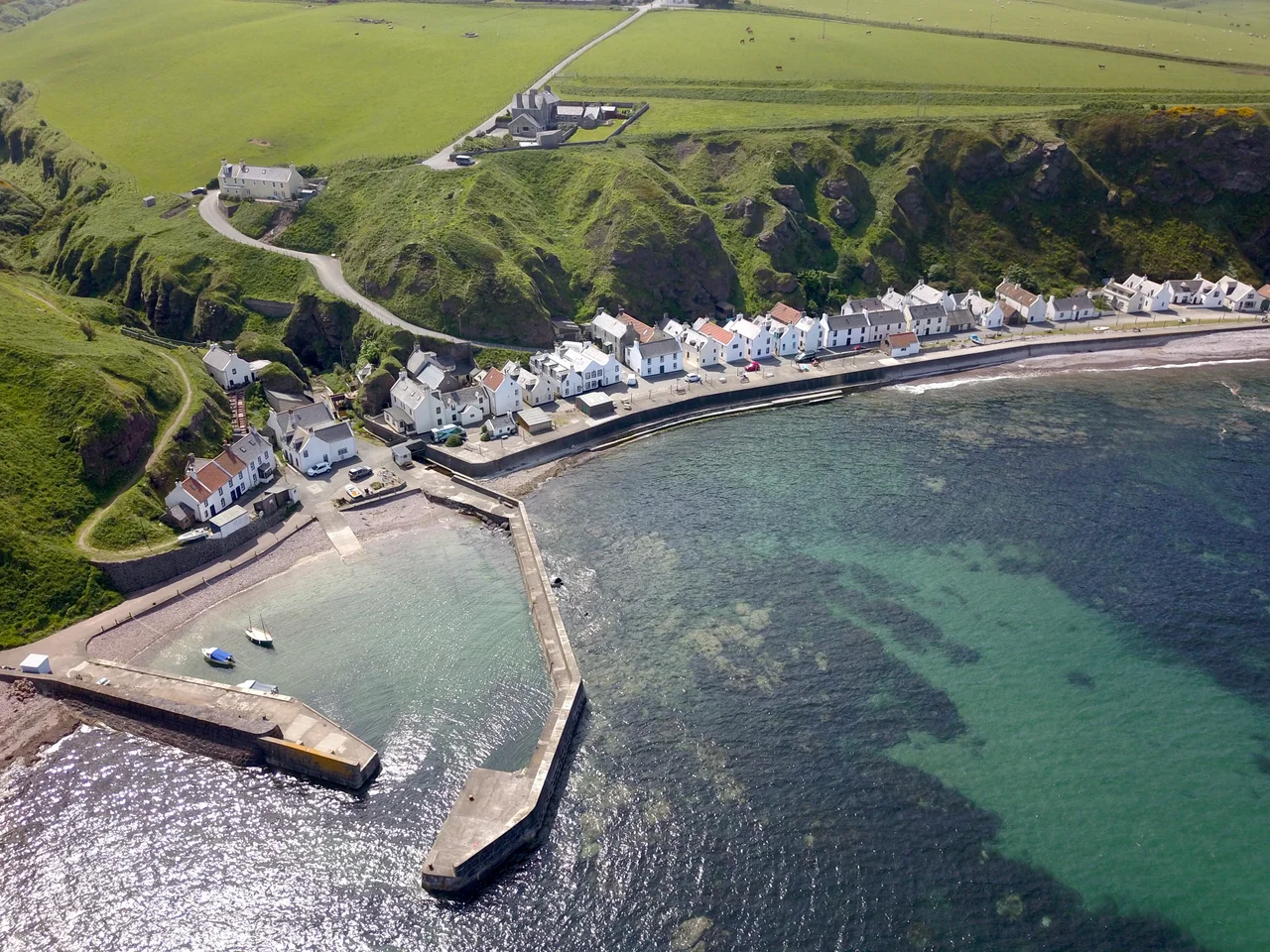

Pennan
There is a red phone box at Pennan. It stands on the quay where a single row of harled cottages meets the harbour, and on a quiet morning in 1983 a Texan oil executive named Mac MacIntyre placed a long-distance call from inside it. The film was Local Hero. The village was renamed Ferness for the script. Forty-three years later the village is still called Pennan, the phone box is still red, and visitors still queue to lift the receiver. The signal Mac was trying to send carried across the Atlantic. The signal a modern visitor needs - a mobile bar - still does not reach.
A Village of Three Surnames
Pennan came into existence as a fishing village in the 18th century, on a narrow shelf of land below the cliffs of the Aberdeenshire coast. The earlier name for the site, recorded in 1587 as Pennand, may come from a Brittonic root meaning head, end, or promontory - the same root that gives Welsh pen. The community lived almost entirely off the sea. Men in small boats went out and brought fish back. Women and children carried the catch inland to sell in farming villages. Until the 1930s the population came under three principal surnames: Watt, Gatt and West. In the past fifty years most of the native families have moved on. The houses are now mostly holiday lets.
Bill Forsyth Comes to the Coast
In 1982 the Scottish director Bill Forsyth was scouting locations for a film about a Texas oil company trying to buy a Scottish village to build a refinery. He wanted a place that looked impossible - a settlement perched in a way no planner today would allow, hard against the cliff with the sea immediately at its door. He found Pennan. The exterior shots of the fictional Ferness were filmed here through the summer of 1982. The beach scenes were shot 250 kilometres west on the Atlantic coast near Mallaig, where the sand was paler and the light cleaner, but the village itself - the row of cottages, the harbour wall, the phone box - is genuinely Pennan.
The Phone Box on the Quay
In the film Mac MacIntyre keeps in touch with his Houston office through that single red phone box because he has no other way out. He places his calls into the small hours, the lights of the village behind him, the sound of the sea everywhere. The box was a working K6 - the classic British design - that had been installed on the quay for the residents. After the film's release it became a place of pilgrimage. The real box was eventually replaced. The current one sits where the original stood. The Local Hero phone number was real, briefly: people called it from around the world to hear it ring on the Pennan quay.
The Cliff Above
Behind the row of cottages the cliff rises sharply, and that cliff is not entirely stable. In 2007 a major landslip sent rock and earth down onto Pennan, damaging the village and reminding everyone that the shelf they live on is a temporary geological arrangement. Further inland this part of Aberdeenshire has been inhabited since at least the Bronze Age. The long barrow at Longman Hill - a few kilometres south - is one of the most ancient surviving monuments in the area. The early-19th-century farmhouse of Mains of Auchmedden, harled and white, still recalls the lost Bairds of Auchmedden whose palace was demolished in the late 18th century. Some of its stone is said to have gone into the building of New Pitsligo.
The Millshore Stone
Just west of Pennan, at the bay called Mill of Nethermill, lies the Millshore Stone - a 125-kilogram natural granite lifting stone that is now part of the small but global community of Scottish lifting-stone traditions. The stones - boulders that fit the body in a particular way and weigh a particular figure - have been used since at least the 18th century as tests of strength. Travellers from elsewhere now come to attempt the Millshore. Pennan, then, is several different small attractions stacked on the same patch of coast: a film location, a working harbour, a vulnerable shelf below crumbling cliffs, and a place with a stone heavy enough to test anyone who comes asking. The phone box gets the queue. The sea, as it always has, gets the last word.
From the Air
Pennan lies at 57.679 N, 2.261 W on the north-facing Aberdeenshire coast about one hour's drive from Aberdeen. From altitude the village appears as a single row of houses on a narrow shelf below the cliff, with a small harbour and short pier. The B9031 coast road runs along the clifftop above. Nearest airport is Aberdeen (EGPD) roughly 30 nm to the south-east; RAF Lossiemouth (EGQS) lies west along the Moray Firth. The neighbouring villages of Gardenstown and Crovie lie a few kilometres west along the same coast.
Nearby Stories
- Cullen Viaduct 5.9 km away
- Fyvie Castle 7.8 km away
- Auchindoun Castle 18 km away
- German submarine U-58 (1938) 27 km away
- HMS Exmouth (H02) 35 km away
- Hill o' Many Stanes 42 km away
- HMS Daring (H16) 99 km away
- Longstone Lighthouse 204 km away