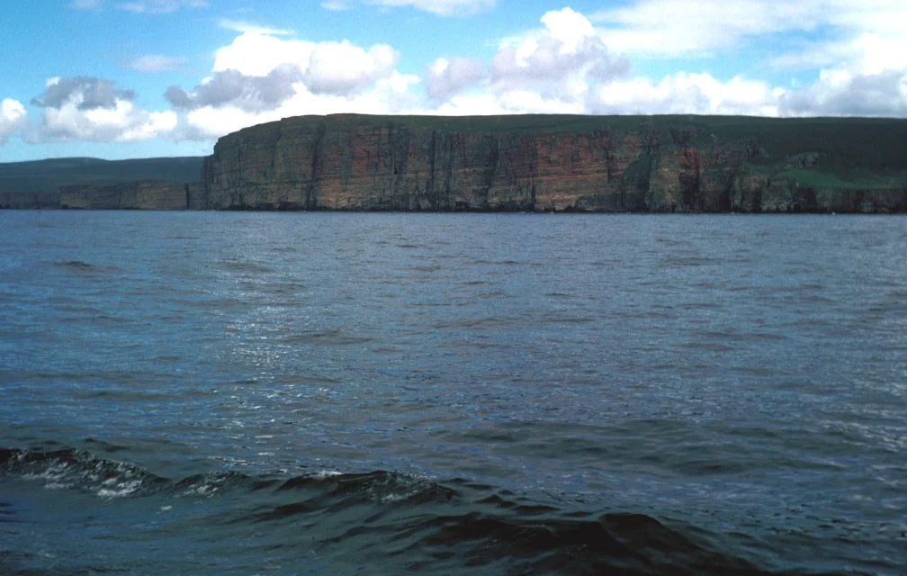

Pentland Firth
Despite the name, the Pentland Firth is not a firth at all - it is a strait, a narrow gap of open water between the Atlantic and the North Sea, twelve miles across at its widest, with currents that can hit thirty kilometres per hour. The name comes from Old Norse *Petlandsfjörð*, meaning the fjord of Pictland - the Picts who lived in Orkney before the Vikings arrived and gave their old territory a Scandinavian label. Even older was the Pictish name itself: the Sea of Orcs. For nine centuries this strait has been the dividing line between mainland Britain and the Northern Isles, and for considerably longer it has been one of the most dangerous and most useful pieces of water in the British archipelago.
Two Oceans, One Tide
Twice a day the Atlantic and the North Sea try to even out their levels through the Pentland Firth, and the volume of water that moves is enormous. Currents can exceed five metres per second - around eighteen kilometres per hour - and accelerate to over thirty in the narrowest gaps. Combined with gale-force winds blowing the wrong way against the flow, the resulting sea state is among the worst in northern Europe. The bottom is shallow and uneven, scattered with the small islands of Stroma, Swona, and the Pentland Skerries, all of which produce their own wakes and eddies. In 2015 the cargo ship *Cemfjord* capsized here in heavy weather and sank with the loss of all eight crew. The firth has killed sailors for as long as sailors have tried to cross it.
The Merry Men and the Swelkie
Each major race in the firth has its own name. The Merry Men of Mey forms off St John's Point during the westbound tide and stretches northwest across the firth toward Hoy, building a moving wall of waves that can act as a natural breakwater for the calmer water behind it. The Swelkie - from Old Norse for swallower - is the whirlpool at the north end of Stroma. Norse poetry in the Eddas explains its existence: two giantesses named Fenja and Menja turn a magical millstone called Grótti at the bottom of the sea, grinding out the ocean's salt. In later Orcadian and Shetlandic folklore the giantesses became witches with the wonderful names Grotti Finnie and Grotti Minnie. The Duncansby Race at the southeast corner forms and reforms with the tide, sometimes called the Boars of Duncansby for the sound and shape of the standing waves. Each race is a navigational hazard with a name old enough to predate any reliable chart.
The Saudi Arabia of Tidal Power
What kills ships also generates electricity, in theory. Currents of five metres per second mean kinetic energy on an enormous scale, and the Pentland Firth is widely regarded as the best tidal stream site on the planet. In 2008 the Scottish First Minister Alex Salmond called the firth the Saudi Arabia of tidal power. Reality has been more modest - peer-reviewed studies put the realistic maximum closer to one gigawatt than twenty - but the project has progressed steadily. MeyGen, a consortium given a lease by the Crown Estate in 2010, installed an initial array of underwater turbines in the inner sound between Stroma and the Scottish mainland. In 2019 they completed the longest continuous run of tidal generation on record. By 2025 four turbines forty metres below the surface had been running continuously for six and a half years, producing six megawatts - enough to power 7,000 homes - without needing surface maintenance. That endurance, more than any peak number, is the real engineering achievement.
Crossings
Ferries cross the firth from three places. NorthLink's *Hamnavoe* runs between Scrabster and Stromness, the oldest continuous route, started in 1856 as a continuation of the Highland railhead at Thurso. Pentland Ferries sail from Gills Bay to St Margaret's Hope on South Ronaldsay, the shortest of the routes. John o' Groats Ferries used to run a small summer passenger service to Burwick at the south tip of South Ronaldsay, though that route has been intermittent in recent years. A tunnel was studied in 2005 and again in 2012 but no spade has yet been turned. Some swimmers cross the firth instead - the first recorded was Coleen Blair in 2011, followed by a small group of cold-water specialists, including Mark Cameron in 2018 and Alison Lievesley in 2020. The Saudi Arabia of tidal power is also, in its way, the Channel of Scotland.
From the Air
The Pentland Firth runs roughly east-west between approximately 58.65°N to 58.78°N, with central coordinates around 58.72°N, 3.12°W. From the air the strait is unmistakable - a wide gap of open ocean between the dark green of Caithness to the south and the lower-lying Orkney Islands of Hoy and South Ronaldsay to the north. The islands of Stroma, Swona, and the Pentland Skerries dot the middle. Look for whitewater races and visible tidal lines, especially around Stroma. Wick Airport (EGPC) sits eight miles south of the south shore at 58.46°N, 3.09°W. Kirkwall (EGPA) is fifteen miles north on Orkney Mainland. Recommended viewing altitude 4,000-6,000 feet. Best photographed at peak flood or ebb when the standing waves and slicks are most visible.
Nearby Stories
- Battle of Harpsdale 5.8 km away
- Noss Head Lighthouse 7.2 km away
- Broch of Gurness 8.7 km away
- Thurso 23 km away
- HMS Daring (H16) 45 km away
- German submarine U-58 (1938) 60 km away
- Fair Isle 70 km away
- The Laki Eruption: The Volcano That Changed World History 954 km away