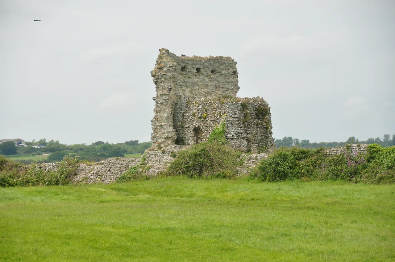

Pevensey Castle
Walk through the western gate at Pevensey and you pass under masonry built in three separate millennia. The towering Roman curtain wall above your head was raised around 290 AD by Carausius - a Roman commander who had declared himself emperor of Britain and northern Gaul, defying Rome itself. The Norman gatehouse beyond is from the 13th century. And the small square block you almost miss, set tight against the Roman tile-courses, is a 1940 pillbox: a concrete machine-gun post built into the ancient wall to face a German invasion that never came. Pevensey is one of the few places in Britain where Rome, the Conquest, and the Second World War share the same masonry.
A Fort to Defend Rome from Itself
The Romans called it Anderitum, "great ford," and built it around the year 290. For centuries scholars assumed it was part of the Saxon Shore system - a chain of nine forts from Hampshire to Norfolk defending Britain from Saxon and Jute raiders sailing out of what is now northern Germany. More recent excavation tells a different story. The wooden piles underneath Pevensey's walls have been dated through dendrochronology to about 290, which puts construction during the rebellion of Carausius. Carausius commanded the Classis Britannica, Rome's Channel fleet, and in 286 he declared himself emperor of Britain and northern Gaul. He was assassinated by his treasurer Allectus in 293; Allectus was killed in turn in 296 when the legitimate emperor Constantius Chlorus crossed the Channel to retake Britain. The Saxon Shore forts may have been Carausius's defence against Rome - the empire defending itself from its own ambitious general - rather than against the barbarians outside. The walls are still here. The treason that may have raised them is a footnote.
Walls That Outlasted an Empire
Pevensey is the largest of the nine Saxon Shore forts. Its oval curtain wall encloses 3.67 hectares, the ramparts standing eight metres high and 4.2 metres thick at the base. Bonding courses of red Roman tile still run through the rubble core in horizontal stripes. The Romans built it in segments, each crew working a separate stretch - you can read the joins in the stonework if you know where to look. Ten towers survive of perhaps twelve. The whole structure sat on a peninsula projecting into a tidal lagoon, with the south wall facing the water and a causeway leading west to the mainland. Civilians lived inside when the legions withdrew in 410. According to the Anglo-Saxon Chronicle, in 491 the Saxons Aelle and Cissa besieged the fort and "slew all the inhabitants; there was not even one Briton left there." The walls outlived everyone inside them and outlived the empire that built them.
The Conqueror's First Night
On 28 September 1066 William of Normandy beached his fleet at Pevensey Bay and sheltered the night inside the ruined Roman walls. His army dug a ditch across the causeway, patched the old curtain wall, and slept under stones that had then already stood for nearly eight hundred years. The choice was practical - it was the largest defensible enclosure on the coast - but it was also political. By making his first English camp inside a Roman fort, William implied that the Normans were on a level with the Romans. He used the same trick at the Tower of London and at Colchester, building his castles against or on top of Roman remains. The army left for Hastings the next morning. After Hastings the Rape of Pevensey - the strip of Sussex centred on the castle - went to William's half-brother Robert, Count of Mortain. The Normans built a smaller stone castle within the Roman walls, dividing the old fort into an inner and outer bailey. By 1088 the new castle was already being besieged, when Robert and other barons backed Robert Curthose against William Rufus. The garrison held the walls but ran out of food and surrendered after six weeks.
Sieges, Starvation, Stones
Pevensey was twice starved into surrender across its long medieval life - in 1088 and again under King Stephen in the 1140s - but never successfully stormed. During the Second Barons' War, Simon de Montfort's forces besieged the castle for more than a year following Henry III's defeat at Lewes in 1264. The defenders raided the surrounding countryside, slipped supplies in by sea in December 1264, and held out until the siege was lifted in July 1265. One of the named defenders, a vassal of Peter of Savoy called Nantelme de Cholay, came from what is now Choulex near Geneva - one tiny illustration of how the politics of 13th-century Europe drew warriors from one end of the continent to the other. The Norman keep was systematically robbed of stone for centuries; as early as 1591 it was recorded that "the best stones had been imbeselled and carried away," and one family alone hauled off 677 cartloads of ashlar facing-stone. By the 1880s the keep had collapsed entirely. What you see today as a low ruined stump is the bottom storey of what may once have stood twenty-five metres tall.
1940
The state acquired the castle in 1925. Fifteen years later, with Britain expecting invasion in the summer of 1940, the army reoccupied Pevensey as an active fortification for the first time since the 16th century. The Home Guard, regular British units, Canadian troops and the United States Army Air Corps were all stationed here at various points between 1940 and 1945. Camouflaged machine-gun posts were cut into the Roman and medieval walls to control the flat Pevensey Levels - the same drained marshland the Romans had originally built the fort to defend. The pillboxes are still there, left in place after the war as part of the monument they had been blended into. Stand by the south wall now and you can see, within a few metres, Roman tile courses, Norman ashlar, and a concrete machine-gun loophole all looking out across the same fields. The coast that 290, 1066 and 1940 all watched is now 1.5 km away through silted marshland. The walls remain.
From the Air
Located at 50.82°N, 0.33°E, immediately west of Pevensey village and just inland from Pevensey Bay. The oval Roman curtain wall - 290 m by 170 m - is the most striking feature from the air, with the smaller inner Norman bailey nested in the eastern end. The drained Pevensey Levels stretch west and south of the castle as a flat geometric patchwork of fields divided by drainage ditches. Nearest airfield is Lydd (EGMD) about 30 km east; Deanland (EGCD) sits to the north-west. Best viewed at 2,000-4,000 ft AGL; the contrast between the castle's earthworks and the level marsh is sharpest in low winter sun.
Nearby Stories
- Chiddingstone Castle 4.4 km away
- Kent 4.6 km away
- Camber Castle 5.4 km away
- Surrey 13 km away
- Amberley Museum & Heritage Centre 13 km away
- Swanage Lifeboat Station 113 km away
- Le Paradis Massacre 137 km away
- Wellington Clock Tower 150 km away