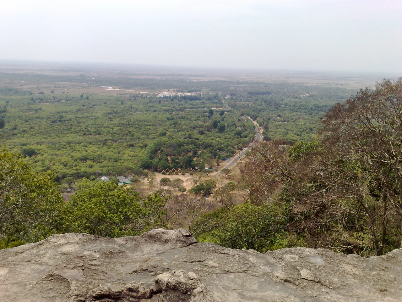

Phnom Santuk
Below the southern peak, where the trees close in and the light turns green, the boulders have faces. Carvers worked them into reclining Buddhas long ago - some more than ten metres from crown to heel - so that a figure at rest appears to be dreaming inside the rock itself. More recent hands have added concrete versions alongside the old stone ones, and the two generations lie together without apology. Phnom Santuk rises 207 metres above the paddy country of Kampong Thom province, which almost anywhere else in the world would make it a hill. Here it is the most sacred mountain the province has.
Eight Hundred and Nine Steps
There are two ways up. The old way is a stone stairway of 809 steps, flanked most of the way by statues, so that the climb becomes a slow procession past figures who seem to have been waiting for you. The new way is a paved road, 2.5 kilometres of it, which spares the knees and costs you the ritual. At the summit stands a white-walled temple ringed by shrines and images, and beside it a multi-storied Chinese pagoda whose figurines are made of porcelain - a detail that catches visitors off guard, since porcelain belongs to interiors and this one sits open to the monsoon. Newer wats in the prasat style are still going up near the hilltop, their surfaces crowded with carved nagas and dragons. Next door, Phnom Srah Kmao holds a brick temple and a cave full of bats. The site is in Ko Koh village, in Ko Koh commune, in Santuk District, and it has been accumulating this way for a very long time.
Relics Carried North from Angkor
The Cambodian Royal Chronicles put the hill's founding story at around 1496, when King Thommo Reachea I arranged for Buddha relics to be moved out of Preah Thong's stupa at Angkor and rehoused in the village of Khvav Brah Dhatu, near Phnom Santuk. Relics travel for reasons - political, defensive, devotional - and the chronicles do not say which one moved this king. The effect, whatever the motive, was to give a modest rise of rock in Kampong Thom a genuine claim on the sacred geography of the Khmer world.
Later custodians left their names on the place. Preah Thamma Vipassana Kong served as chief monk here in the late 18th century. Older than any monk is Neak ta Kraham Ka, the protector spirit of the mountain, remembered as a man who lived in the feudal era under the ruler Decho Borara'a Thipadei Meas. A neak ta is a local guardian spirit, one of the older powers that Cambodian Buddhism absorbed rather than displaced, and their shrines sit comfortably beside the Buddhas. Seven monks perform the worship on the hill today.
The Furthest Point of Chenla II
In the autumn of 1971 this hill was a military objective. Operation Chenla II ran from 20 August to 3 December, the Khmer Republic's attempt to reopen Route 6 and push the People's Army of Vietnam back out of the country's centre. The advance began well. Government forces retook Barai on 26 August and Kompong Thmar on 1 September, and the 5th Brigade Group fought its way to Phnom Santuk and took the hill. On 25 October the phase was declared complete. Phnom Santuk was the furthest north-east the American-backed army ever reached.
It held for a day. On 26 October the PAVN 9th Division, reinforced by the 205th and 207th Regional Regiments, came down on the positions strung along Route 6. Battalions were surrounded, isolated, cut off from relief, and by early December ten of the Khmer Republic's infantry battalions had been destroyed or dispersed, with equipment losses equivalent to ten more. Casualty estimates vary wildly and none of them are comfortable: North Vietnamese accounts claimed 4,500 enemy dead, while the official PAVN history put the figure at 10,000 killed or scattered. Whichever is nearer the truth, the defeat left the Republic's army weakened both militarily and psychologically, and it never regained the initiative.
The Hill Keeps Working
Nothing about the mountain is finished. Construction continues near the hilltop. Concrete Buddhas join stone ones under the trees, the newer ones easy to tell apart and nobody much troubled by the difference. The Phnom Santuk Resort offers nature-based tourism at the foot of a pilgrimage site, an arrangement that would look incongruous in a museum and looks entirely normal here.
Pilgrims come to make merit. Visitors come for the climb and for the view out over the Kampong Thom plain, which from 207 metres runs flat and green to every horizon. Both are accommodated without much fuss. That is the durable thing about Phnom Santuk: kings moved relics to it, a civil war swept across it, construction crews are still at work on it, and the stairway is still climbed one step at a time. The carved sleepers under the southern peak have outlasted every army that ever came for the hill.
From the Air
Phnom Santuk lies at 12.667 N, 105.500 E in Kampong Thom province, central Cambodia. The summit reaches 207 m (679 ft) - a small figure, but the surrounding plain is almost perfectly flat, so the hill and its white summit temple stand out clearly from the air and make a reliable visual fix. Route 6, the Phnom Penh-Siem Reap highway, passes to the north-west; the vast pale sheet of the Tonle Sap lies roughly 60 km west and is unmistakable in any weather. Recommended viewing altitude 2,000-4,000 ft AGL for the stairway and temple complex; the paved 2.5 km access road traces a visible pale line up the eastern flank. Nearest operating airports are Siem Reap-Angkor International (VDSA), roughly 190 km north-west, and Techo International at Phnom Penh (VDTI), roughly 150 km south-west. The former provincial airstrip at Kampong Thom is abandoned and unserviced - useful as a landmark, not as an alternate. Expect thick dry-season haze from agricultural burning between February and April, and strong convective buildups with afternoon thunderstorms from May through October.
Nearby Stories
- Sambor Prei Kuk 16 km away
- Prey Lang Wildlife Sanctuary 19 km away
- Cambodian Genocide 26 km away
- Preah Khan Kompong Svay 60 km away
- Lower Se San 2 Dam 61 km away
- Srepok River 90 km away
- Battle of Ap Gu 96 km away
- French Protectorate of Cambodia 104 km away