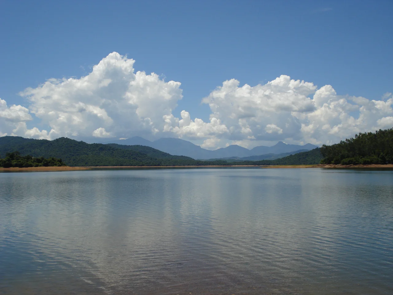

Phú Ninh Reservoir
They called it the blue pearl of Quảng Nam, and the name fits — from the right angle, on a clear morning, Phú Ninh Reservoir sits in its green-forested valley like something precious and improbable. Built as an artificial lake in Phú Ninh District, it now covers an area large enough to contain 15 islands, support 80 tons of fish a year, power a hydroelectric station, and protect a stretch of forest that shelters species still listed in Vietnam's Red Data Book. That's a lot for a reservoir.
What the Water Does
Phú Ninh Lake is not ornamental. Seven kilometers south of Tam Kỳ Town and roughly 70 kilometers from Da Nang, it serves as the primary water supply for residential and agricultural use across Tam Kỳ and the surrounding districts of Phú Ninh and Núi Thành. The hydroelectric plant at its dam generates up to 3 million kilowatt-hours per year — modest by large-dam standards, but meaningful for the region's grid. About 80 tons of fish are harvested from the lake annually, supplying local markets with freshwater species. Beneath the lake floor, near Chap Tra valley, hot mineral springs push up at 90 degrees Celsius underground, cooling to 60–70 degrees as they reach the surface. A mineral water company in Tam Kỳ commune draws on these springs to produce bottled water, with a planned output of 15 million bottles per year. The lake's practical value, in short, is considerable — which makes the fact that it also functions as a significant nature reserve all the more striking.
The Forest at the Water's Edge
The total protected area surrounding Phú Ninh Lake covers 23,409 hectares, encompassing forest, hills, and wetland margins. A 2000 survey by the Quảng Nam Forestry Bureau documented 15,768 hectares of forest, including 1,500 hectares of plantation. Within that larger forest, researchers have recorded approximately 369 plant species, 10 of which appear on Vietnam's Red Data Book. Of those, 250 are useful plants — 211 with medicinal applications, 85 types of commercial timber, 66 used for ornamental and shade purposes. The lake has since been awarded national historical heritage status, recognizing its ecological as well as its practical significance. The forest has not escaped unscathed from the twentieth century: the source article notes it was negatively impacted by the lingering effects of war and continued exploitation. Recovery is ongoing, and the balance between protection and economic use remains complicated.
Islands and Their Inhabitants
Fifteen islands rise from Phú Ninh's surface, ranging from small patches that flood in the rainy season to So Island, the largest, where natural forest is recovering and animals — birds, reptiles, small mammals — are returning. Rua Island holds natural forest and two small species of monkey. In the south and west, on islands and peninsulas belonging to Tam Son and Tam Lanh communes, deer, reptiles, and birds are present in small numbers. The lake's fauna inventory, assembled by the Ministry of Agriculture and Rural Development in 2003, documented 11 mammal species from the Red Data Book, including the red-shanked douc, the yellow-cheeked gibbon, and the crab-eating macaque. Seven reptile species are present, including pythons and cobras. Land vertebrates total 148 species across 4 classes. Chap Tra mountain, a small natural hill in the lake's northern section, has been identified as a sightseeing spot precisely because it retains some of the endangered animal populations. The islands are not pristine, but they are recovering.
A Landscape of Hills and Seasons
The terrain around Phú Ninh is shaped by low hills, most between 100 and 300 meters, with some peaks reaching 500–700 meters to the south. The climate belongs to what the source describes as the Middle South zone — two seasons, rainy and dry, with average annual rainfall of 2,491 millimeters and average temperatures of 25.6 degrees Celsius. Rainfall concentrates between September and December, when storms arrive from the northeast and can bring extreme events; the highest recorded annual rainfall is 3,307 millimeters. The topography funnels water downhill toward the lake: slopes incline west, southwest, and northeast, directing runoff into the valleys. The soil throughout most of the watershed is yellow-red feralite on sandstone — easily eroded, not ideal for farming, which is part of why forest dominates the protected zone and why those lowland river valleys where fertile soil accumulates are so intensively farmed. The lake sits at the convergence of these forces: rain, slope, soil, and human need.
From the Air
Phú Ninh Reservoir sits at approximately 15.49°N, 108.46°E in Quảng Nam Province, central Vietnam. From altitude, the lake appears as a large irregular body of water set against a forested hillscape, with 15 islands visible as dark green shapes rising from the surface. The nearest airport is Chu Lai International Airport (VVCA), approximately 15 km to the east — making Phú Ninh a notable landmark on approach and departure. Da Nang International Airport (VVDN) lies roughly 70 km to the north. A viewing altitude of 5,000–8,000 feet gives a clear picture of the reservoir's shape, the forested buffer zone surrounding it, and its relationship to Tam Kỳ Town to the north.
Nearby Stories
- Hoi An 14 km away
- 1968 Kham Duc C-130 Shootdown 19 km away
- Lý Sơn Island 24 km away
- Operation Utah 28 km away
- Battle of Nam Dong 43 km away
- Operation Hawthorne 53 km away
- Operation Masher / White Wing 85 km away
- Battle of the Paracel Islands 293 km away