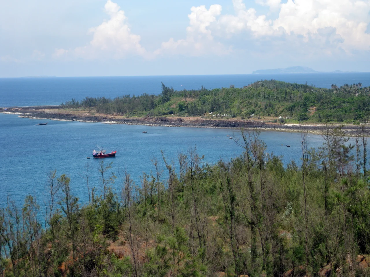

Lý Sơn Island
Approximately 30 kilometers off the coast of Quảng Ngãi Province, two volcanic islands rise from the South China Sea. The larger one, Lý Sơn — once called Cù Lao Ré — has three distinct craters, a geothermal power plant, a well that has been providing fresh water to passing ships for centuries, and a temple housing the bones of a whale believed to be the king of the South China Sea. It has been, at various points in history, a Cham trading post, a waypoint for Admiral Zheng He's treasure fleet, a base for the Nguyễn lords' expansion into the Paracel Islands, a U.S. Navy radar station, and Vietnam's most celebrated garlic farm. Few islands pack quite so many lives into so small a space.
Born from Fire
Lý Sơn is volcanic in origin, and the island wears that fact openly. Three prominent craters mark the main island's landscape, the largest belonging to Mount Thoi Loi (Núi Thới Lới). Hydrothermal waters below the surface are warm enough to power the local electricity plant. The secondary island, known as Little Island (Cù Lao Bờ Bãi), sits just off the main island's coast and is also inhabited. The volcanic soils that make farming difficult elsewhere in the region give Lý Sơn a peculiar agricultural advantage: the combination of volcanic minerals, sea spray, and the island's specific microclimate produces a variety of garlic found nowhere else in Vietnam. The island's garlic is famous throughout the country — pungent, small-cloved, and intensely flavored. Coastal sand mining to support the garlic's extensive cultivation has eaten into the island's beaches, a tradeoff the community is still reckoning with.
Crossroads of the Ages
The oldest human presence on Lý Sơn predates written history: remains of the Sa Huỳnh culture have been found here, a civilization that flourished along Vietnam's central coast before 200 CE. The Cham people, who built the magnificent temples of Mỹ Sơn on the nearby mainland, used Lý Sơn as a transhipment base for maritime trade. The island's Xó La well — still in use today — provided fresh water to ships for centuries, making it a reliable stop for anyone navigating this stretch of the South China Sea. In the 15th century, Admiral Zheng He's treasure voyages used the island as a navigational landmark during their sweeps through Southeast Asian waters. The 17th century brought Vietnamese settlers from the Bình Sơn district on the mainland, planted here by the Nguyễn lords as the first step in the Hoàng Sa Company's organized development of the Paracel Islands — a historical claim to sovereignty that Vietnam still asserts.
Watching the Sea
During the Vietnam War, Lý Sơn's position — offshore, elevated, with clear sight lines along the coast — made it strategically useful. The U.S. Navy installed a radar station on the island to track shipping along the Vietnamese coast, adding another chapter to a long history of the island serving as an observation post for whatever power controlled these waters. After the war the island returned to fishing and farming. In the 21st century, Lý Sơn has been developing its tourism industry, drawing Vietnamese visitors with its volcanic scenery, the natural rock arch known as the To Vo Gate (Cổng Tò Vò), the cave at Hang Câu, the volcanic peak of Mount Thoi Loi, and the garlic fields that carpet the lower slopes in spring.
The Whale King's Temple
On a coast where fishermen have always lived at the mercy of the sea, whales carry a particular spiritual weight. Throughout coastal Vietnam, whales are believed to guide sailors home and rescue fishermen in distress — protectors of those who work the water. On Lý Sơn, this belief runs deep. Around a hundred whale skeletons are kept in temples across the island, objects of reverence rather than curiosity. The most important of these is in Tan Temple in An Hai Commune: a skeleton said to be 200 years old and believed to be the remains of Nam Hai Dong Dinh Dai Vuong — the king of whales, the most powerful whale in the South China Sea. When a stranded whale is found on the island's beaches, the community holds a full funeral, because to let such a protector go unacknowledged would be to risk the sea's favor. The fishermen of Lý Sơn have been making this bargain with the ocean for a very long time.
From the Air
Lý Sơn Island sits at 15.381°N, 109.118°E in the South China Sea, approximately 30 km offshore from the Quảng Ngãi coast. From altitude, the two volcanic islands are unmistakable — distinct dark masses ringed by shallow turquoise water and reef, surrounded by the deeper blue of open ocean. The three craters of the main island are visible from 5,000 feet or above, and the garlic field terracing is apparent in the lower elevations. Flying south from Da Nang (VVDN, approximately 160 km north) or north from Quy Nhơn (VVQN, approximately 140 km south), Lý Sơn appears as a clear landmark in otherwise open water. Nearby ICAO: VVCA (Chu Lai Airport, approximately 35 km west-southwest on the mainland). Recommended viewing altitude: 4,000–6,000 feet.
Nearby Stories
- Phú Ninh Reservoir 22 km away
- Indrapura (Champa) 27 km away
- Chàm Islands 61 km away
- Operation Masher / White Wing 67 km away
- Măng Đen 68 km away
- Battle of the Paracel Islands 229 km away
- Hainan Island Incident 305 km away
- Kashmir Princess 498 km away