
Indrapura (Champa)
In Sanskrit, the name means "City of Indra" — god of storms, god of war, king of the heavens. It was an ambitious name for a city, and the Cham people built one worthy of it. Indrapura, known today as Đồng Dương, rose from the coastal plains of central Vietnam in 875 CE and served as the prime capital of the Champa kingdom for more than a century. Monks chanted in its monastery. Pilgrims departed from its gates on journeys to Java. A Vietnamese emperor would eventually travel nine months just to visit its sacred sites. Then war — first medieval war, then the most technologically devastating kind — reduced most of it to scattered bricks and overgrown memory.
A King Builds a City for the Buddha
Indravarman II came to power in 875 CE and set out to make Champa into something remarkable: a Buddhist kingdom in a region where Hindu traditions dominated. He founded the Bhrgu dynasty and declared Indrapura its capital, then immediately commissioned the Mahayana Buddhist temple complex known as Lasmindra Lokesvara — a sprawling sacred precinct at the heart of the city. Buddhist temples multiplied across northern Champa during his reign and the reigns of his successors, extending as far north as what is now Quảng Bình province. The scale of Indravarman II's ambition shows in what came next: a court official making the arduous pilgrimage from Indrapura to Java Island around 911–912, carrying the new dynasty's Buddhist identity across the sea. By the 13th century, Vietnamese emperor Trần Nhân Tông — himself a devoted Buddhist — traveled to Champa for nine months specifically to visit these sacred sites. Indrapura had become a place worth crossing empires to reach.
Squeezed Between Empires
No capital lasts forever when powerful neighbors are watching. By the 10th century, Champa was caught between the expanding Đại Cồ Việt in the north and the Khmer empire to the west. War with the Khmer came in 945. War with Đại Cồ Việt followed in 979. The combined pressure fractured the kingdom's strength. In 982, Vietnamese emperor Lê Hoàn led his armies north into Cham territory, killing king Paramesvaravarman I in the fighting. The survivors of the Cham royal court retreated 300 kilometers south to Indrapura. Then, in 983, an outsider named Lưu Kế Tông — a Vietnamese man — dethroned the Cham ruler entirely and proclaimed himself king of Champa, seeking recognition from Song dynasty China. Many Cham fled to Hainan Island rather than submit. The city that had welcomed pilgrims from Java now scattered its own people across the sea. Power eventually passed southward to the city of Vijaya in Bình Định by the 12th century, and Indrapura faded from the chronicles.
The Name That Confused Empires
Scholars spent decades arguing about what Indrapura was actually called in Chinese and Vietnamese records. Chinese texts referred to it as Fóshì or Fóshìchéng — which translates, confusingly, as either "City of Indra" or "City of Buddha." Colonial-era scholars assumed this Fóshì must refer to Vijaya, and that assumption helped prop up the theory of a grand Southeast Asian empire called Srivijaya, rediscovered in 1911. Historian Michael Vickery later argued the connection was fabricated — that colonial scholars had bent the evidence to fit a theory, and that Fóshì was always Indrapura. The confusion matters because it distorted how Western historians understood Champa for generations. A 1007 Cham envoy to Song China explained the situation plainly: "my country was formerly subject to Jiaozhou, then we fled to Foshi, 700 li south of our former location." The city was there all along, waiting to be correctly identified.
Bombed Into Silence
Đồng Dương survived medieval war, dynastic collapse, and centuries of jungle growth. It did not survive the 20th century. During the Vietnam War, the site became a hotspot for National Liberation Front (Viet Cong) activity — bunkers were dug among the ancient ruins, soldiers moved through corridors that had once carried Buddhist pilgrims. In August 1969, U.S. Air Force carpet bombing struck both Đồng Dương and the nearby sanctuary of My Sơn, leaving both sites in ruins. What medieval armies had left standing, modern airpower largely destroyed. When archaeologists began returning in the late 1980s and 1990s, they found an eroded citadel, the outline of a royal palace, watch towers barely recognizable, and the collapsed walls of the monastery. The paved roads, bridges, and sewer system — evidence that this had been a sophisticated, organized city — survived only as traces beneath the soil. Most buildings had been constructed of wood, which the centuries and the bombs had claimed. Only the temples and shrines, built in stone, remained to hint at what had stood here.
What the Excavations Found
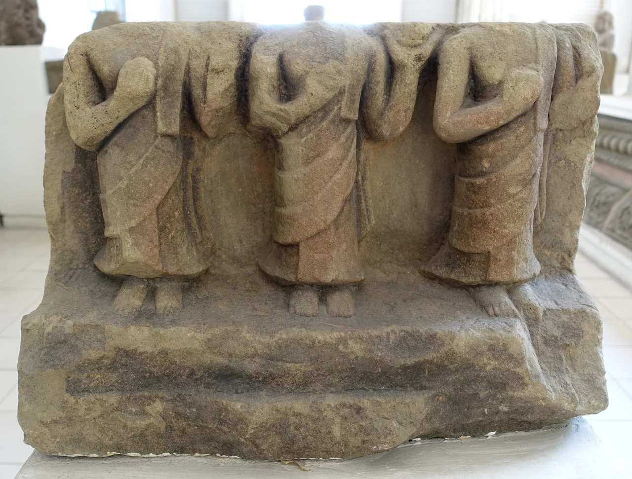
Modern archaeology has slowly pieced together Indrapura's shape. The picture that emerges is of a highly organized, well-urbanized city — not a village or a ceremonial site, but a genuine capital. Streets ran in patterns. Infrastructure existed to handle water and waste. The monastery complex where monks had chanted for generations stood at the city's spiritual core, surrounded by temples in the distinctive Đồng Dương style: the stone sculptures from this period, showing Cham monks carved in the 10th century, are now among the prized objects at the Museum of Cham Sculpture in Da Nang. Reconstruction of what the city once looked like remains incomplete. Most of the wooden structures that housed the population are gone without trace. What survives — the stone carving, the brick foundations, the temple archways — is enough to understand that Indrapura was a place of real sophistication and real spiritual life for the century it stood at the center of the Cham world.
From the Air
Indrapura/Đồng Dương lies at 15.667°N, 108.383°E in Quảng Nam Province, central Vietnam, roughly 60 km south of Da Nang. From the air at 3,000–5,000 feet, look for the flat coastal plain between the mountains and the sea — the site sits inland from the Thu Bồn River valley. The nearest significant airport is Da Nang International (VVDN), approximately 55 km to the north. The town of Tam Kỳ lies about 20 km to the south with its domestic airport (VVTK). My Sơn sanctuary, another bombed Cham site, lies approximately 30 km to the northwest and is visible from altitude as a cluster of forested ruins.
Nearby Stories
- Operation Lamar Plain 11 km away
- 1968 Kham Duc C-130 Shootdown 15 km away
- Hội An wreck 16 km away
- Lý Sơn Island 17 km away
- Bach Ma National Park 24 km away
- Battle of Nam Dong 51 km away
- Operation Masher / White Wing 134 km away
- Battle of the Paracel Islands 288 km away