
Phu Sa Dok Bua National Park
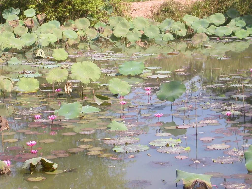
Nobody planted the lotus. That is the part that matters. On the summit of a 423-meter mountain in northeastern Thailand, eleven shallow stone pools sit filled with colorful lotus varieties — species that normally grow in swamp lowlands, not on rocky hilltops. Local legend holds that the flowers appeared spontaneously, without human cultivation, and the place was named for what it inexplicably contained: Phu Sa Dok Bua, the mountain of lotus pools. The name became the park. The mystery became the landmark.
The Mountain and Its Eleven Pools
Phu Sa Dok Bua National Park spans 231 square kilometers across parts of Amnat Charoen, Mukdahan, and Yasothon Provinces in Thailand's northeastern Isan region. The landscape is dominated by dwarf dry dipterocarp forest — a specialized woodland adapted to the thin, sandy soils and seasonal drought of the Khorat Plateau, with trees that never grow tall but spread widely and give the forest a distinctive open, parklike appearance. Within that forest, the mountain rises to 423 meters, modest in absolute terms but prominent on the plateau's flat terrain. The eleven stone pools on its summit are each a few meters wide, and the different lotus species occupying them represent varieties not otherwise found growing together naturally at this elevation. Whether the explanations are botanical, hydrological, or something else, the effect is genuinely strange: colorful aquatic flowers blooming on dry mountaintop rock.
A Cave in the History of Dissent
Below the lotus pools, on the mountain's flanks, a large cave opens into the hillside — large enough, the sources note, to shelter hundreds of people. During the 1960s, it did exactly that. The cave served as one of the strongholds of the Communist Party of Thailand during that decade, when the party was conducting an active insurgency across the country's northeastern and northern regions. The Isan plateau, with its remote forests, its poverty relative to the central plains, and its Lao-speaking population that had reason to feel distant from Bangkok's power, became significant territory for the insurgency. The cave on this mountain was a place people hid, organized, and waited. Today it is a natural attraction on the park trail map. The history it carries is rarely advertised alongside the lotus.
Rock Terraces and Open Views
The park offers more than its famous summit. Phu Pha Hom, a ridge reaching 386 meters, features rock terraces — broad shelves of sandstone carved by weathering into natural platforms — and from them the views extend across the plateau in all directions. In the dry season, the landscape turns golden-brown and the dipterocarp trees lose their leaves, revealing the park's skeletal structure and making the rock formations more prominent. In the wet season, the same trees flush green almost overnight, and the lotus pools on the summit fill with water and bloom. The park straddles three provinces and is managed from headquarters in Amphoe Don Tan, Mukdahan Province, a small district town that most travelers pass through on their way to something else.
Flowers Without an Explanation
The park was established in 1992, and the lotus pools remain its defining image and its persistent question. Botanical theories have been offered — birds carrying seeds, ancient human intervention forgotten over time, specific soil chemistry in the stone basins that mimics wetland conditions. None has fully displaced the local account that holds no explanation is needed: the flowers grew because the mountain wanted them. What the park preserves, alongside 231 square kilometers of dry forest and a cave that held political history, is a riddle that the landscape has posed to everyone who climbs up to look at it. The lotus blooms. Nobody planted them.
From the Air
Phu Sa Dok Bua National Park is centered at approximately 16.20°N, 104.80°E, spanning parts of Amnat Charoen, Mukdahan, and Yasothon Provinces in northeastern Thailand. From the air the flat Khorat Plateau is interrupted by the modest elevation of the park's mountains — the 423-meter summit and the 386-meter Phu Pha Hom ridge. The park headquarters are in Amphoe Don Tan, Mukdahan Province. Recommended viewing altitude is 3,000–6,000 feet to distinguish the forested highlands from the surrounding agricultural plain. The nearest airports are Mukdahan Airport (MDH), approximately 40 km to the northeast, and Ubon Ratchathani Airport (UBP), roughly 90 km to the south.
Nearby Stories
- Savannakhet 21 km away
- St Michael's Church, Songyae 22 km away
- National Route 9 (Vietnam) 25 km away
- Yasothon 37 km away
- Amnat Charoen 37 km away
- Southern Laos 63 km away
- Phu Pha Yon National Park 63 km away
- Pha Taem National Park 67 km away