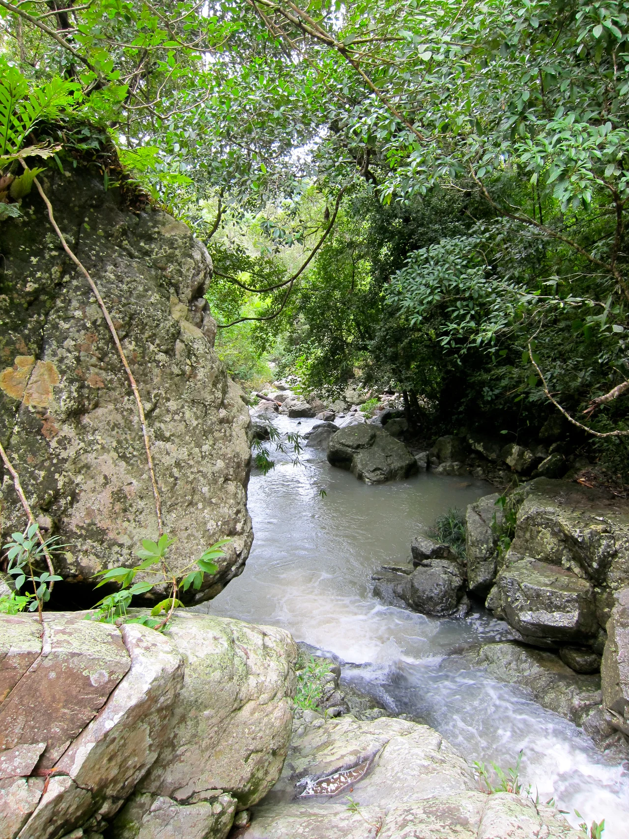

Phước Bình National Park
Somewhere inside this park, under a canopy of montane evergreen forest, is a place called Pi Nang Tac's stone trap. In 1965, more than 100 soldiers died there in a single ambush. The Raglay guerrilla leader Pi Nang Tac built the trap himself — boulders and terrain weaponized against an advancing force. The forest grew back over the killing ground, as forests do. Today you can hike past it, or camp near streams that feed the largest river in one of Vietnam's most arid provinces. The war's wounds and the land's extraordinary vitality occupy the same ground, as they do across much of this country.
The Hinge of Three Regions
Phước Bình National Park sits at a geographic crossroads that makes it ecologically unusual. It lies on the eastern slopes of the Đà Lạt plateau, in the transition zone where the Central Highlands, the south-central coast, and the southeast converge. To the west, peaks climb to 2,200 meters. Moving east, the terrain drops steadily toward the coastal plain of Ninh Thuận Province — one of the driest parts of Vietnam, shaped by rain shadows and semi-arid winds.
This gradient from cool, wet montane forest to dry lowland means the park contains ecosystems you wouldn't expect to find adjacent to each other. Lowland dry dipterocarp forests sit below wet evergreen montane communities that stay cold and damp enough to support species more typical of temperate climates. Three main streams — Gia Nhông, Đa Mây, and sông Hàm Leo — drain the park's uplands into the Cai River, which supplies water to the entire province for drinking, irrigation, and industry. The forest doesn't just shelter wildlife; it keeps the water flowing to a million people downstream.
A Catalog of the Rare
The park holds over 1,225 plant species and 327 animal species, many of them on the IUCN Red List. Some of its flagship animals are almost impossible to find anywhere else. The giant muntjac — a large barking deer known only from the Annamite mountain range — moves through here. So do yellow-cheeked gibbons, calling from the upper canopy at dawn, and black-shanked douc langurs, whose vivid coloring makes them look almost implausibly tropical.
For birdwatchers, Phước Bình is one of the most important sites in Southeast Asia. Five of the eight restricted-range bird species of the Da Lat Plateau Endemic Bird Area occur here, including the collared laughingthrush and the crested argus — both globally threatened, both found in only a handful of places on Earth. The park is also one of only six Important Bird Areas in all of Vietnam to support the pale-capped pigeon. An estimated two herds of gaur — the world's largest wild cattle — graze the park's forests, with roughly 40 animals each. The Pinus dalatensis, a conifer known from fewer than ten locations worldwide, grows here, with most populations limited to fewer than 100 mature trees.
The People at the Edge
Six villages with about 4,438 people live in the park's buffer zone. The Raglay minority group makes up approximately 74 percent of that population; the Churu and Kinh account for the rest. For generations, the Raglay and Churu have practiced shifting cultivation, harvested forest products, and maintained a relationship with this landscape that predates any conservation designation by centuries.
The pressures on the park are significant. More than 75 percent of the natural habitat in the broader Southern Annamite Ecoregion has been converted or degraded — a product of decades of cultivation, the chemical warfare of the 1960s and 1970s, and the post-war clearing of land between 1976 and 2002. What remains is fragmented. Coffee plantations push against the buffer zone. Poaching continues. The park's arid climate makes forest fires a recurring threat. The people who live here are not simply threats to the ecosystem; they are also its longtime custodians, and any lasting conservation depends on their participation.
Into the Forest
Ecotourism is slowly developing in Phước Bình. Visitors can hike through the park's varied terrain, raft the streams, swim in waterholes, and camp under a sky that, far from any city, shows stars in numbers that coastal Vietnam rarely sees. The park lies 62 kilometers northwest of Phan Rang, the provincial capital — close enough for a day trip, remote enough to feel genuinely wild.
Contiguous with Bidoup–Núi Bà National Park to the west, Phước Bình forms part of a larger protected corridor across the southern Annamites. Conservation biologists consider this corridor critical for the long-term survival of species that need large territories to sustain viable populations. The gibbons that call at dawn don't know where one park ends and another begins. The forests that link them may determine whether these animals survive another century.
From the Air
Phước Bình National Park is centered near 12.07°N, 108.75°E, straddling the eastern escarpment of the Đà Lạt plateau in Ninh Thuận Province. From altitude, the transition from the densely forested highlands to the drier coastal plain is visually distinct — the green darkens and thickens to the west, thinning and paling as the land drops toward the South China Sea. The nearest airport is Cam Ranh International Airport (VVCR), approximately 75 km southeast. Lien Khuong Airport in Dalat (VVDL) lies about 80 km to the west-southwest. The park's highest peaks, visible as the ridgeline rising from the coastal plain, reach 2,200 meters and are often cloud-covered in the wet season (May through November).
Nearby Stories
- Lak Lake 17 km away
- Air Vietnam Flight 706 22 km away
- Operation Byrd 31 km away
- Bidoup Núi Bà National Park 36 km away
- Tà Đùng National Park 43 km away
- Vũng Rô Bay 63 km away
- Vũng Rô Bay Incident 92 km away
- South-East Asian Theatre of World War II 211 km away