Pinto Mountains
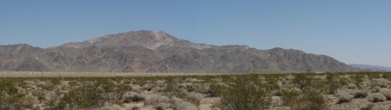
The Pinto Mountains cross the north-central portion of Joshua Tree National Park in an east-west direction — unusual for ranges in this part of the Mojave, where most ridgelines run roughly northwest to southeast following the Basin and Range geometry of the desert. The Pintos run against that grain. They are built from dark gneiss, which gives them a different appearance from the pale granite boulder fields that define the park's famous western landscapes.
Dark Rock, Creosote Flats
The Pinto Mountains reach their highest point at 1,403 meters — roughly 4,600 feet — a significant elevation for terrain that sits within a national park most visitors associate with the lower, hotter landscapes of the Colorado Desert. But the Pintos occupy the transitional zone, the north-central area where the park's two desert ecosystems meet and compete.
Creosote bush dominates the lower slopes and the bajadas that spread from the range's flanks. This is the plant that defines large portions of the Mojave and Colorado deserts — drought-adapted, resinous, capable of living for thousands of years in the same spot through clonal expansion. The Joshua trees that named the park grow primarily in the higher-elevation western portion; the Pintos are creosote country, which places them in a different visual and ecological register than the terrain most visitors photograph.
The Wilderness Established
In 2009, Congress established the Pinto Mountains Wilderness — 24,404 acres managed by the Bureau of Land Management in the lands adjacent to the national park. The designation protects terrain that lies outside the park boundaries while remaining contiguous with the park's own protected landscape.
The Pinto Basin, which lies south of the mountains, is the park's largest basin — a broad, flat expanse of desert that was once a Pleistocene lake. The basin and the mountains together form one of the park's less-visited regions. The north side of the Pintos drains toward the Pinto Valley, while the south side drops into the basin. The BLM wilderness designation extended protection across this terrain without folding it into the national park's administrative structure.
A Quieter Corner
The north-central portion of Joshua Tree is not the park's most-trafficked zone. The famous boulder formations and Joshua tree groves that draw millions of visitors annually are concentrated in the park's western portion, around Hidden Valley and Skull Rock and the terrain between the west entrance and Jumbo Rocks. The Pinto Mountains are farther east, accessible but requiring more intent to reach.
The dark gneiss that forms the range weathers differently from the park's granite, producing less dramatic boulder stacks but a different kind of texture — rough, fractured, imposing at close range. The highest point of the range looks out over the Pinto Basin to the south and the Pinto Valley to the north, terrain that stretches to the horizons in the clear desert air without another prominent ridge interrupting the view.
From the Air
The Pinto Mountains run east-west across the north-central portion of Joshua Tree National Park, centered around 34.03°N, 115.78°W. The range is identifiable from altitude by its darker coloring relative to the pale granite formations to the west. The Pinto Basin lies to the south of the range. Restricted airspace over Joshua Tree National Park — check NOTAMs before transiting. Nearest airports: Twentynine Palms (TNP) ~15 miles northwest, Desert Resorts Regional (PSP) ~50 miles west.
Nearby Stories
- The Integratron 3.2 km away
- Rancho Mirage Library and Observatory 5 km away
- Chuckawalla Bill 8.3 km away
- Murders of Jan Pietrzak and Quiana Jenkins-Pietrzak 13 km away
- Bristol Lake 26 km away
- Poston War Relocation Center 84 km away
- London Bridge (Lake Havasu City) 91 km away
- Felicity, California 122 km away