Felicity, California
Jacques-André Istel sold his parachute business, bought 2,600 acres of California desert, named the town after his wife Felicia, and set about carving the history of humanity into granite panels. He also convinced the Imperial County Board of Supervisors to designate his town the Official Center of the World. That was in May 1985. The museum is still being built.
A Town Designed from Scratch
Felicity is an unincorporated community in Imperial County, California, established in 1986. Istel bought the land in the 1950s and developed it in the 1980s after leaving the parachuting business. The town sits at an elevation of 285 feet in the Colorado Desert, near Interstate 8, 2 miles north of the Mexican border.
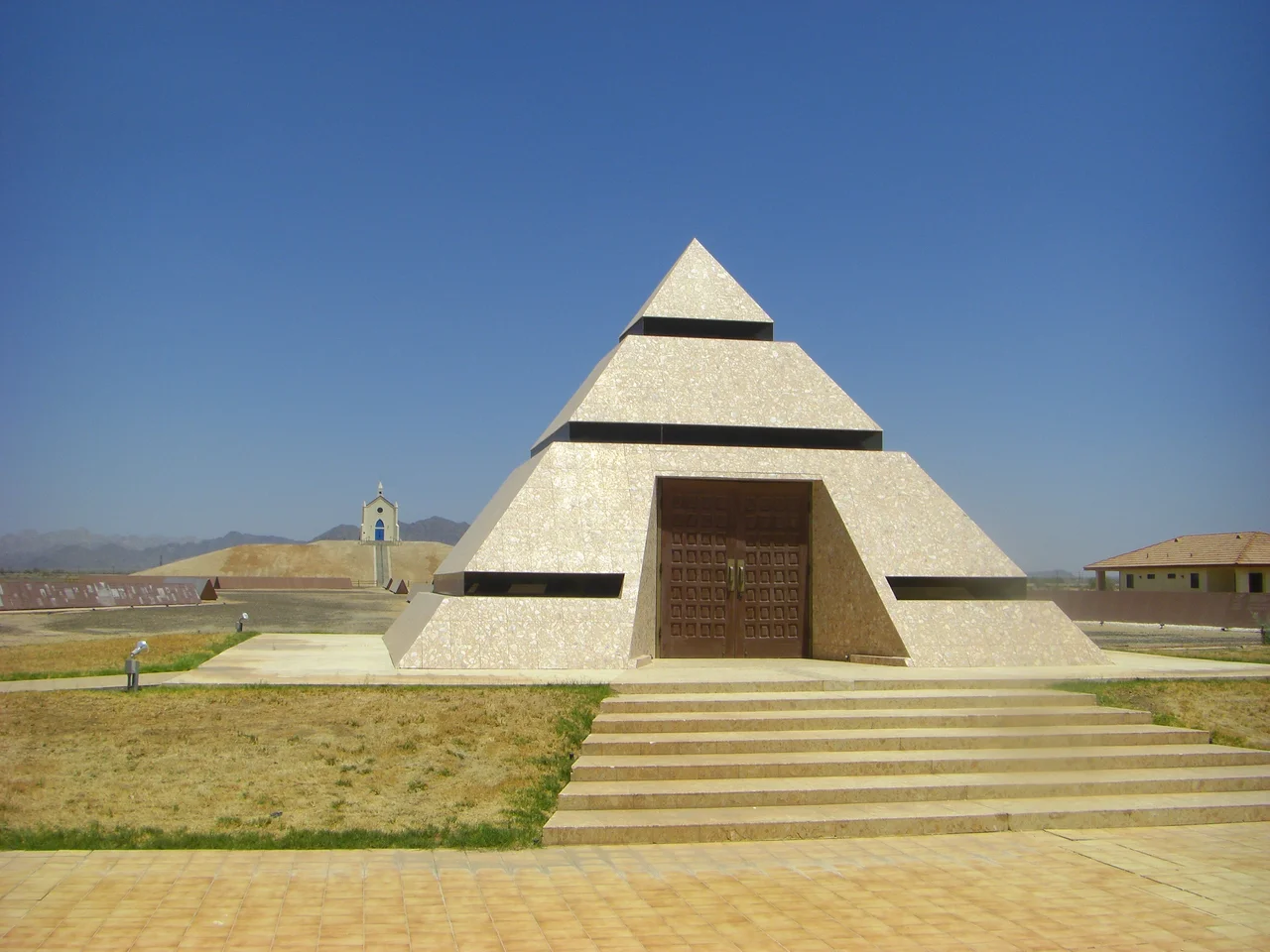
The centerpiece is a 21-foot pyramid that houses the official center point of the world — the geographic designation is as self-declared as it sounds, but Imperial County made it official, and that is not nothing. A church sits on a man-made hill nearby, a small structure visible for some distance across the flat desert, which makes it a landmark of sorts in a landscape with few of them.
History Written in Stone
The Museum of History in Granite is the project that defines Felicity. Istel has been developing it since the town's founding, and it consists of dozens of granite panels, most of them over 100 feet long and weighing approximately 500 tons each, etched with a historical record of humanity as Istel has chronicled it. The lead artist on the project is Gene Britton.
The panels are arranged on the desert floor and inscribed with history — military history, the history of the French Foreign Legion (in which Istel served), the history of the Colorado River, the history of Arizona and California. Visitors walk among them and read. The scale is extraordinary: granite slabs the length of a city block, set in the open desert under a sky that offers no shade.
A Desert with Layers
Before Istel arrived, the land had its own history. During World War II, Camp Pilot Knob occupied this area — one of the Desert Training Center's satellite camps where soldiers from the 85th Infantry Division and 6th Infantry Division prepared for combat. The Felicity train station, now gone, was used to bring troops and supplies to that camp.
The Quechan Tribe of the Fort Yuma Indian Reservation lives nearby, descendants of the people who had inhabited this desert long before the Army arrived or Istel bought his acreage. The desert around Felicity has been many things: a crossing, a training ground, an eccentric monument, a place where someone decided to write everything down in stone.
At the Center of Something
What draws people to Felicity is precisely its absurdity — not as a criticism but as a description. In a landscape of flat desert and sky, someone built a pyramid, declared it the center of the world, and started carving history. It is an act of monumental eccentricity, which is perhaps an American tradition in the desert West.
The town is small, the permanent population modest. But it receives visitors, people who come to see the granite panels, to stand at the certified center of the world, to photograph the church on the hill. Felicity is "Dedicated to Remembrance," its motto says — a name that carries the weight of its creator's intentions and the lightness of a joke that has somehow lasted four decades.
From the Air
Located at 32.75°N, 114.77°W in Imperial County, California, just south of Interstate 8. The pyramid and church on the hill are identifiable landmarks from the air. Pilot Knob is visible to the southeast. Nearest airport: Yuma International Airport (KNYL), approximately 5 miles to the east.
Nearby Stories
- Holtville, California 7 km away
- Rolle Airfield 8.1 km away
- Calipatria, California 21 km away
- Laguna Salada 37 km away
- Chocolate Mountain Aerial Gunnery Range 59 km away
- Battle of Stanwix Station 83 km away
- Gillespie Dam Bridge 140 km away
- 2000 Marana V-22 Crash 285 km away