Where the Peacocks Once Stood
The truck drivers know the wait. They sit in their cabs along the Jakarta-Merak Toll Road, engines off, windows down, queued for 10 kilometers or more in a line that barely moves. Two days, sometimes three, before a ferry berth opens and they can roll aboard for the crossing to Sumatra. At holiday peaks -- Lebaran, Christmas, school breaks -- the port processes over 2,000 cars and 500 buses daily, and still it is not enough. The Port of Merak sits on the northwestern tip of Java, the most densely populated island on Earth, and it is the only major ferry connection to Sumatra, the world's fifth most populous island. Everything about Merak is a story of overwhelming demand meeting stubborn geography.
Erased by the Wave
Merak did not always exist in its current form. The original settlement stood on the same coast, facing the same strait, when Krakatoa erupted on August 27, 1883. The explosion was audible 4,800 kilometers away, on Rodrigues Island near Mauritius. For the people of Merak, the sound was the last thing many of them heard. A series of tsunamis radiated outward from the collapsing volcano, and the largest wave to reach Merak was estimated at 41 meters high -- taller than a 13-story building. It erased the town completely. Approximately 2,700 people died, nearly all of the settlement's inhabitants. What stands at Merak today was rebuilt from nothing, on ground that the sea had scoured clean. The port's name endured, though the creature it honors did not fare as well: merak means peafowl in the local language, after the green peafowl that once lived in the surrounding forests. The birds have since retreated to the remote wilderness of Ujung Kulon National Park, some 60 kilometers to the south.
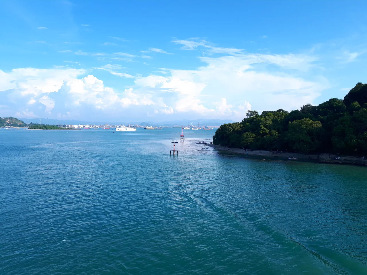
Java's Western Gate
The modern Port of Merak occupies the Pulo Merak District of Cilegon, a city of steel mills and petrochemical plants on the coast of Banten province. The port's primary function is straightforward: move people and goods across the Sunda Strait to Bakauheni on Sumatra's southern tip, where the Trans-Sumatran Highway begins its long run north. Ferry services, operated by ASDP Indonesia Ferry, run continuously. But the infrastructure has not kept pace with demand. The ferry fleet is aging, the terminal facilities are badly overstretched, and the road connecting Cilegon to the port groans under heavy truck traffic that keeps it in perpetual disrepair. During peak travel periods, the system buckles visibly. News reports document the gridlock with a regularity that suggests resignation rather than outrage -- it is simply what happens when a single port must handle the traffic between two islands that are home to nearly 200 million people combined.
Petrochemical Corridor
Merak's role extends well beyond passenger ferries. The port services Indonesia's largest concentration of petrochemical facilities, clustered along the Merak peninsula and the broader Cilegon industrial zone. In 1990, two petrochemical plants operated in the area. By the early 2000s, there were more than 40, drawn by deep-water access and proximity to Jakarta, 100 kilometers east along the toll road. A thermal power plant burns coal delivered by barges. An LPG jetty handles liquefied petroleum gas for distribution across Banten province. In 2007, Shell Oil announced a $52 million expansion of its oil storage facilities at the port. The industrial buildout has transformed this coast from a fishing community into an energy hub. Cilegon itself has grown into a small city with a hypermarket mall and the kind of practical, no-frills commercial district that serves a working port -- including, as guidebooks note dryly, karaoke bars for sailors.
The Bridge That Never Came
For decades, the congestion at Merak has fueled one of Indonesia's most ambitious infrastructure proposals: a bridge across the Sunda Strait. The idea first surfaced in the 1960s and has resurfaced regularly since, gaining serious momentum in 2007 when the government approved a preliminary plan for a road-and-rail crossing. The project would connect Merak's Java side to Bakauheni on Sumatra, spanning roughly 27 kilometers of geologically volatile water -- the same water where Krakatoa erupted and where Anak Krakatau, its volcanic successor, continues to grow and occasionally erupt. Cost estimates reached $11 billion. China Railway Construction Corporation signed an accord in 2012. But the geology, the seismicity, and the price tag conspired against the dream. In November 2014, President Joko Widodo's incoming government shelved the project, declaring it incompatible with their maritime development strategy. The government chose instead to buy new ferries and improve port facilities -- a less dramatic solution, but one that does not require building across an active volcanic zone.
Still Waiting at the Gate
From the air, Merak appears as a thin strip of industrial coast where Java's green interior meets the blue of the Sunda Strait. Ferry wakes crisscross the water between Merak and Bakauheni. Merak is not a destination. It is a threshold, a place people pass through on their way between Java and Sumatra, between the capital and the hinterland, between one half of their lives and another. The green peafowl that gave the port its name are gone from these hills, but the restless human traffic that defines the place shows no sign of diminishing. Every proposal to ease the congestion -- new ferries, improved terminals, the phantom bridge -- acknowledges the same underlying fact: this narrow stretch of coast will remain one of Indonesia's most critical pressure points for as long as Java and Sumatra remain separate islands.
From the Air
Located at approximately 5.93S, 106.00E on the northwestern tip of Java. The port faces west-northwest across the Sunda Strait toward Bakauheni, Sumatra. Ferry traffic is visible crossing the strait on a regular basis. The volcanic profile of Anak Krakatau is visible roughly 40 km to the southwest. Industrial facilities and the thermal power plant are visible along the coastline. The Jakarta-Merak Toll Road approaches from the east, and truck queues are sometimes visible on approach. Nearest major airport: Soekarno-Hatta International (WIII), approximately 100 km east. The Cilegon industrial zone extends south along the coast. Recommended viewing altitude: 5,000-10,000 feet for port detail, 15,000-20,000 feet for strait context.
Nearby Stories
- The Eye of Krakatoa 2.7 km away
- Four Minutes Over the Java Sea 9.8 km away
- Locked Doors at 1:45 AM 14 km away
- Anak Krakatoa 24 km away
- The Crossing at Silebu 27 km away
- Way Kambas National Park 81 km away
- 1933 Sumatra Earthquake 86 km away
- Battle of the Java Sea 501 km away