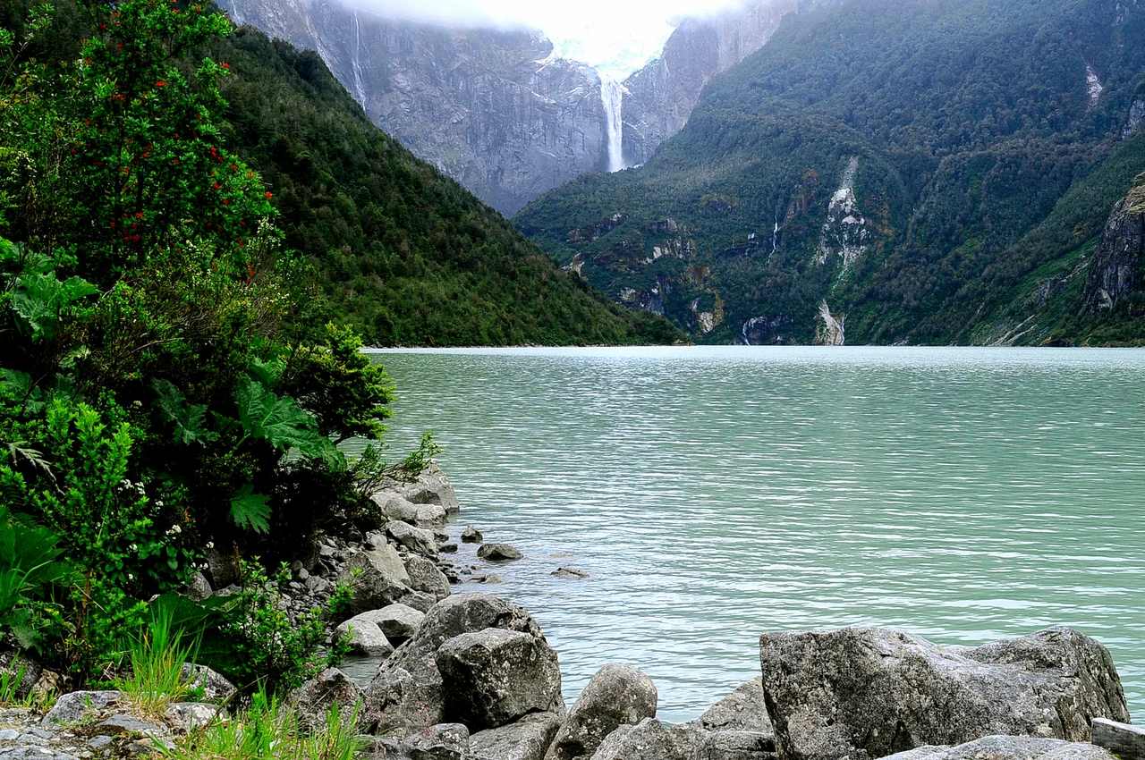

Queulat National Park
You hear it before you understand it: a deep crack, then a rumble like distant thunder, except the sky is full of mist and there is no storm. A chunk of ice has broken loose from the Ventisquero Colgante, the hanging glacier of Queulat, and is falling down a sheer rock face into the lagoon below. The glacier clings to a high shelf of mountain, fed by an ice cap centered near 1,900 meters, and it does not flow all the way down to the water the way most glaciers do. Instead it simply ends in midair, calving into nothing, with a tall waterfall pouring off the same cliff. It is one of the strangest and most photographed sights in all of Patagonia, and it sits at the heart of a rainforest most travelers never reach.
Where the Road Turns to Gravel
Queulat National Park was founded in 1983 and covers more than 150,000 hectares of mountain, fjord, and temperate rainforest in Chile's Aysén Region. Only one thing crosses it: the Carretera Austral, the famous southern highway, which is still unpaved gravel through this section. There is no shortcut. To reach the park you drive the Austral, usually from the fjord-side village of Puyuhuapi, the best base for exploring, set between distant Chaitén to the north and Coyhaique to the south. Most of the attractions lie south of Puyuhuapi, and buses running the highway will let passengers off at the trailheads. The remoteness is the point. The wild, dripping forest here feels genuinely original, the kind of landscape that exists because almost no one has gotten around to changing it.
A Glacier That Hangs
The hanging glacier is the park's magnet, reached by a two-kilometer spur off the Carretera Austral about 20 km south of Puyuhuapi. From the parking area, several routes fan out. The easy one leads in 15 minutes to Laguna Témpanos, the lagoon at the base, where you stand with the icy water in the foreground and the glacier looming on its cliff a good distance beyond. Small fishing boats and kayaks ferry visitors across the lagoon for a closer, vertiginous angle, the ice towering hundreds of meters overhead on its steep face. For the classic postcard view, a moderately difficult three-hour round-trip trail, the Mirador Ventisquero Colgante, climbs through dense rainforest, gaining only 250 meters before opening onto the full sweep of glacier, waterfall, and rock. The best light arrives in the last hours of sun.
Rain as a Way of Life
Queulat is wet. The climate is defined by near-constant rain, and the glaciers usually hang low in cloud, so that the mountains reveal themselves only in fragments. This is what makes the forest so lush and so green, a true temperate rainforest where the canopy drips and the trails stay soft underfoot. Snow is rare at lower elevations even in winter. The advice from those who know the park is simple: check the forecast for Puyuhuapi just before you arrive, and be patient. Even on a day when the clouds never lift enough to show the glacier whole, the tongue of ice above the cliff, the waterfall, and the rainforest closing in around the trail make the trip worthwhile.
Birds, Foxes, and the Occasional Puma
The wildlife here is unbothered. Birds in the park are notably unshy and easy to photograph, going about their business as if visitors were just another feature of the forest. Foxes turn up now and then, and pumas pass through, though encounters with the big cats are rare. There are no shops or restaurants inside the park itself, only a few campsites near the hanging glacier and two simpler ones just outside it along the highway. Everything else, the hotels, the hostels, the meals, waits back in Puyuhuapi and along the fjord. That austerity is part of Queulat's character. You come for the ice and the rain and the green, and you bring everything else with you.
From the Air
Queulat National Park lies in Chile's Aysén Region at roughly 44.40 degrees south, 72.40 degrees west, straddling the Carretera Austral. The nearest major airport is Balmaceda Airport (ICAO: SCBA), serving Coyhaique well to the south; Chaitén Airport (ICAO: SCTN) lies to the north. From the air, the park reads as a tangle of fjords, dense forest, and ice-streaked peaks, with the hanging glacier perched on a cliff above Laguna Témpanos. Expect heavy cloud and frequent rain year-round; clear windows are brief and most common in the summer months of December through February.
Nearby Stories
- Alto Palena–Encuentro River dispute 56 km away
- HidroAysén 103 km away
- Futaleufú River 113 km away
- Hudson Volcano 142 km away
- Trevelin 146 km away
- Parque Tantauco 152 km away
- General Carrera Lake 199 km away
- Chiloé Island 214 km away