.jpg)
Parque Tantauco
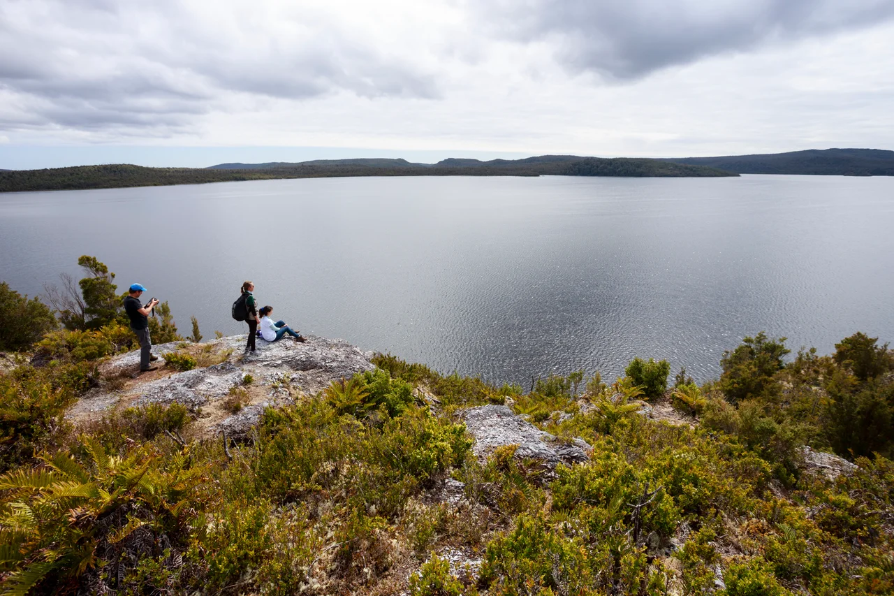
The southern tip of Chiloe Island is where the roads give out and the rainforest takes over. Here, across more than a thousand square kilometers of dripping evergreen forest, peat bogs older than recorded history, and a coastline you mostly reach by boat, lies Parque Tantauco, a private park that protects a corner of the planet rain has scarcely let humans touch.
A Park Bought Quietly, Opened Publicly
Tantauco owes its existence to one of Chile's wealthiest men. In December 2004, businessman Sebastian Pinera, who would later serve two terms as president of Chile, acquired roughly 118,000 hectares of southern Chiloe. The following year, his Fundacion Futuro began running the land as a conservation project, building the Inio lodge as a base of operations and opening visitor offices in the port town of Quellon in 2006. The aim was twofold: lock away a fragile ecosystem and give the Quellon district a reason for people to come. The deal was not without controversy, having been routed through an offshore company, but the result on the ground is real: a vast tract of wilderness kept open to anyone willing to make the journey.
The Forest That Drinks the Pacific
Tantauco preserves Valdivian temperate rainforest, one of only a handful of temperate rainforests on Earth and among the least disturbed anywhere. Rain falls here in earnest, roughly 2,500 millimeters a year, distributed through every season, and the forest answers with a density that can feel almost prehistoric. The endangered Guaitecas cypress, a slow-growing conifer prized nearly to extinction elsewhere, survives in these stands alongside the broad-leaved olivillo. The park's interior holds something rarer still: peatlands that have been accumulating since the last ice age, living archives of climate laid down over thousands of years. The whole region sits inside one of the world's recognized biodiversity hotspots, and part of the park forms the Sitio Chaiguata, designated by Chile's environmental authorities as a priority area for protecting wildlife.
Darwin's Fox in the Underbrush
The most famous animal here is small, shy, and almost entirely nocturnal. Darwin's fox, the zorro chilote, was first collected by Charles Darwin himself in 1834 from a small island off Chiloe's coast, and the species still carries his name. It is one of South America's most endangered canids, with most of the surviving population living on Chiloe Island. The park also shelters the huillin, a river otter clinging to existence in Patagonia's coastal waters. Offshore, the cold, plankton-rich sea draws the largest animal that has ever lived: the blue whale returns to feed in these waters each year, a reminder that Tantauco's wildness extends well past the tree line.
Reaching the Edge of the World
Getting to Tantauco is part of the experience. The park keeps an office in the port town of Quellon, on Avenida La Paz, where the staff hand out a booklet far richer than anything online and answer the questions a website cannot. The northern sector lies at the end of about 40 kilometers of unpaved road off Ruta 5, the first 18 in good shape and the rest rough enough that a four-wheel-drive is wise. The southern sector, anchored at the tiny settlement of Caleta Inio, is reached by lancha, a small supply boat out of Quellon that carries personnel, provisions, and a handful of travelers; space is limited, and you reserve your place with the rangers in advance. There is no shortcut, which is precisely the point.
Walking Into the Quiet
Once inside, the park unfolds along its trails, around 150 kilometers of marked paths, with backcountry routes linking simple refugios deep in the interior for those who want to vanish for a few days. The weather sets the terms. Even in the southern summer, when highs can reach a pleasant 27 degrees Celsius, cold rain can sweep in without warning, and the permanent humidity means the forest is always glistening. Beside Lago Chaiguaco, beneath the cypress and the southern beech, the dominant sound is water: dripping, running, falling. Chiloe's far south does not perform for visitors. It simply continues, ancient and unhurried, and lets you listen.
From the Air
Parque Tantauco occupies the southern end of Chiloe Island in Chile's Los Lagos Region, centered near 43.2 degrees S, 74.2 degrees W. From the air the park reads as an unbroken carpet of dark green rolling down to a ragged Pacific coastline, laced with lakes such as Lago Chaiguaco and the inlet at Caleta Inio. The nearest substantial airport is Mocopulli, serving Castro and Dalcahue to the north (ICAO SCPQ), with the mainland hub of El Tepual at Puerto Montt (ICAO SCTE) farther north still. Expect persistent cloud, frequent rain, and humid maritime air year-round; clear viewing windows are short and best caught in the southern summer.
Nearby Stories
- Chiloé Island 38 km away
- Churches of Chiloé 44 km away
- Church of San Francisco, Castro 75 km away
- Queulat National Park 158 km away
- Alto Palena–Encuentro River dispute 215 km away
- 1687 Peru Earthquake 3079 km away
- The Nazca Lines: Art Made for the Sky 3160 km away
- West Antarctica 4098 km away