.jpg)
RAF Carew Cheriton
In the summer of 1915, two corrugated iron hangars went up on this Pembrokeshire field, each 318 feet long, sized to house non-rigid airships - blimps - that would patrol the approaches to the Bristol Channel for German submarines. The hydrogen they carried was made on site. The first crews lived in tents. Twenty-five years later, the same field reopened as RAF Carew Cheriton, and the threat had moved underwater again - U-boats, now nuclear-free and oil-burning, hunting Allied convoys in the same sea lanes. The blimps were gone. Hudsons and Ansons and Spitfires came and went. Today the airfield hosts car boot sales and a go-kart track, the control tower is restored to exactly how it looked at 23 October 1941, and a memorial remembers 5,000 American soldiers who never came home.
Airships for U-Boats
RNAS Pembroke - also called Milton - officially opened in August 1915, fourteen months into a war that nobody had expected to last so long. German U-boats were already strangling Allied shipping in the Western Approaches. The airship station here flew SS-class and SSZ-class non-rigid blimps - slow, low, lightly armed, but able to stay aloft for hours watching for submarine silhouettes beneath the water surface. Two corrugated iron hangars, each 120 by 318 feet, sheltered the airships against the Welsh weather. Hydrogen storage facilities supplied the lifting gas. Crews were housed in wooden huts, canvas workshops, and tents. In April 1917 the base added fixed-wing aircraft - Sopwith 1½ Strutters at first, then Airco D.H.6 biplanes - operating from Bessonneau hangars alongside the airship sheds. By the end of the war the station was operating multiple Special Duty Flights, all part of No. 255 Squadron RAF, hunting U-boats over the St George's Channel and Bristol Channel. The site closed in 1920, the hangars dismantled, the field returned to farming.
Reopened for a Different War
The Royal Air Force opened a new station on the same site in 1939, with three runways - 16/34 at 2,296 feet, 06/24 at 2,595 feet, and 12/30 at 3,120 feet, all 150 feet wide - and two Bellman hangars. The old name had been Pembroke. The new one was Carew Cheriton, distinguishing the airfield from the flying-boat base at Pembroke Dock a few miles southwest. The station belonged to RAF Coastal Command, again hunting submarines in the same waters as in 1915. No. 5 Coastal Patrol Flight formed here in March 1940 with Tiger Moths and Hornet Moths - civilian biplanes pressed into uniform because the RAF was short of everything. The Luftwaffe noticed. In April 1941, attacks on the airfield prompted Hurricane detachments from No. 238 and No. 32 Squadrons at RAF Pembrey to fly in for fighter cover. The station survived. In 1942 it was transferred to RAF Technical Training Command and the aerial focus shifted from operations to training.
Radio School
On 1 January 1943, No. 10 Radio School RAF formed here. Wireless operators - the radio crew who handled communications and direction-finding aboard bombers, transports, and patrol aircraft - trained on a mix of types: Avro Anson Is, Airspeed Oxford Is, Lockheed Hudson Is, Tiger Moths, and even Supermarine Spitfire Vbs for high-speed work. The school had absorbed No. 1447 (Radar Calibration) Flight earlier, and sixteen Ansons from No. 5 Operational Training Unit formed a second flight. Eventually all wireless operator training in the area went through Carew Cheriton rather than the OTU. The school disbanded on 24 November 1945, three months after Japan's surrender. The radio school closed. The site closed in 1945. The airfield was returned to civilian use, though it kept its runways for a few more years as an emergency landing ground - a Bristol Beaufighter from RAF Llandow crashed here in 1951 attempting an emergency landing, with no survivors.
The 5,000
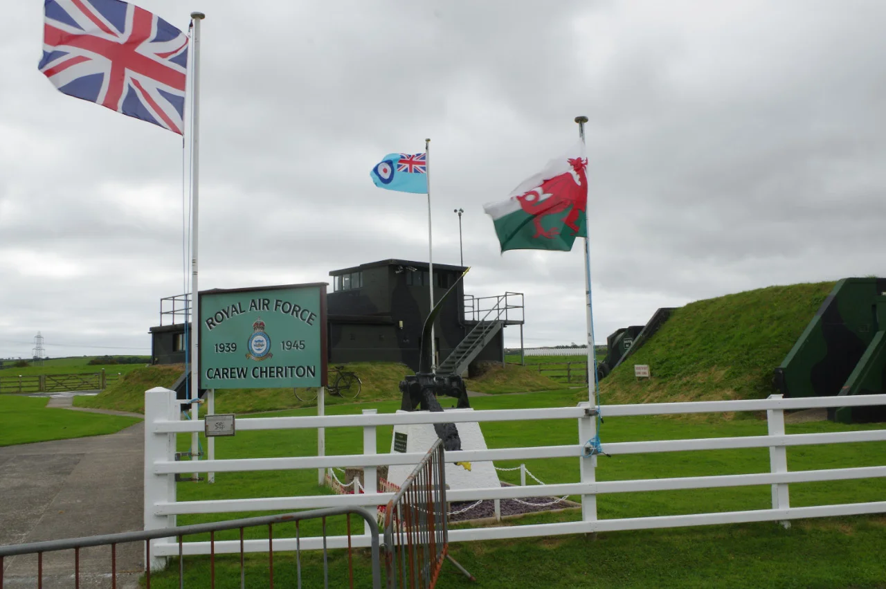
In 2019 a memorial was unveiled at the site to the soldiers of the United States Army's 110th Infantry Regiment, who were stationed in Pembrokeshire from 1943 to 1944 in preparation for the Normandy landings. Five thousand American servicemen passed through. Many died in the liberation of Europe - on the Normandy beaches, in the Bocage country, in the Hurtgen Forest in the bitter winter of 1944, in the Battle of the Bulge. Pembrokeshire had hosted them for less than a year. Carew Cheriton was one of the bases where they trained and waited. The memorial does not name every man. It records that they came, that they trained here, and that many of them never made the return journey. The control tower, fifty yards away, is restored to its 1940s condition - the watch office recreated from first-hand accounts of personnel who served, the flight board fixed to display the actual entries from 23 October 1941, as though a duty officer had stepped out and was about to return.
The Field Now
Today the airfield is used for car boot sales, auctions, and a go-kart track laid out across part of the old runway. The other strips of concrete are slowly weathering. Aircraft no longer take off here. The restored control tower stands at the edge of the activity, a small heritage centre tracing the airship operations, the Coastal Command years, the radio school. Volunteers from the Carew Cheriton Control Tower Group maintain it. The wireless code keys on the desk are working replicas. Outside, the Pembrokeshire weather does what it has always done - low cloud rolling in off Carmarthen Bay, gusts off the Bristol Channel, the occasional clear blue afternoon when you can see the whole length of the runway and imagine the Ansons lining up for the next training flight.
From the Air
RAF Carew Cheriton sits at 51.69°N, 4.81°W, 4.7 miles northwest of Tenby and a mile southeast of Carew village. The old runway layout is still clearly visible from the air - three intersecting strips of weathered concrete in a roughly triangular pattern. Best altitude 1,500-3,000 ft for runway detail; 3,000-5,000 ft for context against Carmarthen Bay. The restored control tower is at the north end. Nearest active airports: Haverfordwest (EGFE) about 9 nm northwest, Pembrey (EGFP) about 14 nm east, Swansea (EGFH) about 29 nm east-northeast. Be aware of light aircraft and microlight activity around the area.
Nearby Stories
- St Andrew's Church, Bayvil 1.6 km away
- Skomer 3.7 km away
- National Botanic Garden of Wales 9 km away
- HMS H47 13 km away
- Mumbles Lifeboat Disaster 32 km away
- Strata Florida Abbey 38 km away
- Lighthouses on Lundy 38 km away
- Tehidy Country Park 140 km away