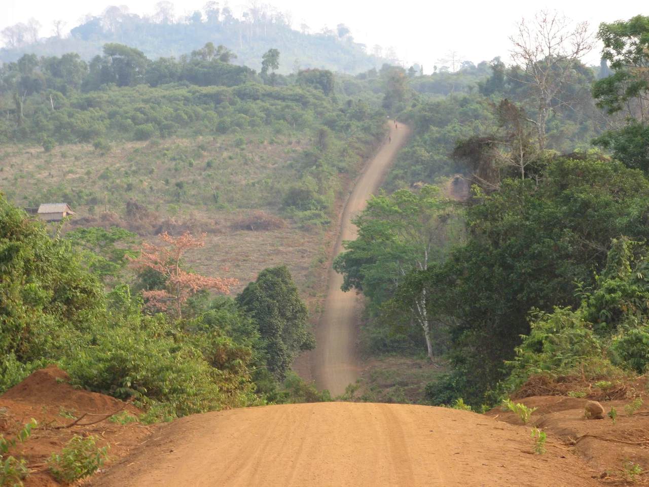

Ratanakiri province
The province is named for two things it has. Rôtânô means gem and kĭri means mountain — Khmer words carrying Sanskrit roots, ratna and giri, that reached the region by way of a thousand years of trade. It is an unusually literal name. There are mountains in the north, the tail spurs of the Annamite Range, and there is blue zircon in the ground, still dug out by hand one shaft at a time. What it does not tell you is that a place can be named for its wealth and still be among the poorest corners of the country that governs it.
The People Who Were Here First
For more than a thousand years these hills have belonged to the Khmer Loeu, the highland peoples who are a small minority everywhere else in Cambodia and the majority here. They are not one group. Tampuan, Jarai, Kreung, Brou, Kachok and Kavet each hold their own language, and as recently as 2006 fewer than one in ten indigenous residents spoke fluent Khmer, the official language of the state they live in. Villages run to between twenty and sixty families, each holding a forest territory in common whose boundaries everyone knows and nobody marks. A family works one or two hectares and lets five or six lie fallow, on a rotation the forest can absorb, and decisions rest with elders who advise rather than rule. In earlier centuries neighbouring empires raided these highlands for enslaved people; those carried off were farmers and parents, and their descendants still live on the same land.
Rubber, Roads and the Uprising of 1968
France absorbed the region into Indochina in 1893 and ended the slave trade, replacing it with something the colonial administration found more useful: enormous rubber plantations around Labansiek, the settlement that is now the provincial capital of Banlung. Indigenous men built and tapped them; resistance was ground down by 1953. Independence brought no relief. Through the 1950s and 1960s Norodom Sihanouk pursued a Khmerization campaign to bring the highlands under control and "modernize" people who had not asked to be modernized: Khmer Loeu were taken to the lowlands to be schooled in Khmer, ethnic Khmer were settled in, and plantation labour was harsh and at times not voluntary at all. Families answered by walking away, deeper into the forest. In 1968 the Brao rose; several Khmer were killed, and the government burned settlements and killed hundreds of villagers.
Practically North Vietnamese Territory
The Khmer Rouge understood that grievance and used it. The Communist Party of Kampuchea moved its headquarters into Ratanakiri in 1966 and recruited hundreds of Khmer Loeu into its units. Vietnamese communists had operated here since the 1940s, and at a press conference in June 1969 Sihanouk described the province as "practically North Vietnamese territory." Between March 1969 and May 1970 the United States bombed it covertly and massively; villagers fled the towns and lived on the run in the forest, foraging alongside the very insurgents the bombs were meant to reach. In June 1970 the government withdrew its troops and left. What followed was not the liberation the Khmer Loeu had been promised. Their languages, ceremonies and spirits were declared incompatible with communism and banned, communal living became compulsory, the schools closed, and purges of ethnic minorities grew more frequent. Preliminary studies suggest bodies equal to about five per cent of the province's population lie in mass graves — a lower share than the rest of Cambodia, which says more about the rest of Cambodia than about mercy here.
Emerald Water and Spirit Forest
Five kilometres south of Banlung, a volcanic crater some seven hundred thousand years old holds Yeak Laom: eight hundred metres across, fifty deep, ringed by forest and filled with water so clear it reads as green stone. Tampuan communities manage it under a twenty-five-year agreement, through a committee of ten elders — one man and one woman from each of five villages. Seventy-eight per cent of the province was still forested as of 2015, watered by some 2,200 millimetres of rain a year. A 2007 survey of Virachey National Park logged thirty-seven fish and thirty-five reptile species, several never recorded anywhere before. Asian elephants and gaur move through the interior; the giant ibis and the greater adjutant depend on it. Some forests are held to be inhabited, and cutting there is forbidden — within those groves particular rocks, pools and waterfalls are themselves sacred.
The Ledger
In 1997 an estimated 300,000 cubic metres of logs crossed illegally into Vietnam, against a legal export limit of 36,000 — a ratio that led Asian Development Bank researcher John Dennis to call the logging a human rights emergency. Visitors hoping for untouched forest increasingly find fresh stumps. A 2001 law let indigenous communities register collective title to ancestral land, yet villages have ended up nearly landless anyway, through "sales" arranged with bribes, threats or misinformation. Against all that, some lines run the other way. The province had seventy-six primary schools and one upper secondary school in 1998; by 2024, 259 and seven. Average schooling rose from 0.2 years in 2005 to 3.4 in 2015, and bilingual teaching that begins in a child's own language, introduced in 2002, is working. The population reached 235,852 in 2024, more than double its 1998 figure — and elders say the young no longer believe in the spirits.
From the Air
Ratanakiri occupies 10,782 square kilometres of northeast Cambodia centred near 13.733°N, 107.000°E, bordered by Laos to the north and Vietnam's Gia Lai and Quảng Ngãi provinces to the east. The signature aerial features are the Tonlé San and Tonlé Srepok running east to west across a red laterite plateau, the near-perfect dark circle of Yeak Laom crater lake just south of Banlung, and the abrupt boundary between standing forest and cleared plantation blocks — a contrast that reads clearly from 4,000 to 8,000 feet AGL. Ratanakiri Airport (VDRK) serves Banlung but has had no scheduled commercial service for years; Stung Treng (VDST) lies west, Pleiku (VVPK) east across the Vietnamese border, and Phnom Penh (VDPP) is 636 kilometres southwest. The dry season from January to February gives the sharpest visibility; June through September brings monsoon cloud, and smoke from field-clearing burns can cut slant range considerably in March and April.
Nearby Stories
- Đức Cơ Camp 5.4 km away
- Virachey National Park 30 km away
- Yali Falls Dam 33 km away
- Srepok River 38 km away
- Stung Treng 60 km away
- Buôn Đôn 72 km away
- Khong Island 75 km away
- Sambor Wildlife Sanctuary 117 km away