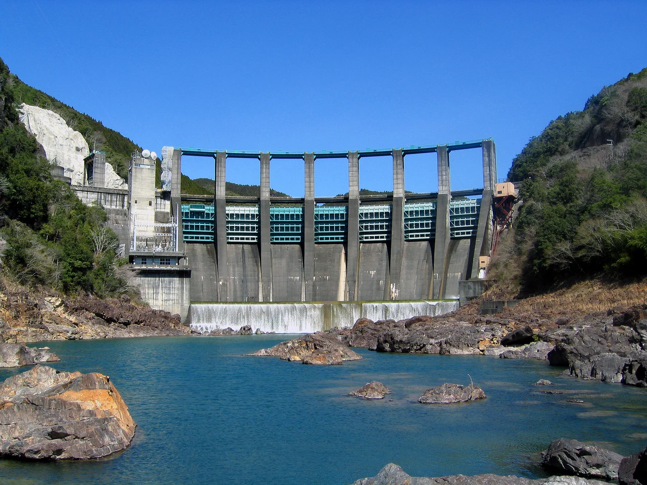

Yali Falls Dam
Downstream, the Cambodian villages have a saying about the Yali Falls Dam: they hear the water before they see it. When Vietnam's operators release from the reservoir unannounced, the Se San River rises meters within hours, sweeping away fishing nets and sometimes the fishermen who set them. The dam itself, a 69-meter wall of concrete in Vietnam's Central Highlands, generates 720 megawatts of electricity — enough to power a significant portion of a developing nation's grid. The argument over whether that power justifies the cost has been going on since the dam was sealed in 1996, and it has never been resolved.
A Dam in the Highlands
The Yali Falls Dam sits on the Krong Poko River, a tributary of the Se San, in a narrow gorge about 70 kilometers upstream of the Cambodian border. Construction began in 1993, a time when Vietnam was pressing hard into economic development after decades of war and embargo. By 1996 the dam was sealed; by 1998 the 64.5 square kilometer reservoir had filled, submerging the valley upstream — displacing more than 8,500 people, the majority of them Jarai and Bahnar indigenous communities whose villages and ancestral lands disappeared under the water.
The site takes its name from the Yali Falls, a natural cataract on the Krong Poko that once drew visitors to the highlands. The dam replaced the falls with a placid reservoir and a concrete intake structure. In the Vietnamese national energy accounting, the project is a success: 720 megawatts of installed hydropower capacity, clean and reliable. In the accounting kept by Cambodian fishing communities downstream, the ledger reads differently.
The River Crosses a Border
What makes the Yali Falls Dam unusual among large infrastructure projects is the geography of its consequences. The Krong Poko flows into the Se San, which crosses into Cambodia and eventually joins the Mekong. The reservoir, the flood pulses from releases, the changed sediment loads — all of these travel downstream across an international border, affecting communities that had no say in the dam's construction and receive none of its electricity.
Cambodian authorities were not formally consulted before construction began. This was the central complaint raised by the Sesan-Srepok-Sekong Protection Network, known as 3SPN, a coalition of 59 villages in northeastern Cambodia organized to advocate for the three river basins. Their backing came in part from Oxfam, which documented the downstream effects in the early 2000s. The pattern was consistent: unexpected releases caused sudden floods, drowned livestock, destroyed fishing equipment, and on at least several occasions endangered people who had no warning the water was coming.
The Flood of July 2008
The dam's most-documented incident came in July 2008, when a heavy release flooded communities in northeastern Cambodia. Probe International, a Canadian environmental watchdog, issued a press release documenting the event — one in a series of such releases over the years since the reservoir filled. Fishing communities along the Se San described losing not only their catches but the physical infrastructure of their livelihoods: nets, boats, landing platforms, riverside gardens.
Fisheries decline along the Se San has been documented by researchers since the late 1990s. The combination of altered flood pulses, changed sediment transport, and blocked fish migration routes created conditions in which traditional fishing practices became increasingly unviable. For communities that had fished the river for generations, the dam represented an economic transformation they did not choose and could not easily survive.
Power and Its Discontents
The Yali Falls Dam is not unique in this respect — large dams on international rivers create transboundary effects that regulatory frameworks rarely handle well. The Mekong River Commission exists partly to address such issues, but Vietnam and Cambodia's bilateral relationship on water sharing has moved slowly. As of the dam's operation through the 2020s, formal compensation mechanisms for downstream Cambodian communities remained limited.
The dam itself continues generating power, now part of a larger cascade of hydroelectric projects on the Se San and its tributaries. Vietnam's energy needs have grown considerably since 1993, and the Central Highlands' river systems have become central to meeting them. The question that the Yali Falls Dam raised — who bears the cost when infrastructure benefits one country and burdens another — remains as live today as when the first water backed up behind the concrete in 1996.
From the Air
The Yali Falls Dam lies at 14.227°N, 107.829°E, in the highlands straddling Gia Lai and Kon Tum provinces. The reservoir appears as a distinctive elongated blue body of water in the otherwise green highland terrain, clearly visible from altitude in clear weather. Pleiku Airport (VVPK) is approximately 60 km to the southwest. The dam structure itself sits at the reservoir's western end where the valley narrows into the gorge. The Cambodian border lies roughly 70 km downstream to the west-southwest. Viewing altitude of 10,000–15,000 feet provides good context for the reservoir's relationship to the surrounding watershed.
Nearby Stories
- Operation Francis Marion 9.3 km away
- Operation Wayne Grey 14 km away
- Măng Đen 21 km away
- Kon Ka Kinh National Park 22 km away
- Banlung 29 km away
- Virachey National Park 31 km away
- 2018 Laos Dam Collapse 96 km away
- Quy Nhon 102 km away